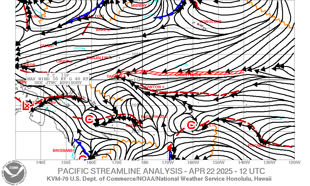
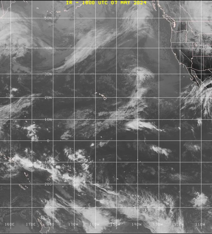
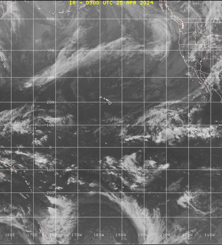
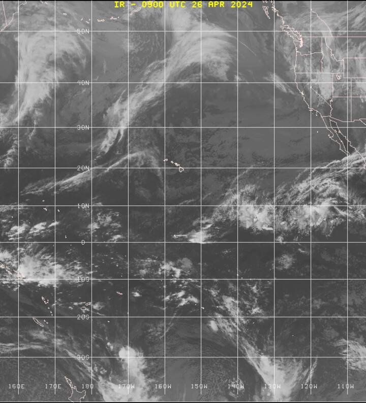
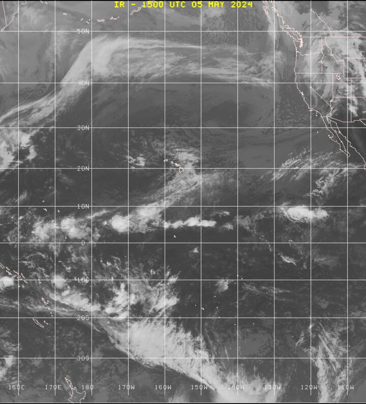
Weather GALAPAGOS Weather French Polynesia – Marquesas French Polynesia – Tuamotus French Polynesia – Society Islands Cook Islands SAMOAS TONGA – FIJI VANUATU – NEW CALEDONIA NEW ZEALAND AUSTRALIA Hawaii NOAA HIGH SEAS Wester Pacific High Seas Forecast 120w/160e 00n/25s https://www.weather.gov/hfo/HSFSPNWS – Honolulu radio fax home page: (this is the best source I’ve found) https://www.weather.gov/marine/hawaiiSouth East Pacific Surface Charts: 20s/30n East of 145W Surface Analysis – verified 00Z – https://tgftp.nws.noaa.gov/fax/PYFA96.TIF 06Z – https://tgftp.nws.noaa.gov/fax/PYFA97.TIF 12Z – https://tgftp.nws.noaa.gov/fax/PYFA98.TIF 18Z – https://tgftp.nws.noaa.gov/fax/PYFA99.TIF Tropical Surface Forecast ITCZ 24hr 00Z – https://tgftp.nws.noaa.gov/fax/PYFE79.TIF 24hr 12Z – https://tgftp.nws.noaa.gov/fax/PYFE80.TIF 48hr 00Z – https://tgftp.nws.noaa.gov/fax/PYFI81.TIF 48hr 12Z – https://tgftp.nws.noaa.gov/fax/PYFI82.TIF 72hr 00Z – https://tgftp.nws.noaa.gov/fax/PYFK83.TIF 72hr 12Z – https://tgftp.nws.noaa.gov/fax/PYFK84.TIF WIND WAVE FORECAST – Central Pacific 30s/30n 120w/130e 24hr 00Z – https://tgftp.nws.noaa.gov/fax/PWFE82.TIF 24HR 12Z – https://tgftp.nws.noaa.gov/fax/PWFE84.TIF 48HR 00Z – https://tgftp.nws.noaa.gov/fax/PJFI89.TIF 48HR 12Z – https://tgftp.nws.noaa.gov/fax/PJFI91.TIF 72HR 00Z – https://tgftp.nws.noaa.gov/fax/PJFK89.TIF 72HR 12Z – https://tgftp.nws.noaa.gov/fax/PJFK91.TIF Central Pacific Surface Charts 30s/40n 120w/130e 24hr 00Z – https://tgftp.nws.noaa.gov/fax/PYFE87.TIF 24hr 12Z – https://tgftp.nws.noaa.gov/fax/PYFE88.TIF 48hr 00Z – https://tgftp.nws.noaa.gov/fax/PYFI87.TIF 48hr 12Z – https://tgftp.nws.noaa.gov/fax/PYFI88.TIF 72hr 00Z – https://tgftp.nws.noaa.gov/fax/PYFK87.TIF 72hr 12Z – https://tgftp.nws.noaa.gov/fax/PYFK88.TIF Western pacific streamline analysis 120w/140e. 30n/30s chart: https://www.weather.gov/images/hfo/graphics/stream.gif Satelite photos Pacific Eastern Equatorial: 00Z – send http://tgftp.nws.noaa.gov/fax/evpz00.jpg 06Z – send https://tgftp.nws.noaa.gov/fax/evpz06.jpg 12Z – send https://tgftp.nws.noaa.gov/fax/evpz12.jpg 18Z – send https://tgftp.nws.noaa.gov/fax/evpz18.jpg
[…] WEATHER […]