“We have salt in our blood, in our sweat, in our tears.
We are tied to the ocean.”
— John F. Kennedy
SOUTH PACIFIC POSSE FLEET UPDATE
2023-04-13
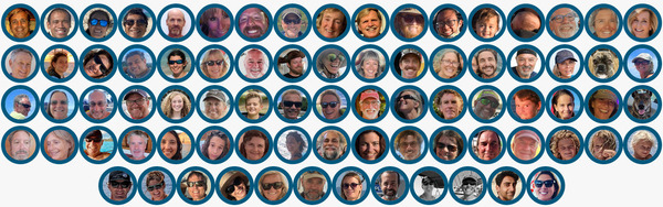
61
Yachts from 13 ensigns are signed up from now until November ’23
they will share up to date information, scout for opportunities and
alert each other to threats.
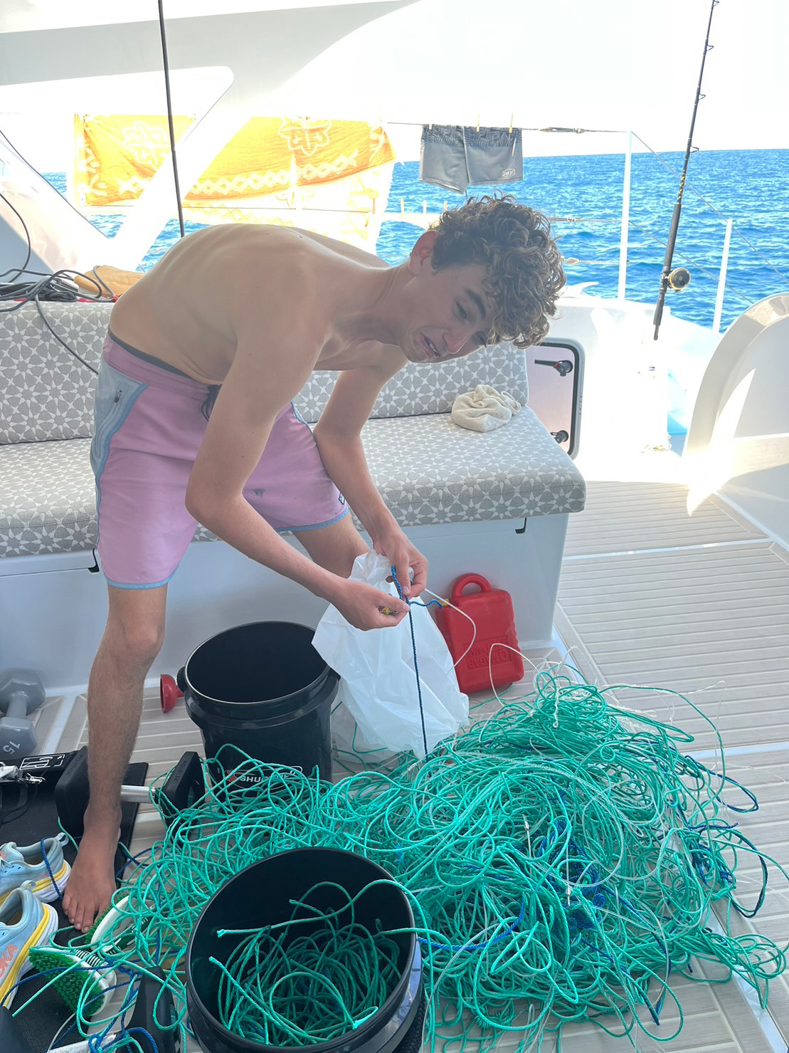
Penmanship was busy cleaning the booby poop never ending!!!
Penmanship
caught a number of long lines about 250 west of Galapagos. Hooks stuck
in bow then wrapped around prop. Took an hour in water then got
ourselves free. Only positive is we picked up a couple hundred bucks of
hooks and lines (pleased face)Fisherman came by they were fishing
swordfish.
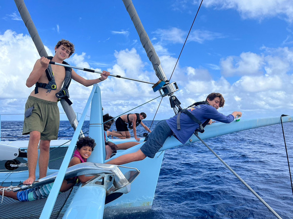
SY PENNMANSHIP 🇯🇪 Michael & Charlotte, Kenneth, Duncan, Mirabelle, Andre, Piers & Tommy – Aquidneck Custom Composites 72′
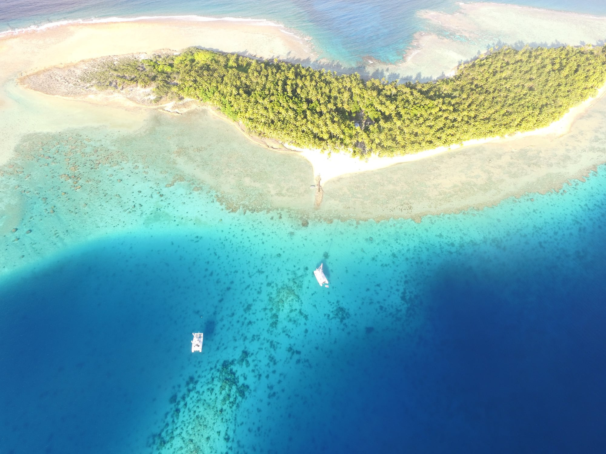
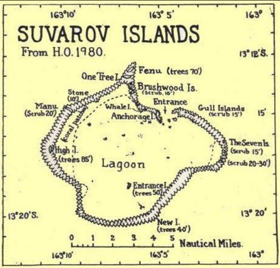
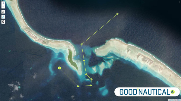
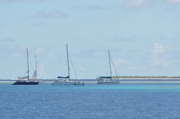
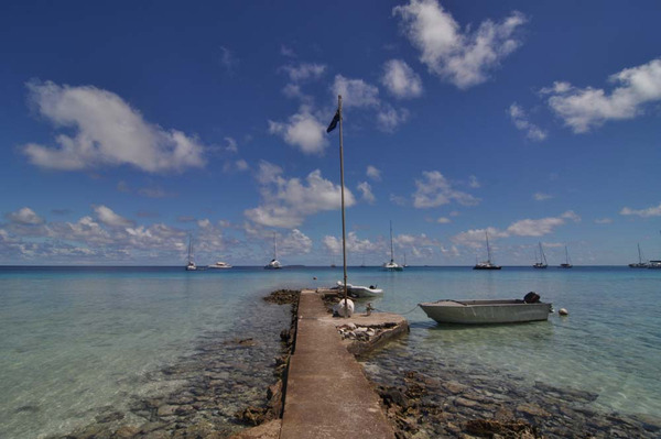
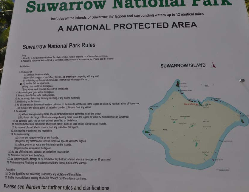
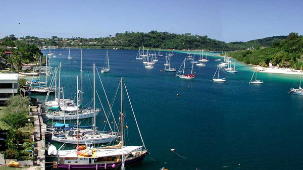
2) SUWARROW 🇨🇰 COOK ISLANDS
⚓ Good Anchorage @ 13° 14.958 S 163° 6.476 W Suwarrow 🇨🇰 Cook Islands
Suwarrow
(also called Suvorov or Suvarov) is a low coral atoll in the Cook
Islands in the Pacific Ocean. It is about 1,300 km west of Bora Bora
and 825 km northwest of Rarotonga, from which it is administered.
It
was uninhabited when discovered by the Russian ship “Suvorov”, which
reportedly followed clouds of birds to the island on September 17, 1814.
It has been only intermittently inhabited since. The Island name
has also been spelled variously as “Souvorow”, “Souwaroff” and
“Souworoff”. “Suwarrow” is the official spelling adopted by New Zealand.
Suwarrow
is possibly the most isolated of all the Cook Islands. 18th
century Spanish galleons have been found wrecked on its reef, and in the
mid-1800’s, a salvage expedition uncovered a treasure chest containing
more than 15,000 dollars worth of historic coins from the Americas. ( 5 M
USD today )
Entrance waypoints are in Good Nautical
Described
as “Treasure Island” or as “the most romantic island in the world” by
author Robert Louis Stevenson’s wife Fanny, Suwarrow.
With
one of the best harbours in the Pacific, the reef encloses a large
landlocked lagoon and the pristine islets that form the island are
scattered around the rim. At about one and a half times the size of
Rarotonga.
Author
Robert Frisbie brought his family from Pukapuka in the early 40’s for a
short visit and was caught in the worst cyclone of the 20th century.
They were fortunate that they survived, he told about their trials and
tribulations in his book, Island of Desire.
However,
Suwarrow’s greatest fame comes from the late Kiwi recluse Tom Neale,
who lived on Suwarrow at three separate times during his lifetime
between 1952 and 1977 (a total of 15 years). He spent his time tending
his garden, raising chickens, catching fish and hunting for coconut
crabs. A Kiwi sailor who dreamed of living alone on a tropic isle, he
read about Suwarrow and fell in love with it when his ship stopped there
in 1945.
Capt. Dietmar on Suwarrow back in ’09
This
“hermit of Suwarrow” stayed on his dream island until he was forced
through ill health, to return to Rarotonga where he died at the age of
75. His tale “An Island to Oneself” about his experience of living on
this remote atoll turned the secluded haven into one of the most
renowned of the South Seas. Fascinating and moving, no doubt fellow
yachties around the world were charmed by his reasons for living this
lonely life – “I chose to live in the Pacific islands because life there
moves at the sort of pace which you feel God must have had in mind
originally when He made the sun to keep us warm and provided the fruits
of the earth for the taking.” To which there is probably no further
incentive needed to discover this island for yourself.
Mr.
Rhys Jones, a bird researcher from New Zealand, was commissioned to
make a survey of Suwarrow. Among his recommendations were that an
official caretaker should be assigned to police passing ‘yachties’, a
migratory bird sanctuary be established and supervised and that a
permanent museum be erected and maintained by the government in order to
have a permanent record of its history.
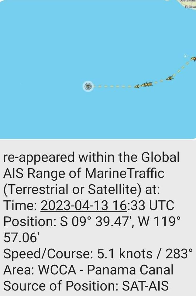
3) PAN PAN # BOLO ⚠️ SY SAOIRSE @
**** PAN PAN ****
BOLO (BE ON THE LOOKOUT)
132218Z APR 23
HYDROPAC 1225/23(83).
EASTERN SOUTH PACIFIC.
DNC 06.
M/V SAOIRSE OVERDUE. LAST KNOWN POSITION
IN VICINITY 09-36.00S 120-13.00W.
VESSELS IN VICINITY REQUESTED TO KEEP A
SHARP LOOKOUT, ASSIST IF POSSIBLE.
REPORTS TO JRCC TAHITI,
INMARSAT-C: 582422799192,
PHONE: 689 4054 1616,
FAX: 689 4042 3915,
E-MAIL: CONTACT@JRCC.PF
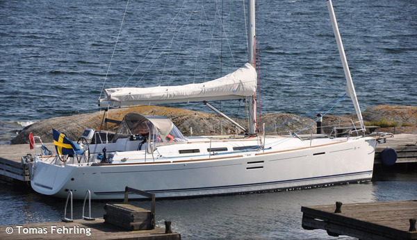
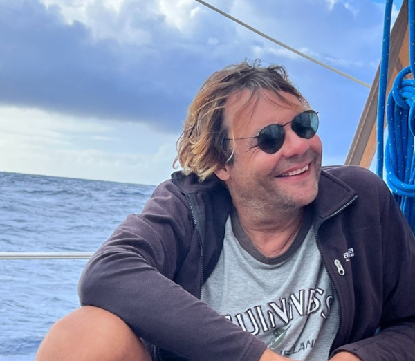
Single hander Tomas Fehrling aboard, en route to the Marquesas.
Vessel equipped with:
Life raft
Epirb
Life jackets with AIS transponders
Sat phone and iridium goSITUATION
He
has not checked in with his buddy boats in >48 hours, missed his
usual calls with his mother and his tracker has gone stale . New
satellite AIS received today confirms boat is moving – if nearby
please confirm comms
atellite AIS received ~5 days ago. Any sightings or information appreciated.
Saoirse last known Location
Wed 12/Apr 05:35 GMT
09º 39.39.47′ S 119º 57.06′ W
Course: 252° true, 6.9 kts
VESSEL MANUFACTURER AND MODEL Dufour 40 e’ MMSI 265663070 CALLSIGN SD8589 WEBSITEhttps://sysaoirse.com/
Tomas Fehrling
⚠️ UPDATE FROM SY BELEZA
SV_Beleza
is en route to pick up Dan & Jeanne from Lucky Dog. They have told
us they will abandon ship. We are communicating with them on our iridium
go and their Garmin inreach. We will meet in the morning, and transfer
safely. Lucky Dog’s coordinates approx. 0135 UTC 05 00.242S 129 54.621W
drifting 1.5 kts southwest.
⚠️ DISTRESS SIGNAL
132155Z APR 23
HYDROPAC 1224/23(21).
EASTERN NORTH PACIFIC.
DNC 13.
DISTRESS SIGNAL RECEIVED ON 406 MHZ FROM
F/V ALTAR 8 IN 05-14.27N 101-02.00W.
VESSELS IN VICINITY REQUESTED TO KEEP A
SHARP LOOKOUT, ASSIST IF POSSIBLE.
REPORTS TO RCC ALAMEDA,
TELEX: 230172343, PHONE: 510 437 3701,
E-MAIL: RCCALAMEDA1@USCG.MIL.
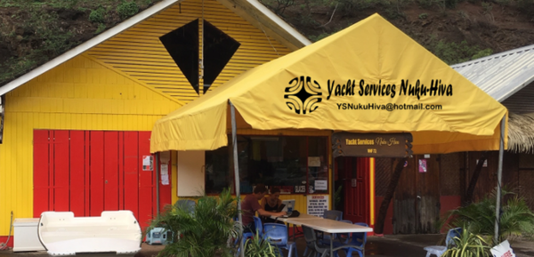
4) GET YOUR BURGEE FROM KEVIN @ NUKU HIVA YACHT SERVICES
Yacht Services Nuku Hiva 🇵🇫 Sponsors the South Pacific Posse
I look forward to meeting and helping the participants
Bond Exemption Letter (medical insurance required)
5) GALAPAGOS 🇪🇨 UPDATE
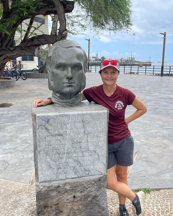
Charles Robert Darwin born 1809 – 1882 & Mary
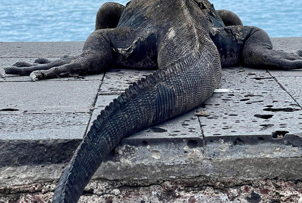
Tail of the Galapagos Marine Iguana
Galapagos marine iguanas are everywhere – but especially around the water.
Few Facts
1. They feed in the water
Marine
iguanas feed on algae and seaweed on the rocks under the water. The
adults can dive up to 9ft (2.7 m) to rip the algae and seaweed off the
rocks with their very small, yet very sharp, teeth. Younger marine
iguanas feed at low tide as they don’t have the strength to dive to the
same depths as the adults. Despite their very long claws and sharp
teeth, they are herbivores and use their claws and teeth for eating
algae and seaweed, not tearing flesh.
2. They can’t breathe underwater
Marine
iguanas can’t breathe underwater because they lack gills (like those on
a fish) which are necessary to extract oxygen from water. Instead, they
just hold their breath for a really long time.
3. They can hold their breath for a long time
Marine
iguanas can hold their breath for a staggering 60 minutes, as proved by
Charles Darwin. His shipmate sank a marine iguana over the side of the
boat with a weight and then pulled it up an hour later and it was still
alive; no doubt more than a little annoyed. Marine iguanas normally opt
for shorter dives of up to 40 minutes, which is extremely impressive – I
can barely hold my breath for 30 seconds sitting still.
4. They turn rainbow colors during mating season
Male
marine iguanas turn very bright shades of blue, pink, green, and red
during mating season to attract females. They turn black again once the
mating season is over.
5. The only iguanas that feed in the ocean
Galapagos
marine iguanas are the only iguanas in the world that feed in the
ocean. They swim by pointing their limbs straight back and twisting
their long bodies and tail side to side – like some really funny-looking
mermaids. The raised part from their head to the end of their tail acts
like a dorsal fin, making it easier to slide through the water.
6. They play cat and mouse with Galapagos hawks
The
Galapagos hawk is the marine iguanas greatest natural predator. They
will hunt the adult iguanas, and you wouldn’t think the iguanas have
much of a chance. But these are some feisty little iguanas. Galapagos
hawks have even been seen sitting on top of marine iguanas as the
iguanas run around trying to shake them off – and the iguana sometimes
succeeds. The iguanas are also extremely fast and can quite easily
outrun the hawks if they see them in time. Unfortunately, the young
marine iguanas don’t always have the same good results as the adults.
7. They have a symbiotic relationship with mockingbirds Marine
iguanas and mockingbirds have a symbiotic relationship: Mockingbirds
let out a distinctive call when there is a Galapagos hawk in the area.
The marine iguanas recognize this warning call and flee for cover.
8. They can get pretty big Adult marine iguanas can reach a length of 5 ft (1.5 m) and weigh 3 lbs (1.5 kg).
9. Their color matters The
black color of the marine iguana helps it to absorb as much sunlight as
possible. These cold-blooded reptiles get quite cold-blooded after a
dive into the ocean, they lose a lot of their body heat and may only be
around 10°C (50°F). They need to sunbathe to bring their body
temperatures back up, but this slows them down and makes them very
vulnerable. It’s a good thing their black color helps them absorb heat
as fast as possible!
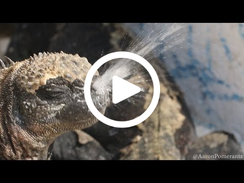
10. They sneeze. A lot. Marine
iguanas sneeze because they feed in the ocean and consume a lot of
salt. This excess salt is unhealthy for them and needs to be expelled;
violently and all over so they snot all over themselves and any other
iguanas that happen to be close by. This is why most marine iguanas you
see have a white encrusted head and neck – all the salty snot has dried
on them.
Marine
iguanas sneeze because they feed in the ocean and consume a lot of
salt. This excess salt is unhealthy for them and needs to be expelled;
violently and all over so they snot all over themselves and any other
iguanas that happen to be close by. This is why most marine iguanas you
see have a white encrusted head and neck – all the salty snot has dried
on them.
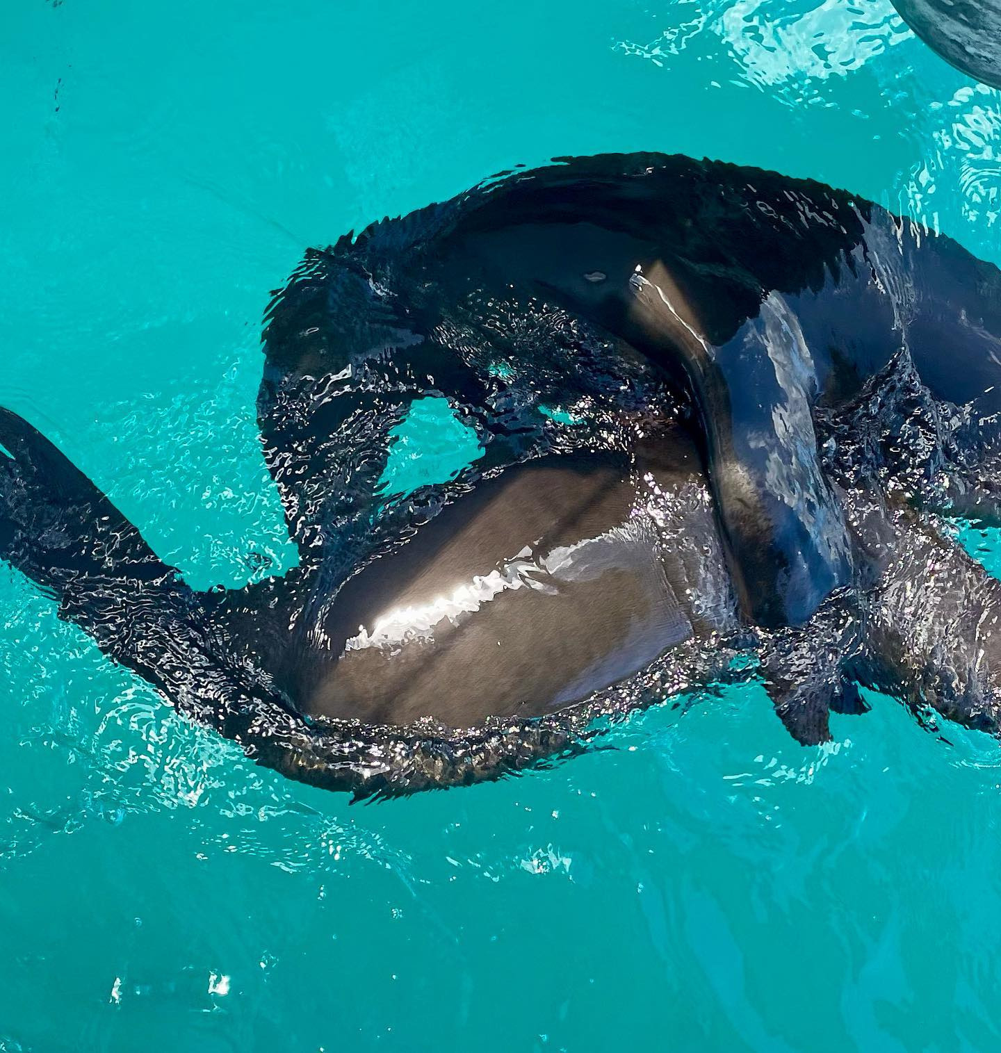
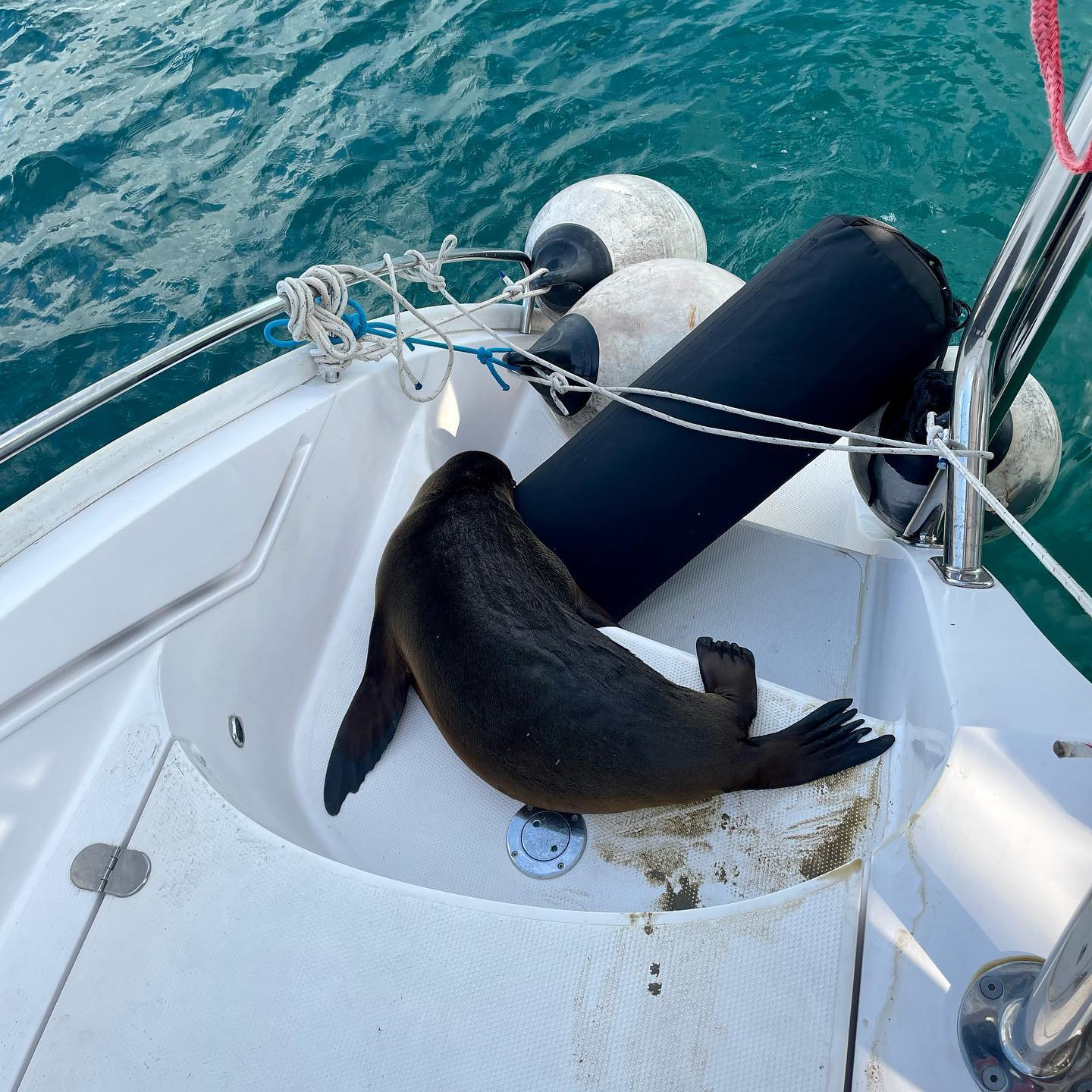
seal play
UNINVITED VISITORS
Hello all,
we
arrived into Galápagos Islands yesterday morning. Wanted to let
you know just after we had visit around 12:30 from two nice fishermen in
a panga FAR from shore(they asked for drinks and food, which we
provided) and we went on our merry way, shortly after we caught one of
their green corded fishing lines. They have long line pots out
with floating jugs along the lines. I wasn’t paying attention and
the line caught across our two skegged rudders (catamaran). We
dropped sails and pulled up the line on each side of the boat and tied
them off to release pressure on lines against the rudders. We then
pulled the two together and tied them. Then cut the loose loop
and let the fishing lines float away. This was at position N 1
39.577/W 86 29.859
Then
later that afternoon we caught another line on rudders. This time
we didn’t spend as much time trying to save their lines and floats by
tying together, so I just cut the line and it slipped off the rudders.
The
next evening two hours after Mary was off watch, at 22:00, we caught
another fishing pot line. I cut it loose. Then again caught
another at 22:30…🤬. I was watching all the ARC boats go by all
around us and a fishing group of boats off to our starboard about 3nm.
I could see the lights on the fishing boats, but nothing on any of
the floats or lines! We were all motor sailing at this time, so
perhaps the ARC boats props just cut the lines or they didn’t get
caught. Our position for late night fishing lines was N 0 39.705 /
W 88 10.329.
Not terrible, just a nuisance.
All the best,
SY PISCES 🇺🇸 Mary & Kevin – Antares 44e’
6) ENTRY INTO CAPTAIN RON AWARD
WHAT HAPPENS WHEN YOU EAT THE FLYING FISH OFF THE DECK
SY TRAVELLER 🇺🇸 Mike, Daisy , Hannah & Jeb – Jeanneau 52.2′
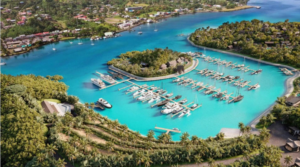
Nawi
Island is located in the beautiful Fiji Islands.It will feature an
International Superyacht Marina, which will have 132 marina berths,
including 21 superyacht slips (up to 85m). The marina has been designed
and built up to category 5 cyclone resistance rating.
The
South Pacific Posse is planning a get together at Nawi on Sept 2nd
2023. A week before the infamous Musket Cove regatta. Nawi will be
offering entertainment, markets, kava tasting and discounts on berths,
water sport activities, restaurant & bar orders, with Pacific Posse
hosting a Pig on the spit and rum delights.
The
fully serviced marina will include “plug in” services through utility
pedestals to water, sewerage pump out, power, fuel & gas facilities,
plus 24hr security, complimentary Wifi, a.m.o..
16° 46.5716′ S 179° 19.9533′ E – Nawi Island Savusavu 🇫🇯 Fiji
SAVU SAVU IS A HUB FOR THE NORTHERN FIJIAN ISLANDS AND THE JUMP OFF POINT FOR THE LAU GROUP
8) SOUTH PACIFIC POSSE SEMINARS ON DEMAND
SEMINARS RECORDINGS ARE ONLINE
INTRODUCTION
GALAPAGOS ISLANDS
FRENCH POLYNESIA
COOK ISLANDS – SAMOA(S) – TONGA
FIJI
VANUATU & NEW CALEDONIA ’23
PROVISIONING
LOGISTICS
OPEN CPN USE CASE
WEATHER and HEAVY WIND SQUALLS AND ELEVATED SEA STATE
ENTRY INTO THE ’22 SPP PICTURE OF THE YEAR AWARD – NOMOTU – SEAGLUB
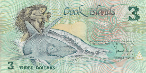
10) THE BEAUTY OF SOUTH PACIFIC CURRENCY
Cook Islands 3 dollar bill
Although
the Cook Islands operates on the New Zealand dollar, there is still
some Cook Islands dolalrs in circulation that is equal in value to NZD.
The
$3 note which is more of a collectors or novelty item. These can be
picked up from the Rarotonga Philatelic Bureau or given as change when
paying departure tax. The official Cook Islands currency is the
New Zealand dollar.
In
terms of cost of living in the Cook Islands, its price point is fairly
middle range in that it is a little more expensive than Fiji but a lot
less than French Polynesia and Tahiti. Part of the Cook Islands economy
is the VAT or Value Added Tax. Charged at 12.5% of the price, the tax is
added at the point of sale to almost everything however refunds are
available for tourists upon exiting the country.
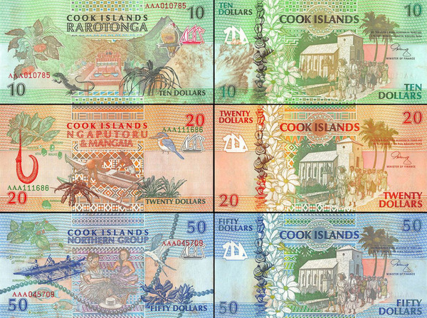
Old Cook Island Dollars
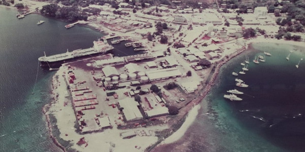
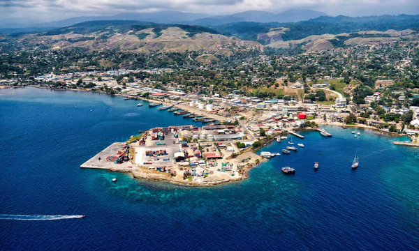
PORT VILA 🇻🇺 VANUATU
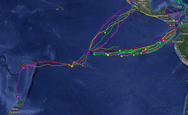
11) “AND THEY ARE OFF” FLEET TRACKING FOR PARTICIPANTS
About Tracking:
Designed to give interesting parties an overview. For specific vessel details including their floatplan,
latest updates, changes, positions and specific location related
questions please contact each vessel directly. If you are on
passage let us know and the fleet can monitor your progress.
Importance
of tracking – with accidents and incidents trackingallow sus to
respond and help redirect vessels to your aid – this provides safety for
particpants as those who come after you can aids – without tracking
this becomes a very difficult task to figuer out where everyone is and
who is best suited to help
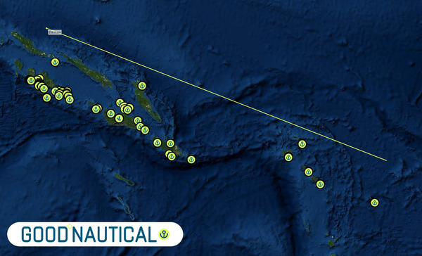
12) FREE ACCESS TO GOOD NAUTICAL
IF
YOU ARE SIGNED UP FOR THE ’23 SOUTH PACIFIC POSSE you will
be assigned access credentials to GOODNAUTICAL South Pacific
regions
CONSIDER MAKING A TAX DEDUCTIBLE DONATION TO GOOD NAUTICAL
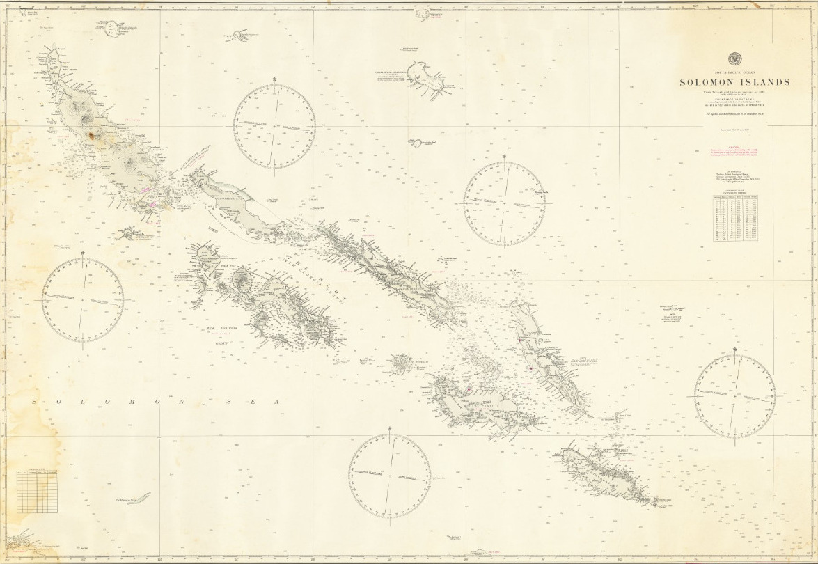
The
Spanish navigator Alvaro Mendana discovered these islands in 1567,
though it is somewhat doubtful whether he was actually the first
European who set eyes on them. In anticipation of their natural riches
he named them Islas de Salomon. The expedition surveyed the southern
portion of the group, and named the three large islands San Cristoval,
Guadalcanal and Ysabel. On his return to Peru, Mendana endeavoured to
organize another expedition to colonize the islands, but it was not
before June 1595 that he, with, Pedro Quiros as second in command, was
able to set sail for this purpose. The Marquesas and Santa Cruz islands
were now discovered; but on one of the latter, after various delays,
Mendana died, and the expedition collapsed.
Even
the position of the Solomon Islands was now in uncertainty, for the
Spaniards, fearing lest they should lose the benefits expected to accrue
from these discoveries, kept secret the narratives of Mendana and
Quiros. The Solomon Islands were thus lost sight of until, in 1767,
Philip Carteret lighted on their eastern shores at Gower Island, and
passed to the north of the group; without, however, recognizing that it
formed part of the Spanish discoveries. In 1768 Louis de Bougainville
found his way there. He discovered the three northern islands (Buka,
Bougainville and Choiseul), and sailed through the channel which divides
the two last and bears his name. In 1769 a French navigator, de
Surville, was the first, in spite of the hostility of the natives, to
make any lengthened stay in the group. He gave some of the islands the
French names they still bear, and brought home some detailed information
concerning them which he called Terre des Arsacides (Land of the
Assassins); but their identity with Mendanas Islas de Salomon was soon
established by French geographers. In 1788 the English lieutenant
Shortland coasted along the south side of the chain, and, supposing it
to be a continuous land, named it New Georgia; and in 1792 Captain
Edward Manning sailed through the strait which separates Ysabel from
Choiseul and now bears his name.
Traders
attempted to settle in the islands, and missionaries began to think of
this fresh field for labour, but neither met with much success, and
little was heard of the islanders save accounts of murder and plunder.
In 1845 the French Marist Fathers went to Isabel, where Mgr Epaulle,
first vicar apostolic of Melanesia, was killed by the natives soon after
landing. Three years later this mission had to be abandoned; but in
1851 work was again resumed. In 1856 John Coleridge Patteson, afterwards
bishop of Melanesia, had paid his first visit to the islands, and
native teachers trained at the Melanesian mission college subsequently
established themselves there. About this date the yacht Wanderer cruised
in these seas, but her owner, Benjamin Boyd, was kidnapped by the
natives and never afterwards heard of. In 1873 the foreign labour
traffic in plantation hands for Queensland and Fiji extended its baneful
influence from the New Hebrides to these islands. In 1893 the islands
Malaita, Marovo, Guadalcanal and San Cristoval with their surrounding
islets were annexed by Great Britain, and the final delimitation of
German and British influence in the archipelago was made by the
convention of the 14th of November 1899.
The Japanese occupied the islands from 1942 to 1945. They became independent in 1978.
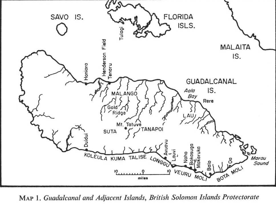
Honiara
is the capital of the Solomon Islands, southwestern Pacific Ocean. The
town is situated at the mouth of the Mataniko River on the north coast
of Guadalcanal. As a port and communications center it trades chiefly in
coconuts, timber, fish, and some gold (from Gold Ridge in the middle of
the island). Honiara International Airport is located approximately 10
miles (16 km) east of the town.
Prior
to World War II, Honiara did not exist; it developed around the site of
the U.S. military headquarters. In 1952 it officially replaced Tulagi
as the capital of the Solomons. Government buildings are on a narrow
coastal strip behind Point Cruz. In the 1960s the government, together
with the private sector, began an extensive development program in the
new capital. The first multistory buildings appeared in the 1980s. In
2006, amid an ongoing period of political instability, Honiara’s
Chinatown sustained severe damage in postelection rioting.
Solomon Islands 🇸🇧 in Good Nautical
14) MEET OUR SPONSORS
PREDICT WIND
PANAMA CANAL AGENT ERICK GALVEZ CENTENARIO CONSULTING
YACHT AGENTS GALAPAGOS
YACHT AGENTS NUKU HIVA
SAIL TAHITI
OCEAN TACTICS | PACIFIC WEATHER ROUTING
SHELTER BAY MARINA PANAMA
DENARAU MARINA FIJI
NAWI ISLAND MARINA
VUDA POINT MARINA
COPRA SHED MARINA FIJI
CLOUD 9
PUERTO AMISTAD ECUADOR
RIVERGATE MARINA AUSTRALIA
MARSDEN COVE MARINA NEW ZEALAND
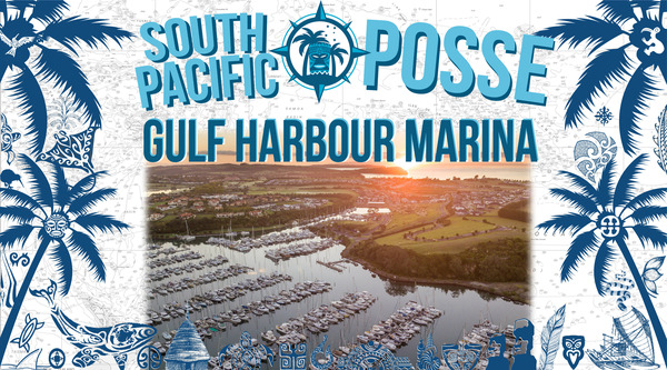
GULF HARBOUR MARINA NEW ZEALAND
YACHTING WORLD MARINA PORT VILA VANUATU
15) LAST ONE
Some
of the major wrecks of Iron Bottom Sound in the Solomon Islands include
the American cruiser Quincy, the Australian heavy cruiser Canberra, the
Japanese aircraft carrier Kinugasa, the battleship Kirishima and the
freighter Kasi Maru
WE OPERATE UNDER INTERNATIONAL MARITIME LAW
YOUR VESSEL YOUR CREW YOUR RESPONSIBILITY
south pacific posse communications @ 9811 w charleston blvd 2262 89117 Las Vegas USA
This e-mail has been sent to registration@pacificposse.com, Click here to UNSUBSCRIBE


[…] PICTURES OF THE WEEK […]