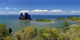
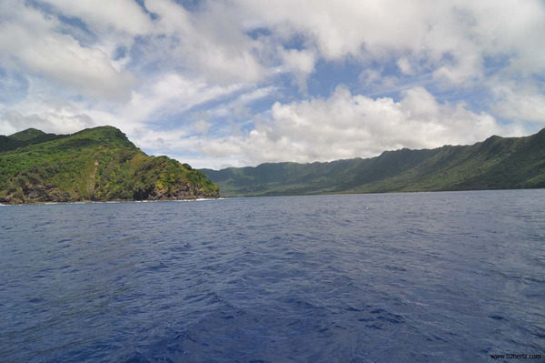
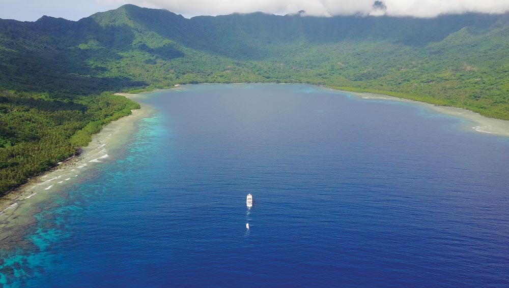
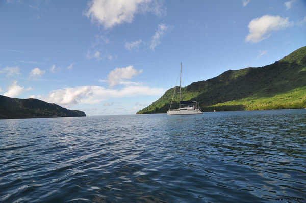
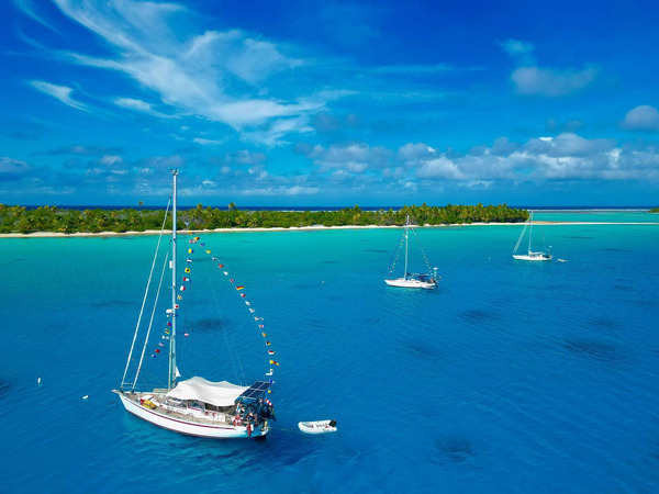
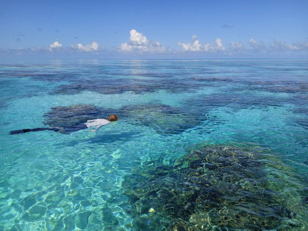
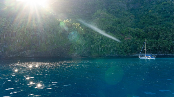
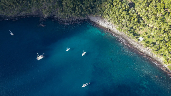
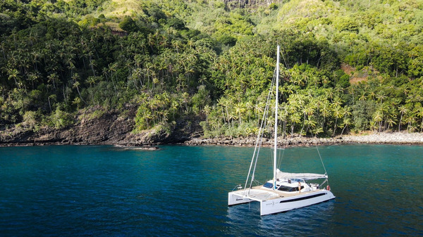
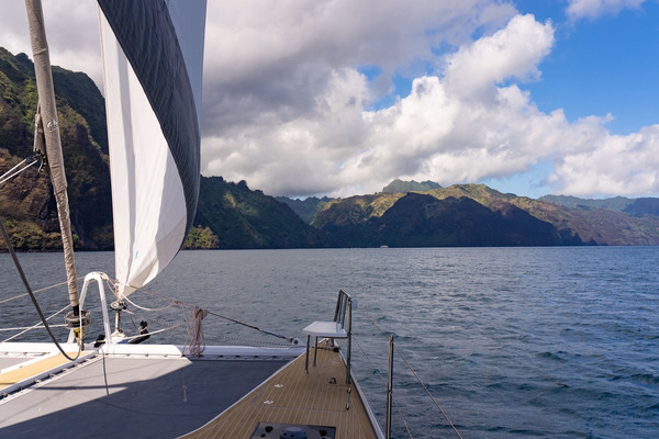
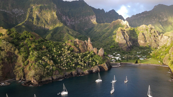
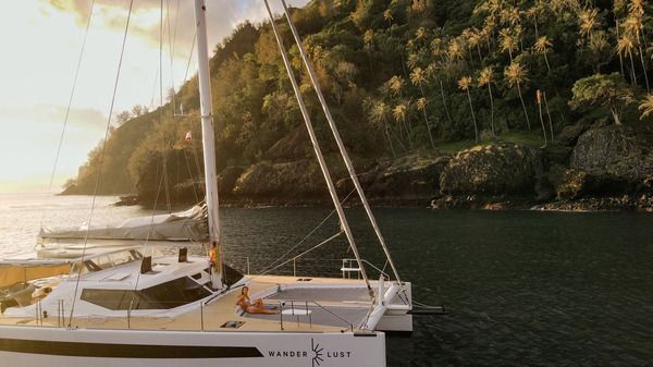
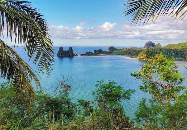
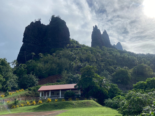
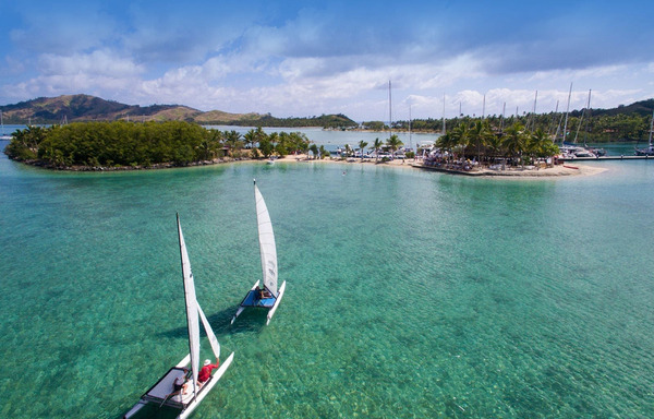
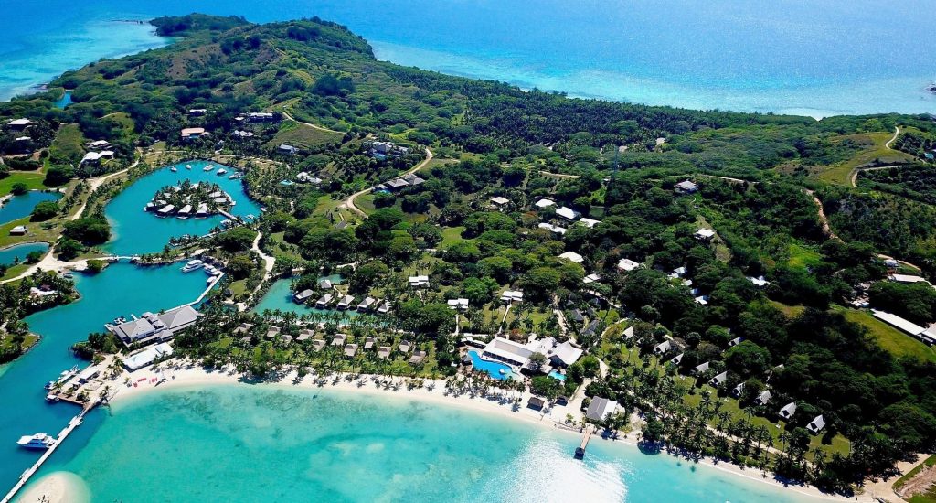
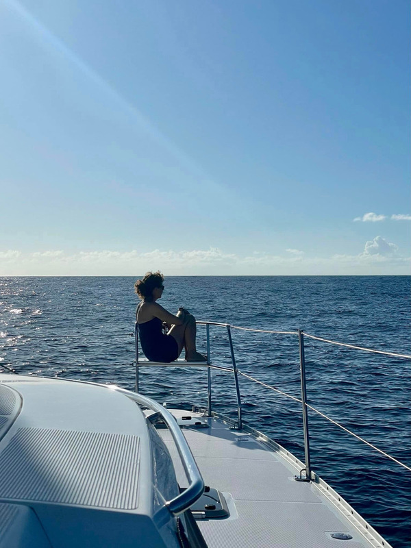
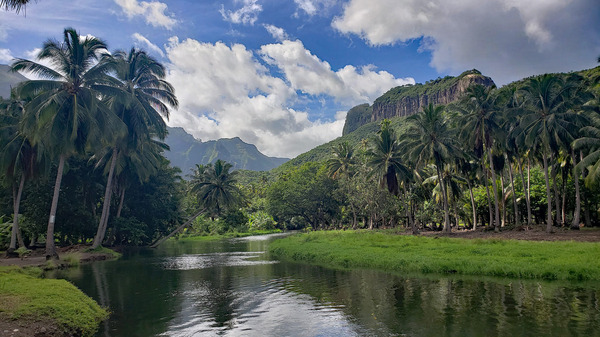
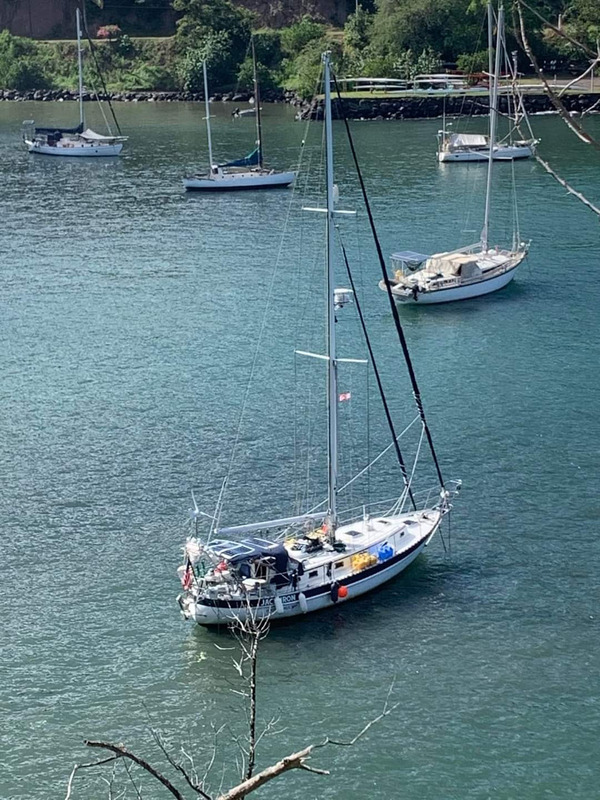
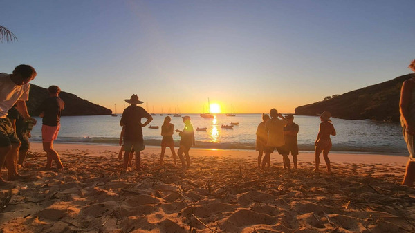
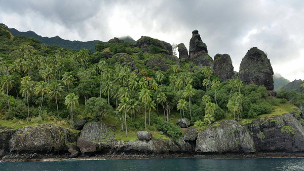
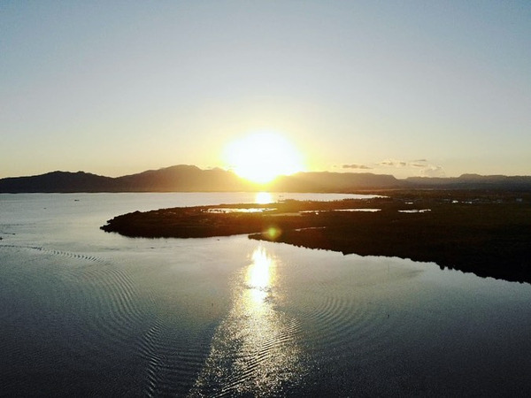
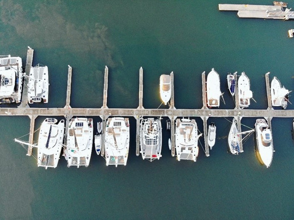
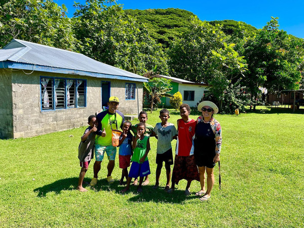
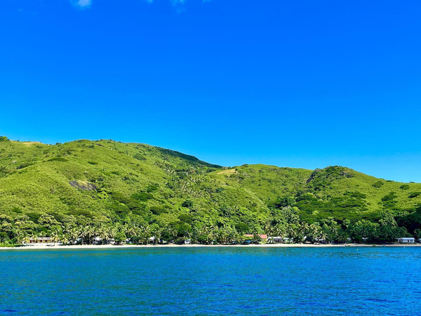
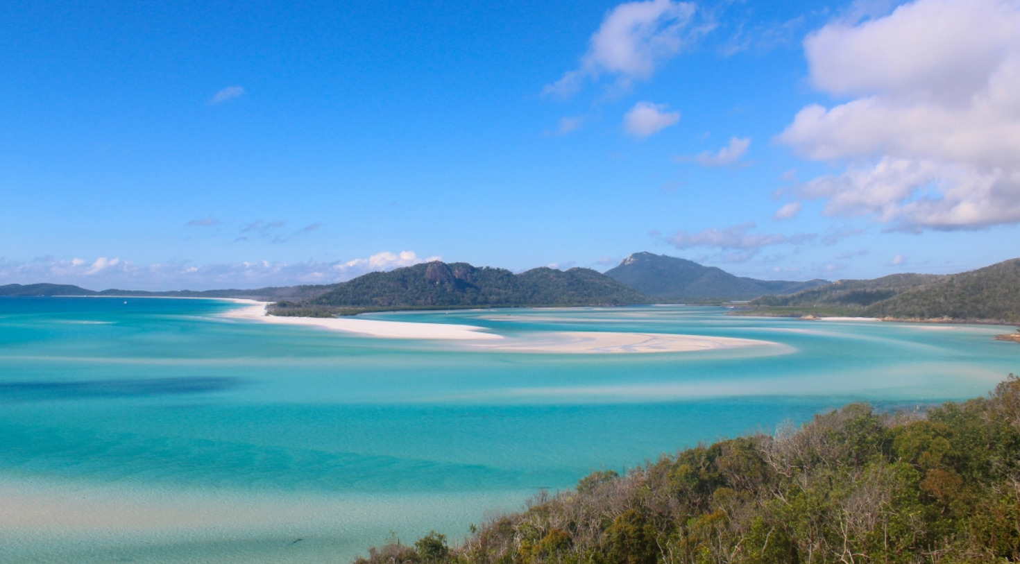
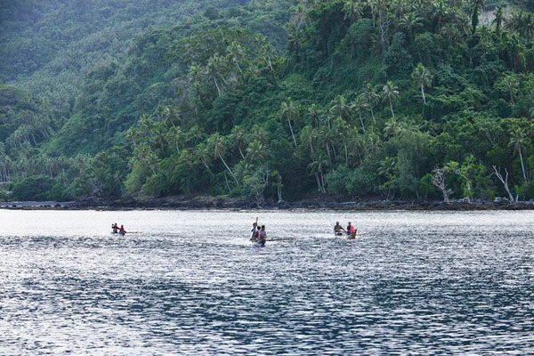
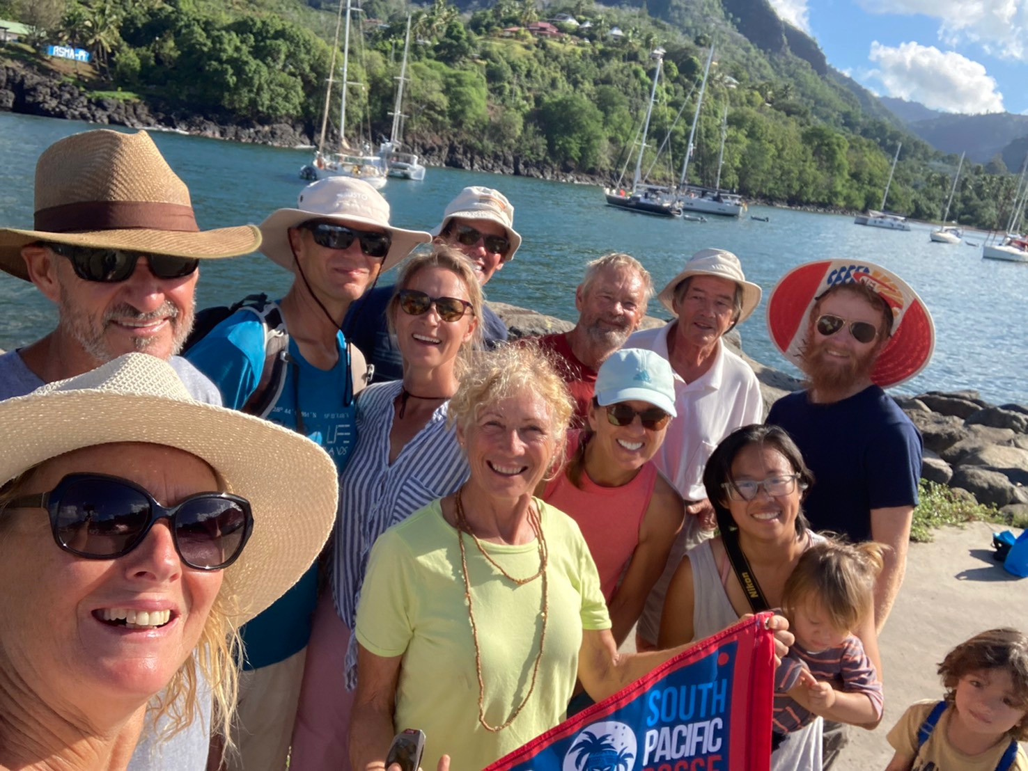
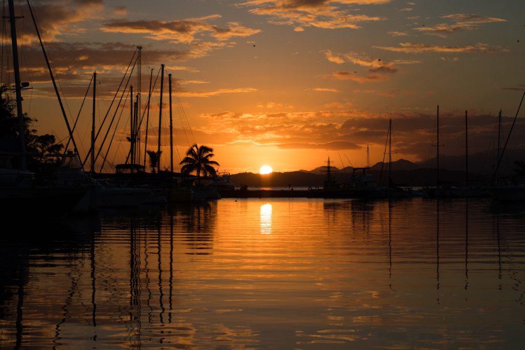
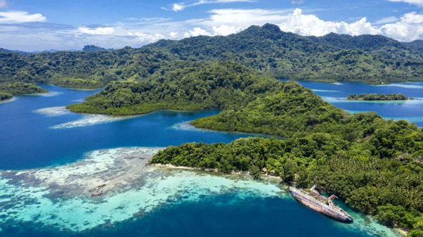
Hienghene New Caledonia

FLEET UPDATE 2024-01-27

South Pacifc Posse

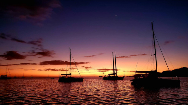
SUNSET ALERT

"The traveler was active; he went strenuously in search of people, of adventure, of experience. The tourist is passive."

- Johann Wolfgang von Goethe

SOUTH PACIFIC POSSE 
FLEET UPDATE 
SEASON 4

2024-01-27

TOP NEWS

1) NOTICE OF A RALLY 
SOUTH PACIFIC POSSE SEASON 4

South Pacific Posse

47 YACHTS ARE ALREADY SIGNED UP  

South Pacific Posse Burgee Season 4 '24
SOUTH PACIFIC POSSE

2) LA NIÑA 
SWITCH MID SEASON 

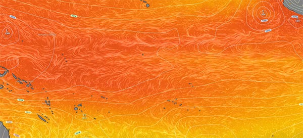
La Niña impacts

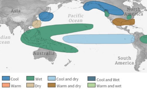
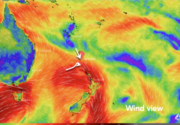
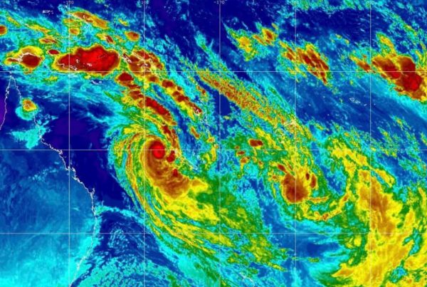
Weather Outlook Through Summer 2024 Sees El Niño Switch back to La Nina. It's not unprecedented, but it is very rare. After going from three straight La Niña winters to an El Niño for the 2023-2024 winter, a quick change back to La Niña for summer 2024 is a very strong likelihood.

How does La Niña affect the South Pacific?

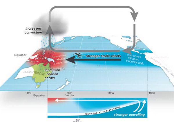
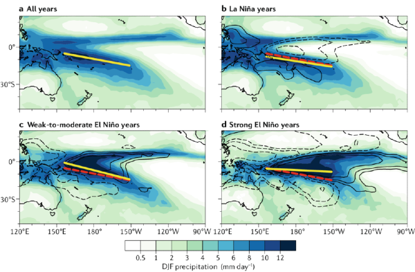
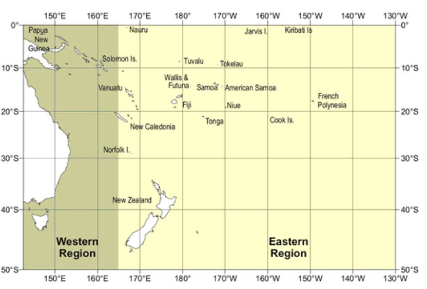
How does La Niña affect the South Pacific? La Niña causes the jet stream to move northward and to weaken over the eastern Pacific. During La Niña, atmospheric pressure increases in the east of the Pacific and lowers in the west. This pressure difference causes trade winds to strengthen. The Pacific waters north of Australia become warmer than normal, as the central and eastern Pacific cools. La Niña occurs when there is an increase in the strength and intensity of trade winds, which then enhances the warm pool in the Western Pacific, causing sea surface temperatures in the Central and Easter Pacific to become cooler resulting in above normal rainfall in the West. The warm ocean around Australia increases moisture in the atmosphere and enhances the chance of rainfall for the northern and eastern parts of the country. It also increases the likelihood of tropical cyclones. During a La Niña event, countries in the Central and South Pacific region, such as Kiribati, Nauru, Tuvalu, and northern Cook Islands will experience below normal rainfall, while countries in the Southwest Pacific, such as parts of Papua New Guinea and Solomon Islands, New Caledonia, Vanuatu, Fiji, Tonga and Niue will see higher than normal rainfall.

La Niña
causes the jet stream to move northward and to weaken over the eastern
Pacific.  During La Niña, atmospheric pressure increases in the
east of the Pacific and lowers in the west. This pressure difference
causes trade winds to strengthen. The Pacific waters north of Australia
become warmer than normal, as the central and eastern Pacific
cools. 

la nina

La Niña occurs
when there is an increase in the strength and intensity of trade winds,
which then enhances the warm pool in the Western Pacific, causing sea
surface temperatures in the Central and Easter Pacific to become cooler
resulting in above normal rainfall in the West. The warm ocean around
Australia increases moisture in the atmosphere and enhances the chance
of rainfall for the northern and eastern parts of the country. It also
increases the likelihood of tropical cyclones.

During a La Niña event,
countries in the Central and South Pacific region, such as Kiribati,
Nauru,  Tuvalu, and northern Cook Islands will experience below
normal rainfall, while countries in the Southwest Pacific, such as parts
of Papua New Guinea and Solomon Islands, New Caledonia,  Vanuatu,
Fiji, Tonga and Niue will see higher than normal rainfall.

la nina


3) MEET THE FLEET  

🚢

MV CELT

 MEET THE FLEET 🚢 MV CELT

We
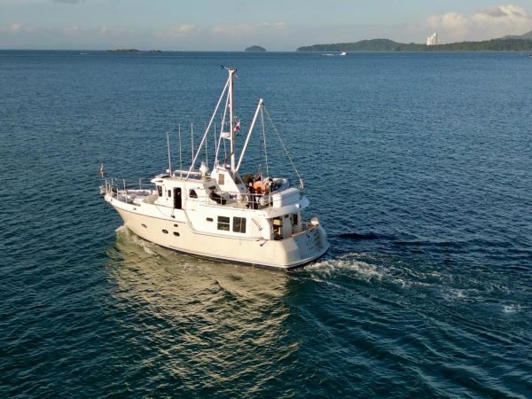
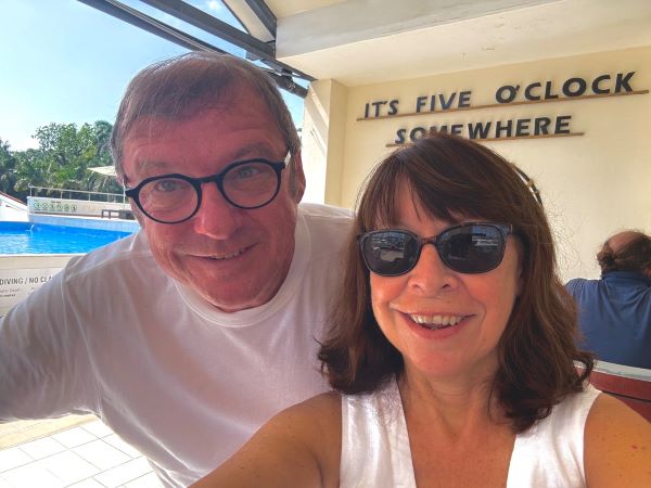
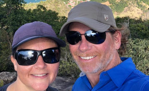
are Angela and Gerry onboard Celt a Nordhavn 43.  We are Irish but
have lived in the US for more than half our lives.  We are married
40 years and just retired two years ago.  We have traveled the
east coast of the US and the Caribbean down to Grenada and Bonaire,
onward through the Canal.  Presently, we are in Buenadventura on
the Pacific Side of Panama.  We are excited to be part of this
group as we make our way to the South Pacific.

YEA

MV CELT 🇺🇸 Gerry & Angela – Nordhavn 43′

CELT CELT
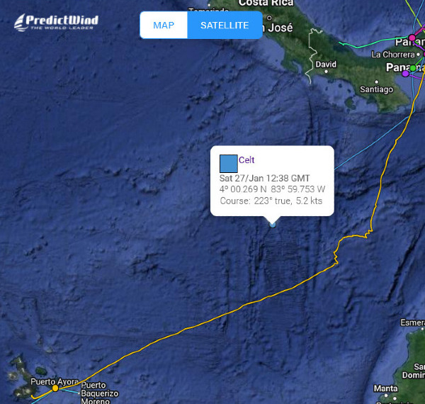
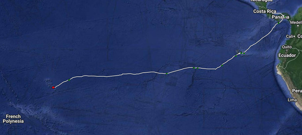
on their way

MV Celt is on their way and as part of the South Pacific Posse is carrying MANY South Pacific Burgees to the Fleet further afield.


4) WEST MARINE PRO DISCOUNT 

FOR THE SOUTH PACIFIC POSSE  

West Marine

Your South Pacific Posse / Good Nautical West Marine Pro discount is 5 -25%

To get your discount please fill this form below – allow 2 weeks …

https://pacificposse.com/westmarine

South Pacific Posse Perk


5) SOUTH PACIFIC POSSE 
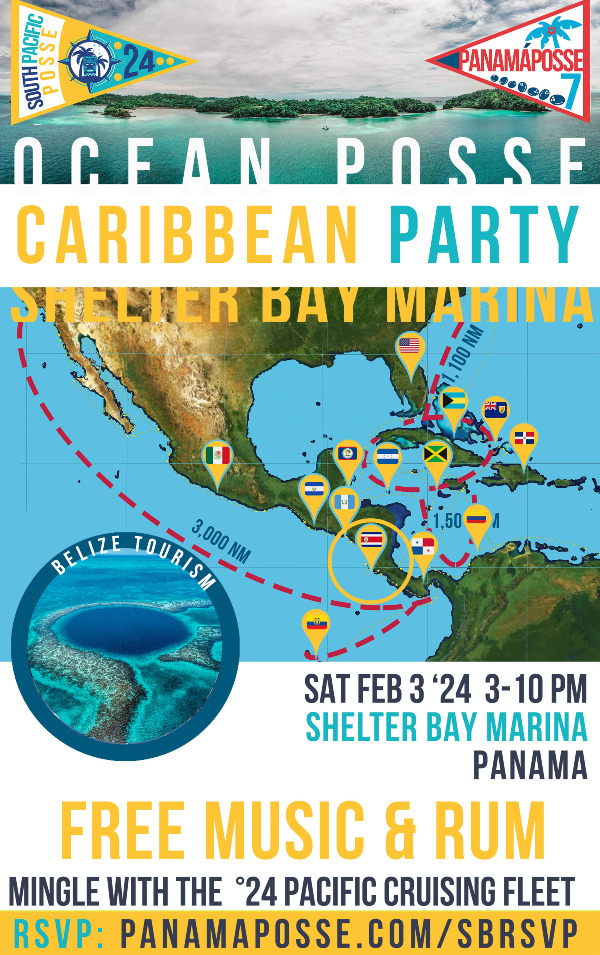
PARTY SHELTER BAY MARINA  🇵🇦  PANAMA

https://panamaposse.com/sbrsvp
RSVP FOR THIS EVENT


6) 24'  SEASON OVERVIEW 

The
South Pacific Posse starts when the last cyclone blows through and
stops before the first cyclone of the following season develops

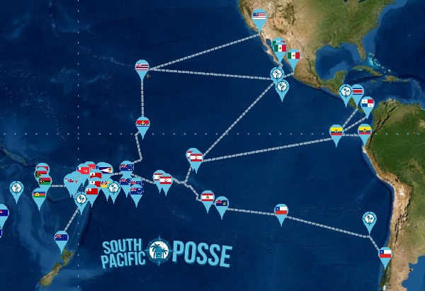
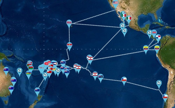
ROUTE

Dec '23 - Feb '24  PRE - SEASON   
Mar '24 - Oct '24  IN SEASON 

TRANSPARENT FEES 

Transparent Pricing
SIGN UP NOW 

7) SAVE THESE DATES -   ZOOM & DESTINATION PLANNING

South Pacific Posse

Sat Feb 3, '24  @ SHELTER BAY MARINA - 16:00 South Pacific Posse route presentation – beyond Bora Bora lie 10000 islands

Mon Feb 5, 24  @ 20:30 UTC  🐢 Galapagos 🗿 Easter Island 🇵🇳  Pitcairn Kiribati

Tue Feb 6, '24   @ 20:30 UTC 🇵🇫  French Polynesia 

Wed Feb 7, '24  @ 20:30 UTC 🇨🇰 Cook Islands 🇳🇺 Niue

Thu Feb 8, '24  @ 20:30 UTC  🇦🇸 American Samoa 🇼🇸  Samoa 🇼🇫 Wallis & Futuna

Fri Feb 9, '24   @ 20:30 UTC  🇹🇴 Tonga

Sun Feb 11, '24   @ 20:30 UTC  🇫🇯 Fiji 

Mon Feb 12, '24   @ 20:30 UTC 🇻🇺 Vanuatu 

Tue Feb 13, '24   @ 20:30 UTC  🇳🇨 New Caledonia

Wed Feb 14, '24   @ 20:30 UTC  🇳🇿 New Zealand, North Island

Wed Feb 15, '24  @ 20:30 UTC  🇳🇫 Norfolk Island 🇦🇺 Australia, QLD

Kiribati

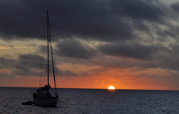
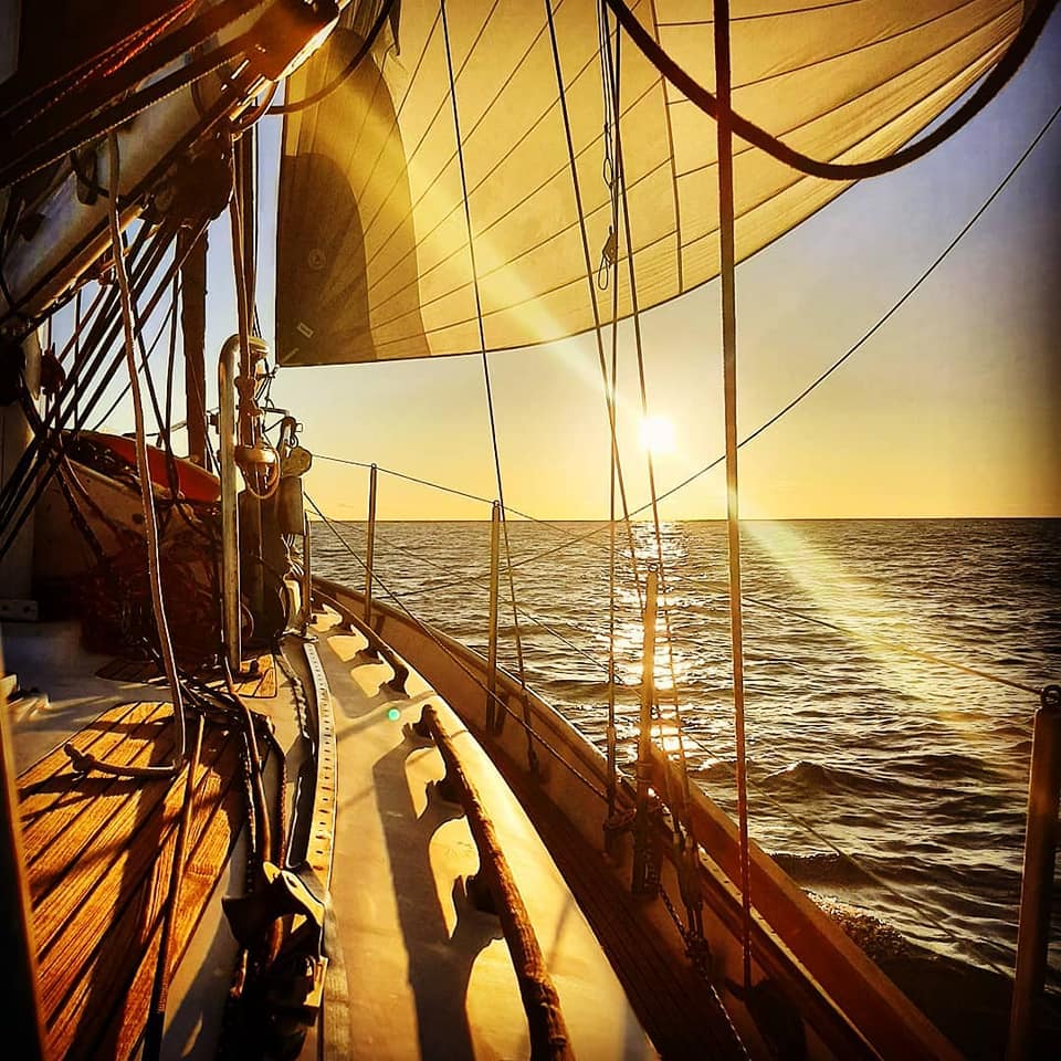
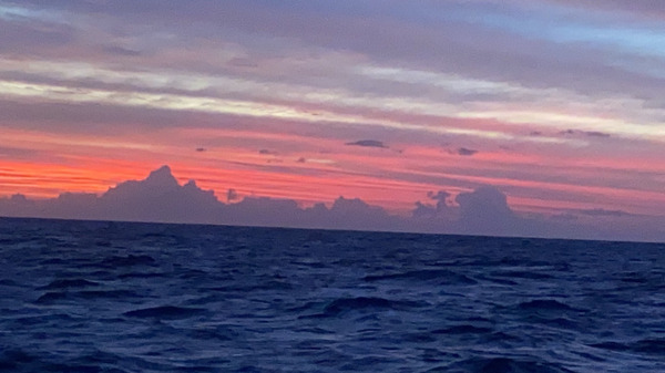
SET SAILS TOWARDS THE SOUTH PACIFIC SUNSETS

 8)  NEXT ON BOARDING ZOOM CALLS 

Panama Posse zoom

SATURDAY Jan 27, 2024 ( today ) 
SATURDAY Feb 17th, 2024
 
14:00  PM PACIFIC TIME  
 16:00 PM Mexico City / Costa Rica 
  17:00   PM PANAMA TIME  / ET 

request the zoom link via email from registration@pacificposse.com 


  • Values, goals and expectations
  • Resources and perks
  • Ongoing information
  • Participation and involvement
  • Social events and  activities
  • Check-ins and feedback
  • Emergencies 
  • Milestones
    & Awards
  • Ongoing learning  
  • Q&A & Meet the Editor
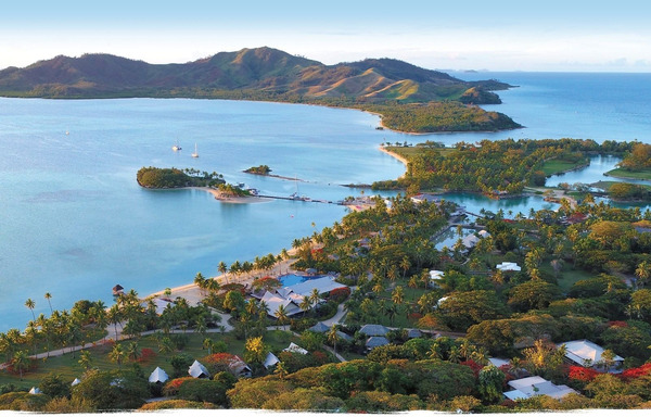
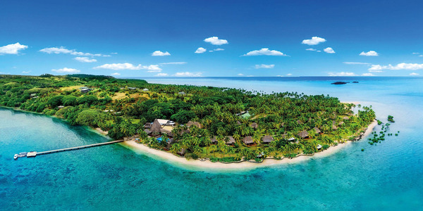
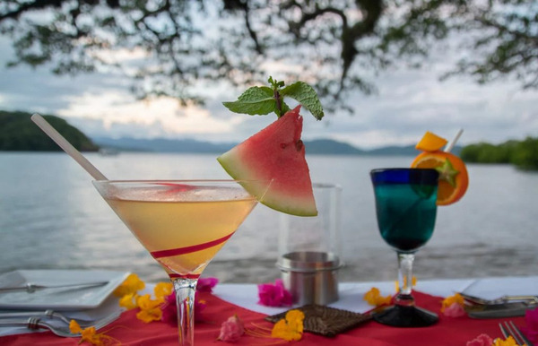
Quintessential South Pacific resorts

Quintessential South Pacific resorts 

9) SEASON GATHERINGS 🎉 CELEBRATIONS
  

SAVE THE DATE 

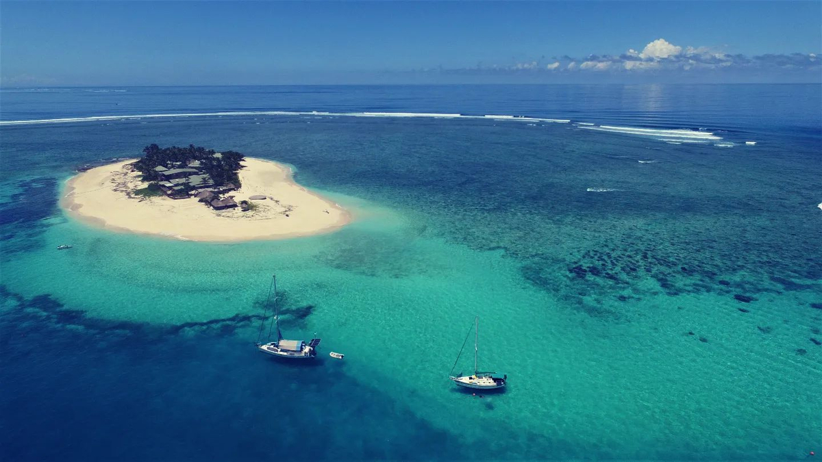
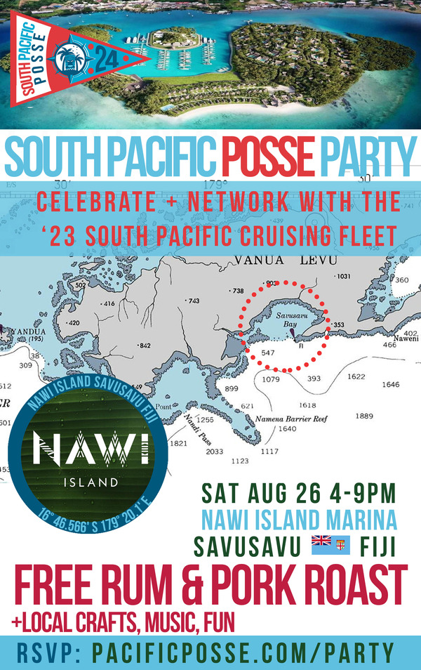
SAT AUG 31, 2024 NAWI ISLAND MARINA 🇫🇯 FIJI 
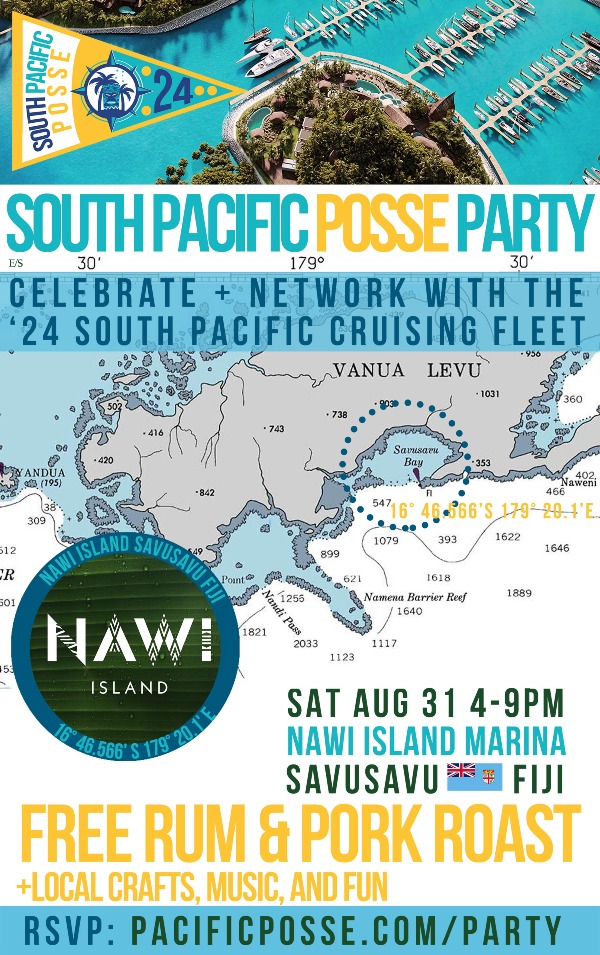
NAWI ISLAND PARTY
RUM PARTY

10) THE ITCZ 

AKA THE DOLDRUMS 

4) MEET THE ITCZ AKA THE DOLDRUMS

The Inter-tropical Convergence Zone, known by sailors as the doldrums or the

calms because of its monotonous windless weather, is the area where the

northeast and the southeast trade winds converge. It hovers near the

thermal equator and its specific position varies seasonally
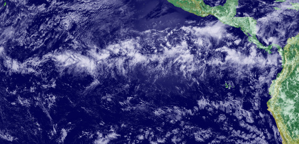
 Our strategy was to bring enough diesel andready to motor for up to 600 nm. Since it’s pulsates and is hard to pinpoint we eventually turned on the engines in the fading winds below 4 knots of SOG and motored for 425 nm ~2.5 days to get through it
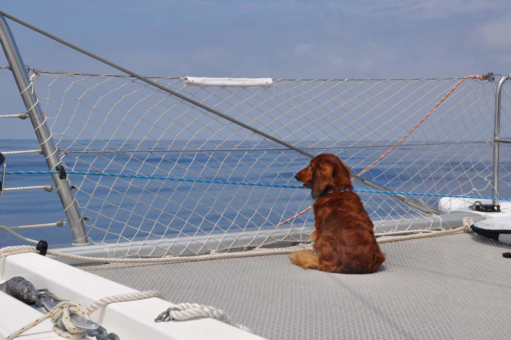
Our strategy was to bring enough diesel and ready to motor for up to 600 nm.

Since it’s pulsates and is hard to pinpoint we eventually turned on the

engines in the fading winds below 4 knots of SOG and motored for 425 nm

~2.5  days to get through it 

Oceania

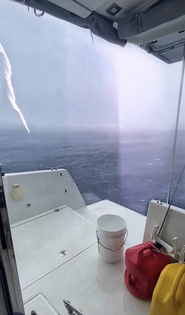
In addition to heat and glass like conditions it does bring the danger of squalls, and quite strong ones too.
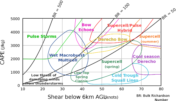
MICROBURSTS

The ITCZ area  can even create micro burst which are very intense and

played a role in the loss of Air France Flight 447 in May of 2009
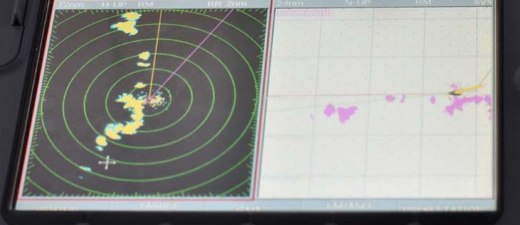
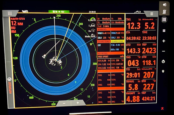
Squalls are easily visible on radar and the sky itself ( less so at night ) and their general direction can be tracked. The only time we diverted from our rhumb line course was to avoid squalls
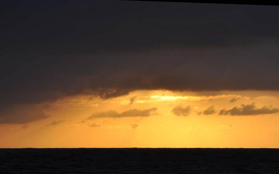
Squalls are  visible for us on our radar and the sky itself ( less so at night ) and

their general direction can be tracked. The only time we diverted from

our rhumb line course was to avoid squalls 

Even when the ITCZ is present, however, it is constantly moving and changing in intensity. It varies from 3° N to 10° N. It can be anywhere from 50 to 300 miles wide. The dousing we got with one of these squalls was also a welcoming source of delicious fresh water and clean decks.

Even when the ITCZ is present, however, it is constantly moving and changing

in intensity. It varies from 3° N to 10° N. It can be anywhere from 50

to 300 miles wide. The dousing we got with one of these squalls was also

a welcoming source of delicious fresh water and clean decks 

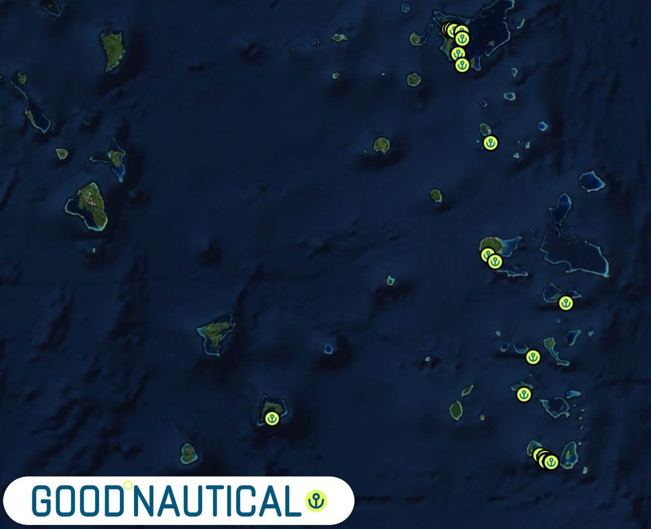
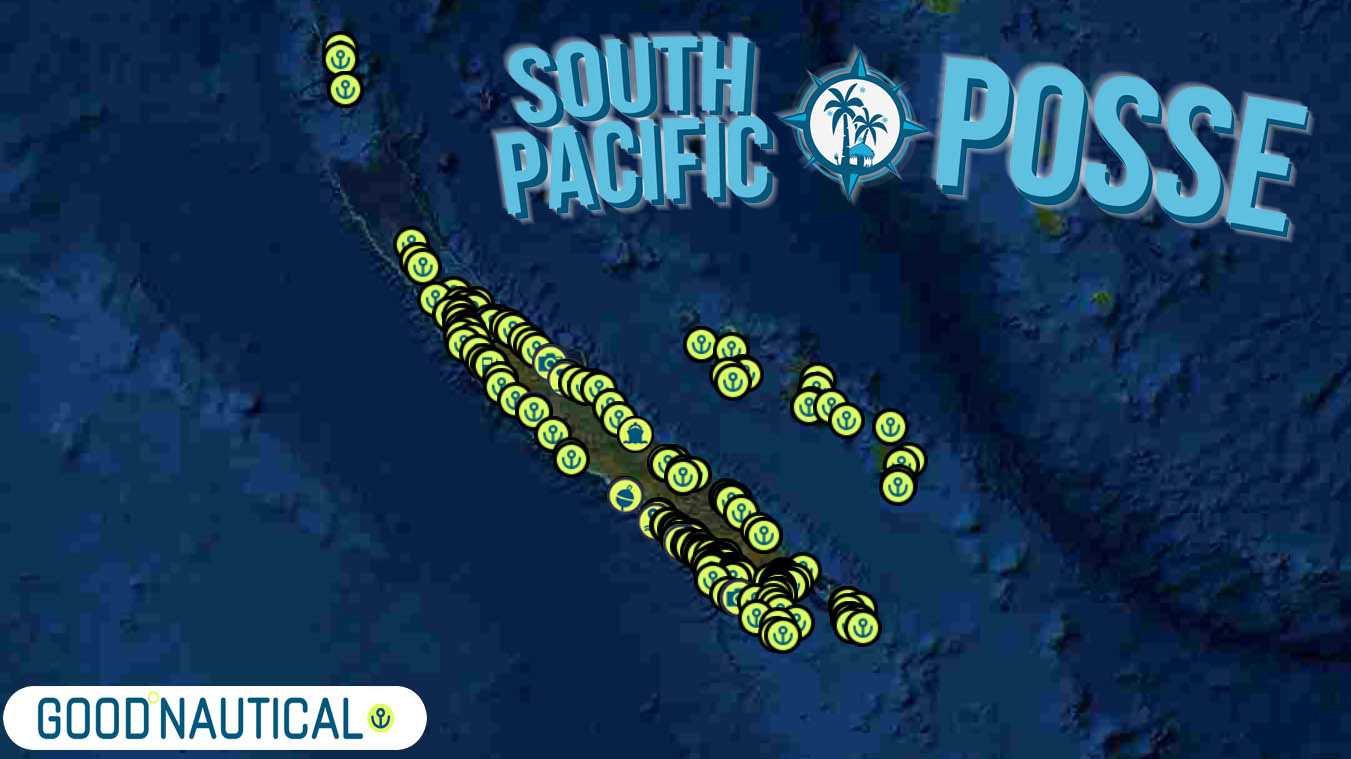
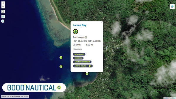
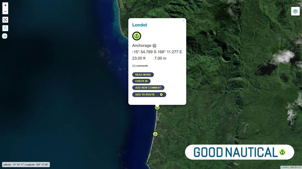
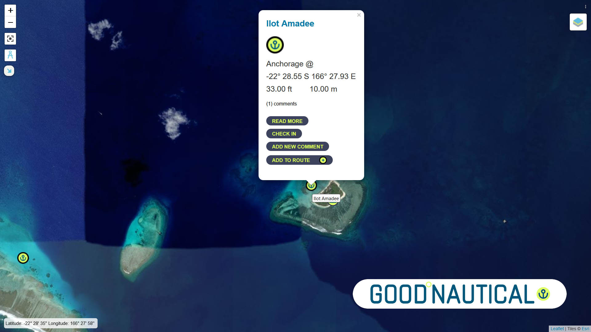
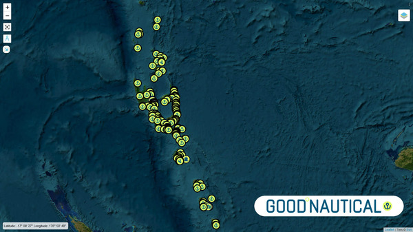
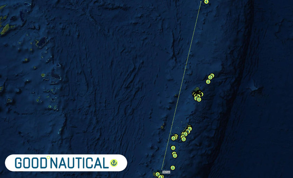
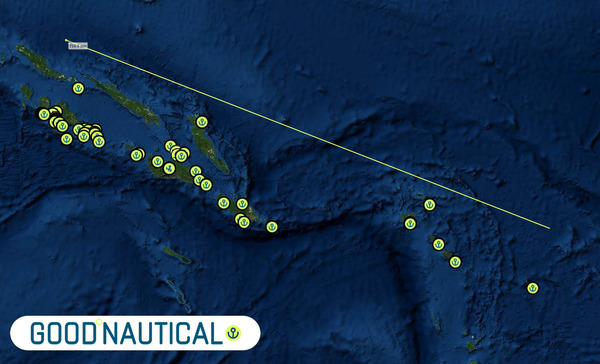
11) 1,000+ SOUTH PACIFIC ANCHORAGES 
IN GOOD NAUTICAL 

Location
Good Nautical
GOOD NAUTICAL

Full
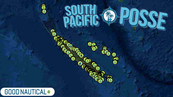
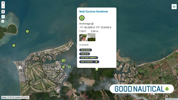
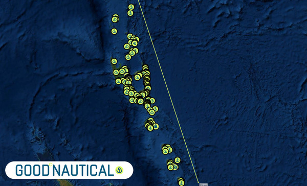
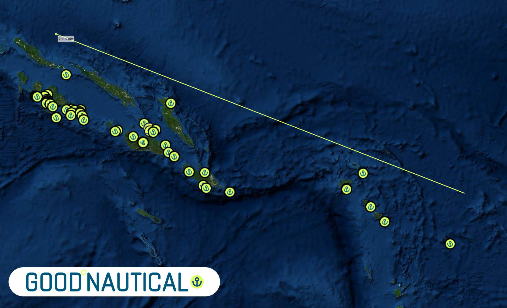
access to Good Nautical with 1000+ hard to find anchorage data compiled
over the last 12 years by participants and explorers.  
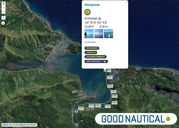
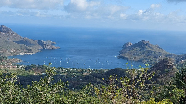
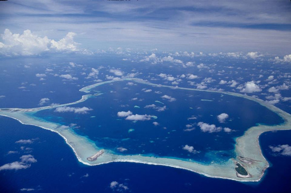
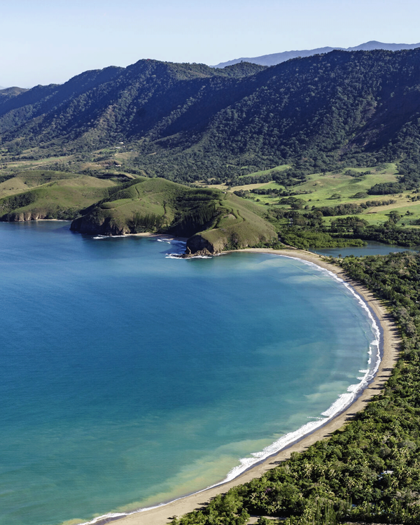
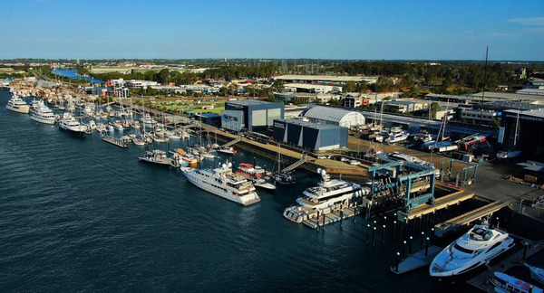
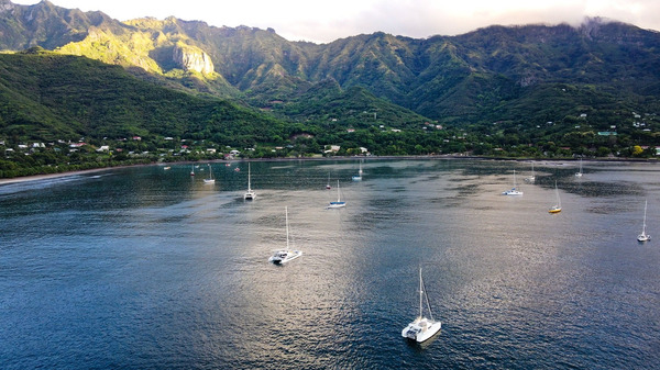
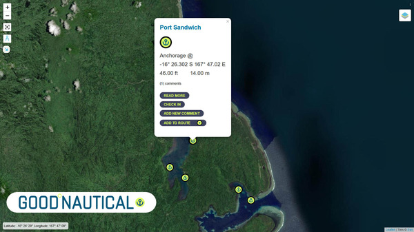
Hienghene

Routes through reefs  are also avail in GPX format in Good Nautical 
here
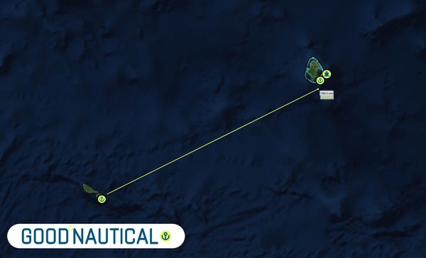
is the venerable and tricky  pass  to be validated to Marina
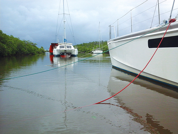
de Hienghene in 🇳🇨 New Caledonia ( Cyclonehole ) 
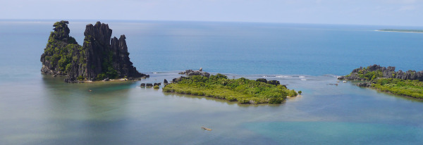
Hienghene

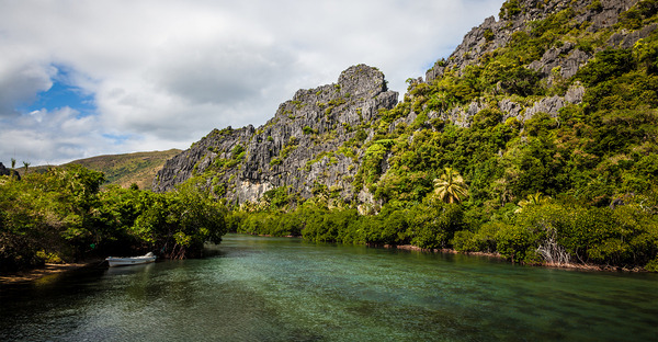
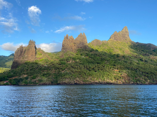
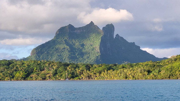
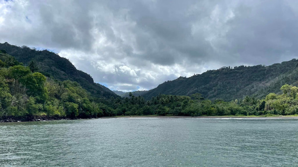
Hienghène's
renowned Poule Couveuse (Brooding Hen) rock formation sits on one side
of the entrance to Baie de Hienghène, facing the Sphinx on the
other. 

12) PASSAGE 🛠️ PREPARDENESS 
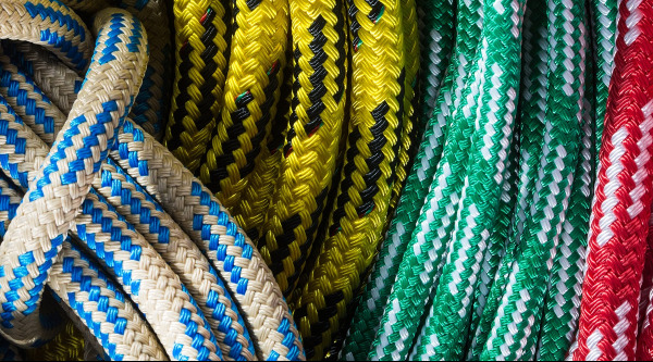
ROPES

RUNNING RIGGING AND CHAFE MITIGATION ON LONG PASSAGES

From the Rigger: There are many ways to extend the life of your rope. Here are some of our favorites…

End-for-Ending
This very simple solution is definitely under-utilized. Simply flip
your rope around end-for-end to vary stress and abrasion points. For
example, the end of the jib sheet attached to the sail becomes the end
in the cockpit. And as you end-for-end each rope, take the opportunity
to visually inspect the entire length for damage and uneven wear.

Chafe points
– It is so sad to see perfectly good rope chafed at one spot (Murphy’s
Law: usually in the middle). And when there is chafing, people often fix
the rope without addressing the source of the chafe. Look for points
along the path of your ropes that are likely to cause chafing. Are
fairleads well-greased and running smoothly? Are metal chafe points
protected with tape, leather, plastic or cloth? And be proactive…

Technora® chafe sleeve to the section of rope that passes through your clutches. 

Consider applying “millionaire’s tape
to abrasion points along the length of your rope. This high pressure,
low-friction tape comes in a variety of materials, widths and colors.
PROtect Tape® and 3M®, which can be purchased by the foot or by
the roll.

Sky Your Halyards
(intentionally!) – If you want to extend the life of your halyards, do
what the serious racers do… sky your halyards. Carefully attach a
retrieval line to each halyard (or you might be climbing your mast),
then pull the halyards into the mast to protect them from exposure to
sun and heavy weather. Just to be on the safe side, we suggest that you
do not use the releasable part of a shackle to sky your halyards.

Cleaning
– limit the cleaning of your rope to a fresh water rinse to remove salt
particles and loose dirt. If you must use a cleaning solution, stick
with a small amount of a very mild detergent in warm water and
rinse it well. Avoid contact with anything stronger, especially in the
earlier years when the rope still has the coatings and lubricants
applied by the manufacturer. Then simply lay the rope out to dry. Never use bleach.

Storage
– We suggest that you neatly coiling your rope for storage and hang it
by an endpoint. Rope stored on the ground is more likely to collect
moisture and dirt. Make sure that your rope is stored dry to avoid
mildew and rotting. Avoid kinks and knots which can weaken the fibers in
the rope. If possible, store your rope in a shady spot out of direct
sunlight. Avoid contact with chemicals such as leaking hydraulic fluid,
gasoline, oil, acids, etc.

Protect Rope ends
Splice where possible. Proper splicing   creates less stress on
your rope than standard knots which weaken rope fibers. Consider adding Dyneema®
chafe sleeve to the working end of your rope. Use halyard balls at the
end of your spinnaker halyards to prevent over tightening.

Overload
– Make sure that the rope you select is adequately rated for the job at
hand. Overloading your rope can result in excessive stretching,
diameter reduction & hardening.

Overheat
– Rope manufacturers, warns that synthetic rope is very susceptible to
heat, including heat cause by friction. Rope that exceeds 250 degrees or
is too hot to touch is likely to be compromised.  
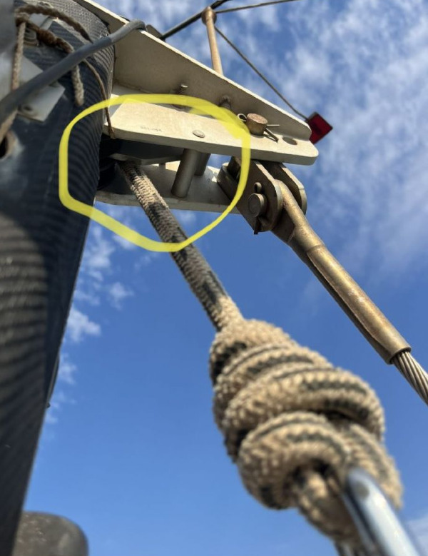
Yachts and safety

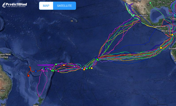
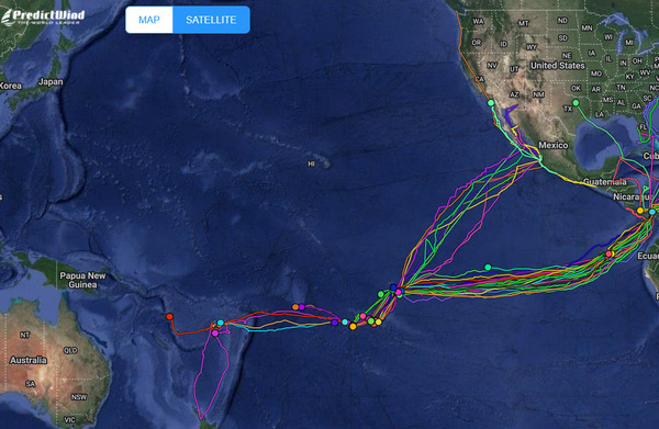
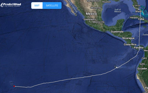
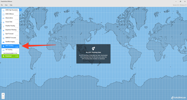
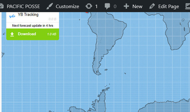
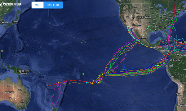
13) FREE FLEET TRACKING '24 
🛰️ 

WITH PREDICT WIND 
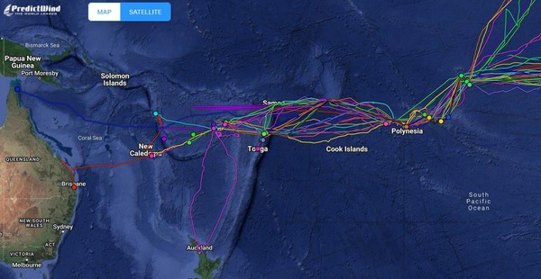
Tracking

 About Tracking:

Designed to give interesting parties  an overview. For specific vessel details including their float plan,
latest updates, changes, positions and specific location related
questions please contact each vessel directly.  If you are on
passage  all of us and the fleet can monitor your progress.

https://pacificposse.com/add-to-tracking

Landfall Bay


14) SOUTH PACIFIC POSSE  
🏆 
AWARD CATEGORIES 

poison cru

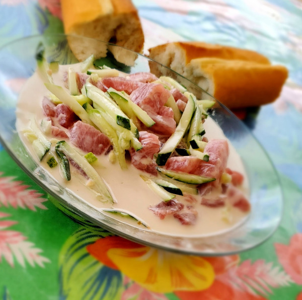
Galley Goddess award for Ota 'ika / Poisson Cru ?

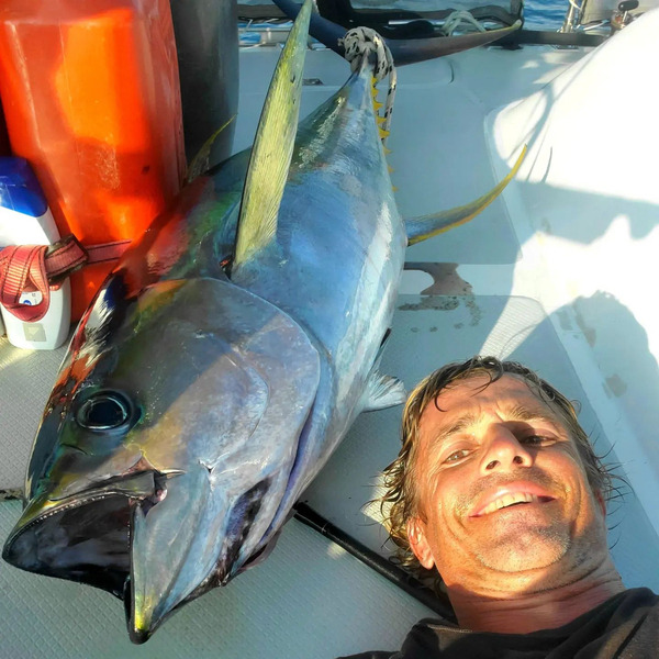
  • BIGGEST FISH CAUGHT ✔ 
  • PICTURE OF THE YEAR ✔  
  • PACIFIC POSSE YODA OF THE YEAR ✔  
  • THE CAPTAIN RON AWARD ✔
  • MOST UNWELCOME VISITOR ONBOARD ✔ 
  • HIGHEST WIND RECORDED ✔ 
  • SPIRIT OF EXPLORATION ✔ 
  • GALLEY GOD(ESS) ✔ 
  • SPEEDY AWARD
  • GOOD SAMARITAN OF THE YEAR ✔  
  • BOAT YOGA POSE OF THE YEAR ✔
  • COURAGE AWARD 
Vanua Levu Taveuni Blight Water

Vanua Levu Taveuni Blight Water 🇫🇯 FIJI

SIGN UP FOR THE '24 SOUTH PACIFIC POSSE

15) POSSE PERKS  🚩  BENEFITS 

we sail

BENEFITS FOR YOU, YOUR YACHT & YOUR CREW

✔️ Up to date and verified information by fellow yachts

📊 Focused on facts, not opinions or unsolicited advice

💰 Save real money at 12 Marinas with discounts

🛰️ Free vessel and fleet tracking courtesy of Predict Wind

🚩 Free Burgee

💰 Save with service providers and chandleries

🕵️ dedicated, experienced and discounted agents

🗺️ Free aid to navigation 150 Gb OpenCPN satellite charts (mac/pc/android)

💰  Save Money on parts with a Westmarine Pro Discount

💰 Save Money with a Predict Wind Pro Discount

🗺️ Free Printable Reference Charts emergency backup to your electronics

📹 Free Video Seminars on destinations from those who are there

🌩️ Top weather routing discount by Ocean Tactics and Seminars

⛵ Community of voyagers all are welcome, kids, single-handers, pets

⚓ Peer support in emergencies with escalation procedures

🛈  Fleet Updates via email – free

🏆 Fun Award Categories

📍 Free access to GOOD NAUTICAL 1,500 + South Pacific Anchorages

☎️ Free Weekly live calls on Mondays via dedicated LINE.me group

💬 Free 24/7 LINE group channel from now – December ’23

🌊 Benefit from the latest information and prior experience participants

🔭 Be part of a fleet of sensor for those who come behind you or meet

🚷 Always priority traffic – for participants by participants

a.m.o. >> 

local customs

A lot of fun with fellow cruisers in remote locations - meet the locals 

16)  SOUTH PACIFIC POSSE 
FLEET COMMUNICATIONS 📣 

Starlink
  • Monday live LINE calls over IP @ 20:00 UTC
  • Monthly Fleet Updates 
  • 24/7 Chatroom with location sharing / pictures  
  • Emergency Escalation 
  • Local vetted Agents when need 
  • Discounted personalized Weather Routing 

Vanuatu Women's Water Music


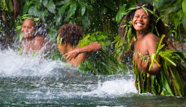
The
performers of the Vanuatu Women’s Water Music group hail from the
remote northern tropical islands of Vanuatu. They travel the world
performing the Na Mag and Ne Lang dances as a prelude to the mystical
water music, dressed in their traditional costumes of Gaua and Mere Lava
made from flowers and leaves, coconuts and pandanus.


Their
performance is truly mesmerizing as they reimagine the old with
contemporary expressions of Matto - bringing together traditional beats
and rhythms with ukulele-led melodies and soaring vocal harmonies. 

water music

17) THE HAKA

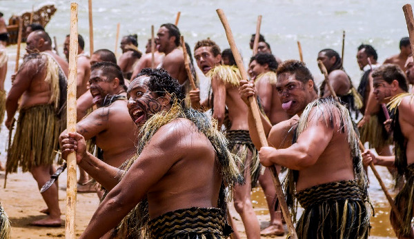
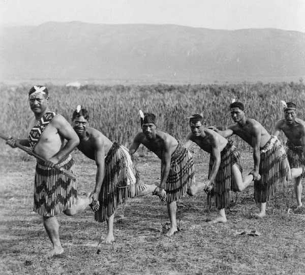
HAKA

Meaning of the Haka

Traditionally,
the Haka was performed by warriors before a battle, proclaiming their
strength and prowess in order to intimidate the opponent. The fierce
display was meant to showcase the tribe's unity and readiness for
battle.

Today,
the Haka is performed on many occasions and is used to express
collective emotions. It can be an expression of celebration, welcome, or
respect at gatherings and special occasions.

Many
Hakas tell a story or convey a specific message. The words, movements,
and rhythms are carefully chosen to reflect the particular emotions and
messages the group wishes to convey.

The
Haka also has a spiritual aspect for the Māori people, connecting them
to their ancestors and the land. The performance is often seen as a link
between the past and the present, a way of honoring ancestors and
continuing their traditions.

For
the Māori, the Haka is a powerful expression of cultural identity and
pride. It is an essential part of their heritage and a living tradition
that continues to evolve while maintaining its historical roots.

It
is a profound cultural expression that encompasses rhythm,
storytelling, emotion, and heritage. Its performance is a deeply moving
experience, both for the participants and for those who witness it,
encapsulating the spirit, history, and values of the Māori people.

HAKA

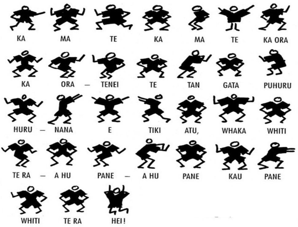
Rhythm of the Haka

 The
Haka is characterized by synchronized, rhythmic chanting,
body-slapping, and vigorous movements. The rhythm is often dictated by
the words of the chant and is punctuated by sharp, synchronized
movements by the performers.

 The
Haka incorporates a range of vocal techniques, from deep grunts to
high-pitched yells. This variation in tone and pitch contributes to the
rhythm and intensity of the performance.

 Participants
often use their bodies as instruments, slapping their chests, thighs,
or hands in time with the chant. This body percussion adds to the
rhythmic element of the Haka and heightens its physical intensity.

 Strategic
pauses and moments of silence are also integral to the Haka’s rhythm.
These moments can heighten anticipation and emphasize the power of the
subsequent actions or words.

HAKA

18) MEET OUR SPONSORS 

CLoud SPonsors
  • PREDICT WIND
  • PANAMA CANAL AGENT ERICK GALVEZ CENTENARIO CONSULTING
  • YACHT AGENTS GALAPAGOS
  • YACHT AGENTS NUKU HIVA
  • SAIL TAHITI
  • OCEAN TACTICS | PACIFIC WEATHER ROUTING
  • SHELTER BAY MARINA PANAMA
  • DENARAU MARINA FIJI
  • NAWI ISLAND MARINA
  • VUDA POINT MARINA
  • COPRA SHED MARINA FIJI
  • CLOUD 9
  • PUERTO AMISTAD ECUADOR
  • RIVERGATE MARINA AUSTRALIA
  • MARSDEN COVE MARINA NEW ZEALAND
  • GULF HARBOUR MARINA NEW ZEALAND
  • YACHTING WORLD MARINA PORT VILA VANUATU

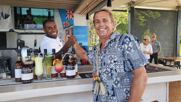
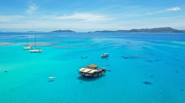
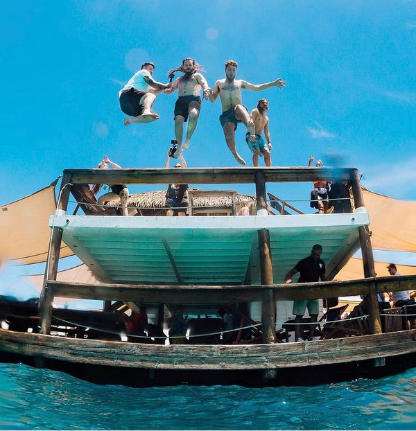
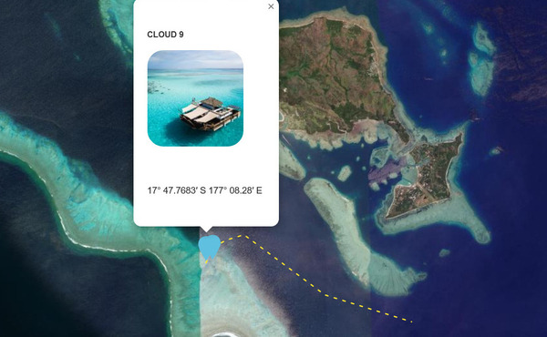
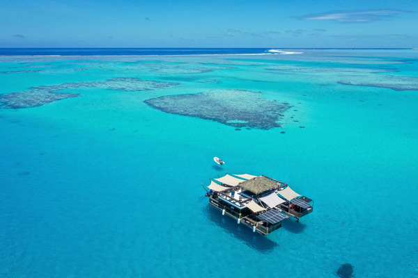
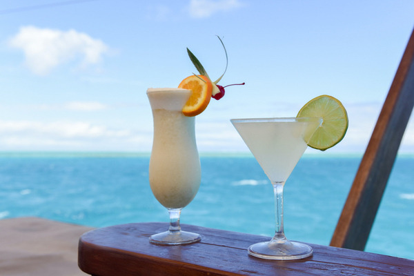
Have a drink at cloud 9

Get your free drink at Cloud 9 in Fiji 

SIGN UP NOW

19)  HOIST YOUR FREE BURGEE  

HOIST

Burgees
will be available at the Panama Kick off event in February /
Barra MX & PVYC event in Mexico in December and in French
Polynesia starting in March - for additional location please arrange and
pay for a 8 oz envelope to be shipped to your preferred intl.
location 

futuna

Wallis and Futuna 🇼🇫 the anchorage  @ Futuna  

calm

WE OPERATE UNDER INTERNATIONAL MARITIME LAW

YOUR VESSEL YOUR CREW YOUR RESPONSIBILITY 

South Pacific Posse

This e-mail has been sent to registration@pacificposse.com, click here to unsubscribe.


FLEET UPDATE 2023-12-01

South Pacifc Posse

  “Avoiding danger is no safer in the long run than outright exposure. Life is either a daring adventure or nothing.”

― Helen Keller

SOUTH PACIFIC POSSE 
FLEET UPDATE 
SEASON 4

2023-12-01

SIGN UP FOR THE '24 SOUTH PACIFIC POSSE
South Pacific Posse
ROUTE


1) WELCOME TO THE 
SOUTH PACIFIC POSSE 
SEASON 4

A
new South Pacific Posse is forming over the next few months. For many
it's been in the planning stages for years, for others it will be a spur
of the moment to participate. A 3,000+nm ocean crossing and subsequent
4,000+ nm of island hopping will be the future for some of the most
adventurous sailors in the world.

Our
mission is to support you in this endeavor with facts, seminars,
up-to-date information, tracking, shared experiences, communications and
create a self-supportive fleet.

The South Pacific Posse has no set schedule. Join whenever you are ready.
Most vessels will leave from the Americas between February and April.

It
is not a race, there is no prize for being fastest. We value your
safety, your happiness and the ability to proceed further too much, to
put you in such time-based predicaments.

Making landfall in paradise will be your ultimate reward and will change your life forever.  

Please hoist your South Pacific Posse burgees.

- Captain Dietmar 

South Pacific Posse Burgee Season 4 '24


2) 24'  SEASON OVERVIEW 

Dec '23 - Feb '24  PRE - SEASON   
Mar '24 - Oct '24  IN SEASON 

The
South Pacific Posse starts when the last cyclone blows through and
stops before the first cyclone of the following season develops

South Pacific Posse

3) SAVE THESE DATES -   ZOOM DESTINATION PLANNING

South Pacific Posse

Sat Feb 3, '24 @ SHELTER BAY MARINA - 13:00 SPP Route Seminar 

Mon Feb 5, 24 @ 20:30 UTC  🐢 Galapagos 🗿 Easter Island 🇵🇳  Pitcairn Kiribati

Tue Feb 6, '24  @ 20:30 UTC 🇵🇫  French Polynesia 

Wed Feb 7, '24  @ 20:30 UTC 🇨🇰 Cook Islands 🇳🇺 Niue

Thu Feb 8, '24 @ 20:30 UTC  🇦🇸 American Samoa 🇼🇸  Samoa 🇼🇫 Wallis & Futuna

Fri Feb 9, '24  @ 20:30 UTC  🇹🇴 Tonga

Sun Feb 11, '24  @ 20:30 UTC  🇫🇯 Fiji 

Mon Feb 12, '24  @ 20:30 UTC 🇻🇺 Vanuatu 

Tue Feb 13, '24  @ 20:30 UTC  🇳🇨 New Caledonia

Wed Feb 14, '24  @ 20:30 UTC  🇳🇿 New Zealand, North Island

Wed Feb 15, '24  @ 20:30 UTC  🇳🇫 Norfolk Island 🇦🇺 Australia, QLD

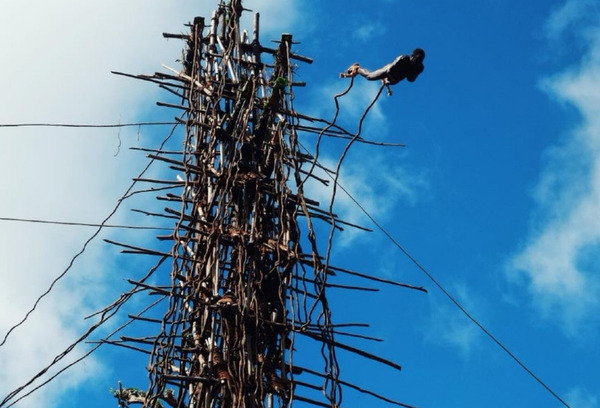
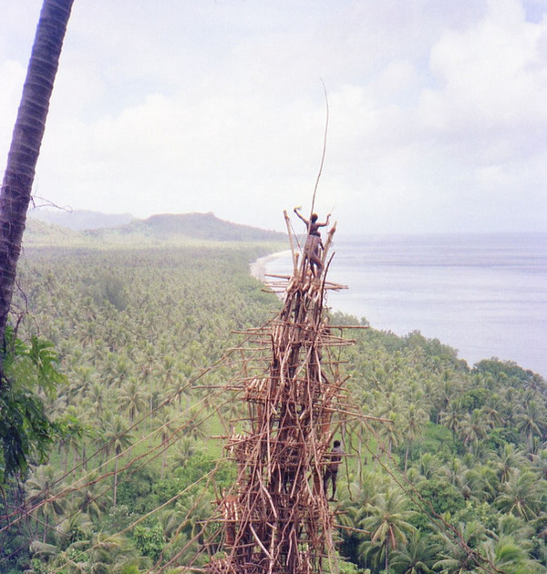
Vanuatu Land Diving

Land diving in South Pentecost 🇻🇺 Vanuatu

 4)  ONBOARDING ZOOM CALLS 

Sat Dec 23rd, 2023
Sat Jan 20th, 2024 
Sat Feb 17th, 2024
 
14:00  PM PACIFIC TIME  -  16:00 PM Mexico City -  17:00   PM PANAMA TIME 

  • Introductions
  • Meet
    your peers
  • Values, goals and expectations
  • Resources and perks
  • Ongoing information
  • Participation and involvement
  • Social events and  activities
  • Check-ins and feedback
  • Emergencies 
  • Milestones
    & Awards
  • Ongoing learning  
  • Q&A & Meet the Editor
Kiribati

5) EVENTS, GATHERINGS AND CELEBRATIONS
 🎉 

SAT FEB 3, 2024 SHELTER BAY MARINA 🇵🇦 PANAMA

OCEANPOSSE

SAT AUG 31, 2024 NAWI ISLAND MARINA 🇫🇯 FIJI 

NAWI ISLAND PARTY
SIGN UP NOW THE '24 SOUTH PACIFIC POSSE

6) PLENTYFUL RESOURCES 
⚓ 

10,000 ISLANDS BEYOND BORA BORA

open cpn

LARGE SATELLITE CHARTS FOR THE ENTIRE SOUTH PACIFIC AVAILABLE TO PARTICPANTS  6 months of work done for you !

  •     🇪🇨 Galapagos ↴ 19 Gb
  •     🇨🇱 Chile Pacific Islands ↴ 305 Mb
  •     🇼🇫 Wallis and Futuna ↴ 284 Mb
  •     🇻🇺 Vanuatu ↴ 12.0 Gb
  •     🇹🇴 Tonga ↴ 6.0 Gb
  •     🇹🇰 Tokelau ↴ 252 Mb
  •     🇼🇸 Samoa  ↴ 3.6 Gb
  •     🇳🇫 Norfolk Island ↴ 75 Mb
  •     🇳🇺 Niue ↴ 331 Mb
  •     🇳🇨 New Caledonia ↴ 25.1 Gb
  •     🇰🇮 Kiribati ↴ 4.9 Gb
  •     🇵🇫 FP Tuamotus ↴ 12.04 Gb
  •     🇵🇫 FP Society-Islands ↴ 4.1 Gb
  •     🇵🇫 FP Marquesas ↴ 1.2 Gb
  •     🇵🇫 FP Gambiers ↴ 320 Mb
  •     🇵🇫 FP Australs ↴ 350 Mb
  •     🇫🇯 Fiji ↴ 22.2 Gb
  •     🇨🇰 Cook_Islands ↴ 540 Mb
  •     🇵🇳 Pitcairn Islands ↴ 54.7 Mb
  •     🇳🇿 NZ – North Island (Northern Part) ↴ 8.82 Gb 
  •          a.m.o.
Oceania

7) 1,000+ SOUTH PACIFIC ANCHORAGES 
IN GOOD NAUTICAL 

Location
Good Nautical
GOOD NAUTICAL

Full
access to Good Nautical with 1000+ hard to find anchorage data compiled
over the last 12 years by participants and explorers 

ROUTES

Save Routes through reefs are also avail in GPX format in Good Nautical 

8) YACHT 🛠️ PREPARDENESS 

VUDA POINT MARINA

 YOUR VESSEL – YOUR CREW – YOUR RESPONSIBILITY


At a very high level here is what you WILL need  !

  • Seaworthy vessel well equipped, tested, rig and com checks and ready to go capable of voyaging up to 3,000 nm without assistance between stops
  • Experienced skipper and competent crew
  • Water ( 3 liters pppd ) and Provisions 
  • Functioning one to one and one to many communications gear with backup(s) 
  • Tracking device w backup 
  • Autopilot or Windvane
  • Money and Credit Cards 
  • Time
  • Vessel Documentation 
  • Passports
  • Vaccination Records
  • IF you have a Pet international Chip and Vaccination Records
  • Emergency Gear 

For a more extensive list follow this link https://pacificposse.com/requirements

Yachts

9) FREE FLEET TRACKING '24 
🛰️ 

WITH PREDICT WIND 

Tracking

 About Tracking:

Designed to give interesting parties  an overview. For specific vessel details including their float plan,
latest updates, changes, positions and specific location related
questions please contact each vessel directly.  If you are on
passage  all of us and the fleet can monitor your progress.

https://pacificposse.com/add-to-tracking

Landfall Bay

10) SOUTH PACIFIC POSSE  
🏆 
AWARD CATEGORIES 

MANA
  • BIGGEST FISH CAUGHT ✔ 
  • PICTURE OF THE YEAR ✔  
  • PACIFIC POSSE YODA OF THE YEAR ✔  
  • THE CAPTAIN RON AWARD ✔
  • MOST UNWELCOME VISITOR ONBOARD ✔ 
  • HIGHEST WIND RECORDED ✔ 
  • SPIRIT OF EXPLORATION ✔ 
  • GALLEY GOD(ESS) ✔ 
  • SPEEDY AWARD
  • GOOD SAMARITAN OF THE YEAR ✔  
  • BOAT YOGA POSE OF THE YEAR ✔
  • COURAGE AWARD 
big fish
SIGN UP FOR THE '24 SOUTH PACIFIC POSSE

11) MULTIPLE 🚩  BENEFITS 

BENEFITS FOR YOU, YOUR YACHT & YOUR CREW

✔️ Up to date and verified information by fellow yachts

📊 Focused on facts, not opinions or unsolicited advice

💰 Save real money at 12 Marinas with discounts

🛰️ Free vessel and fleet tracking courtesy of Predict Wind

🚩 Free Burgee

💰 Save with service providers and chandleries

🕵️ dedicated, experienced and discounted agents

🗺️ Free aid to navigation 150 Gb OpenCPN satellite charts (mac/pc/android)

💰  Save Money on parts with a Westmarine Pro Discount

💰 Save Money with a Predict Wind Pro Discount

🗺️ Free Printable Reference Charts emergency backup to your electronics

📹 Free Video Seminars on destinations from those who are there

🌩️ Top weather routing discount by Ocean Tactics and Seminars

⛵ Community of voyagers all are welcome, kids, single-handers, pets

⚓ Peer support in emergencies with escalation procedures

🛈  Fleet Updates via email – free

🏆 Fun Award Categories

📍 Free access to GOOD NAUTICAL 1,500 + South Pacific Anchorages

☎️ Free Weekly live calls on Mondays via dedicated LINE.me group

💬 Free 24/7 LINE group channel from now – December ’23

🌊 Benefit from the latest information and prior experience participants

🔭 Be part of a fleet of sensor for those who come behind you or meet

🚷 Always priority traffic – for participants by participants

a.m.o. >> 

parties

A lot of fun with fellow cruisers in remote locations - dress up for Halloween in Tonga 🇹🇴

12)  SOUTH PACIFIC POSSE 
FLEET COMMUNICATIONS 📣 

Starlink
  • Monday live LINE calls over IP @ 20:00 UTC
  • Monthly Fleet Updates 
  • 24/7 Chatroom with location sharing / pictures  
  • Emergency Escalation 
  • Local vetted Agents when need 
  • Discounted personalized Weather Routing 
land drawing

Sand Drawing: A
rich and dynamic graphic tradition has developed as a means of
communication among the members of some 80 different language groups
inhabiting the central and northern islands of Vanuatu. The drawings
also function as mnemonic devices to record and transmit rituals,
mythological lore and a wealth of oral information about local
histories, cosmologies, kinship systems, song cycles, farming
techniques, architectural and craft design, and choreographic patterns.

13)  MEET THE FLEET

HEADS
Chris

Captain Chris on SY Seaglub currently in Fiji  once again will be the Lead vessel 

At Anchor

SY Seaglub anchored at Namotu / Cloudbreak 🇫🇯 FIJI 

SEAGLUB Chris

14) THE ACCURACY OF A CLOCK 

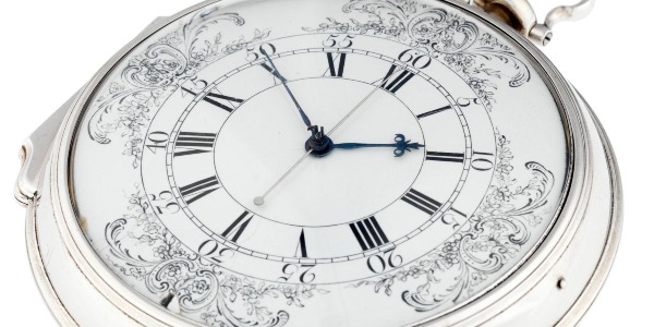
John Harrison's H4 marine chronometer

John Harrison's
H4 marine chronometer holds a significant place in maritime history,
marking a pivotal moment in the age of exploration and navigation. 

Challenge  Prior
to the H4, determining longitude at sea was hazardous and imprecise.
The inability to accurately gauge a ship's east-west position led to
numerous maritime disasters. Harrison's invention directly addressed
this critical issue.

Innovation Harrison's
H4 chronometer was a groundbreaking invention in the 18th century. It
was the first timekeeping device accurate enough to be used for
calculating longitude at sea, a problem that had plagued sailors for
centuries.

Details
The H4 differed greatly from its predecessors (H1, H2, H3) in design
and functionality. It was much smaller, resembling a large pocket watch,
and utilized a fast-beat balance wheel that significantly improved its
accuracy.

Longitude Prize
Harrison's work was partly motivated by the Longitude Act of
1714, which offered a substantial prize for anyone who could devise a
practical method for precisely determining a ship's longitude. The
creation and success of the H4 were instrumental in Harrison eventually
claiming this prize.

 Impact  The
H4 didn't just solve a navigational problem; it revolutionized
long-distance sea travel, making it safer and more reliable. This had
profound implications for global trade, exploration, and the expansion
of empires.

 Display Today,
Harrison's H4 chronometer is often showcased in museums as a testament
to human ingenuity and the quest to master the oceans. Its story
continues to inspire and fascinate those interested in maritime history
and the science of navigation.

The Harrison clocks

Harrison presented the H1 in 1735

15) MEET OUR SPONSORS 

CLoud 9
  • PREDICT WIND
  • PANAMA CANAL AGENT ERICK GALVEZ CENTENARIO CONSULTING
  • YACHT AGENTS GALAPAGOS
  • YACHT AGENTS NUKU HIVA
  • SAIL TAHITI
  • OCEAN TACTICS | PACIFIC WEATHER ROUTING
  • SHELTER BAY MARINA PANAMA
  • DENARAU MARINA FIJI
  • NAWI ISLAND MARINA
  • VUDA POINT MARINA
  • COPRA SHED MARINA FIJI
  • CLOUD 9
  • PUERTO AMISTAD ECUADOR
  • RIVERGATE MARINA AUSTRALIA
  • MARSDEN COVE MARINA NEW ZEALAND
  • GULF HARBOUR MARINA NEW ZEALAND
  • YACHTING WORLD MARINA PORT VILA VANUATU

Weather routing
SIGN UP NOW

16)  HOIST YOUR FREE BURGEE  

HOIST

Burgees
will be available at the Panama Kick off event in February /
Barra MX & PVYC event in Mexico in December and in French
Polynesia starting in March - for additional location please arrange and
pay for a 8 oz envelope to be shipped to your preferred intl.
location 

wilson

cast away without a burgee .... 

Forestry beach

Forestry Beach 🇳🇿 New Zealand

WE OPERATE UNDER INTERNATIONAL MARITIME LAW

YOUR VESSEL YOUR CREW YOUR RESPONSIBILITY

South Pacific Posse


FLEET UPDATE 2023-10-09

FLEET UPDATE 2023-10-09

South Pacifc Posse

There was this ghost ship called the Zebrina. British cargo ship hauling coal. She ran aground in France after floating past all of you fellas coming to join the war. My hospital ship ran from her for weeks. I swear that empty b!%-$ , she was chasing us. But the strangest thing I ever saw was off the coast of Indonesia. Little dinghies, two-man fishing skiffs, Just floating, 300 miles off shore. The seagulls swarmed 'em like hornets, picking at the men inside. And there must have been a thousand of them small dinghies, maybe more. I passed 'em for a week. Must have been a big swell that pushed 'em all out to sea. I don't know. It's a mystery. The sea's like that. Cunning... Like a fox. Always looking for ways to trick you. Now, who wants first watch?

- Lucca, 1923, S01E05


SOUTH PACIFIC POSSE
FLEET UPDATE

2023-10-09

14 Ensigns
image

67 Yachts from 13 ensigns
scout for opportunities and alert each other to threats

Heads
At anchor

SY KAWAINE II 🇨🇭 Jean-Dominique & Guylène - C.M.P.F. – Fecamp 42′

KAWAINE II Jean-DominiqueKAWAINE II Guylène

TOP NEWS

  • Best Mechanic Award Nomination
  • South Pacific Seas
  • Courage Award Nomination
  • Award Categories
  • Seminars On Demandthe Passage To 🇳🇿 New Zealand
  • Re Or Register For Spp '24
  • Pictures Of The Week
  • The Final Strech
  • Meet A Posse Sponsor
  • Good Nautical
  • Historic Ports ⚓ Of The South Pacific
  • South Pacific Press

1) BEST MECHANIC AWARD NOMINATION 🇫🇯 FIJI

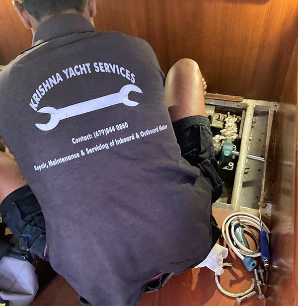
Best mechanic in Fiji is Ritesh, if you can get him.

That’s Ritesh's back working on our rudder shaft packing gland.

KRISHNA YACHT SERVICES
Contact +679 844 0860
krishnayachtservices@gmail.com

SY CALLY LILLY 🇺🇸 Michael, Shelby, David & Kelli - Compass 47′

CALLA LILI Mike

2) SOUTH PACIFIC SEAS
🌡️
SURFACE TEMPERATURES AND THE
SOUTH PACIFIC 23-23 CYCLONE SEASON

Sea Surface Temperature

During the season, tropical cyclones will be officially monitored by the Fiji Meteorological Service, Australian Bureau of Meteorology and New Zealand's MetService. The United States Armed Forces through the Joint Typhoon Warning Center (JTWC) will also monitor the basin and issue unofficial warnings. The FMS attaches a number and an F suffix to tropical disturbances that form in or move into the basin while the JTWC designates significant tropical cyclones with a number and a P suffix. The BoM, FMS and MetService all use the Australian Tropical Cyclone Intensity Scale and estimate windspeeds with a period of approximately ten minutes, while the JTWC estimates sustained winds over a 1-minute period, which are subsequently compared to the Saffir–Simpson hurricane wind scale (SSHWS).

South West Pacific Marine

• El-Niño Southern Oscillation (ENSO) is currently in a weak El Niño state.
• Overall, the current El Niño is expected to gradually strengthen through to the December 2023 to February 2024 period.

• Example: Fiji usually experiences below normal rainfall during an El Niño event.

The 2023-2024 Cyclone Names

  • Lola
  • Mal
  • Nat
  • Osai
  • Pita
  • Rae
  • Seru
  • Tam
  • Urmil
  • Vaianu
  • Wati
  • Xavier
  • Yani
  • Zita
South Pacific region long-range forecast accuracy

South Pacific tropical cyclone long-range forecast region bounds

3) AWARD ENTRIES

COURAGE AWARD NOMINATION

100% perseverance during extreme stressful, highly personal
and life-changing situations

KATIE

SY FLITE DECK 🇺🇸 Katie - Seawind 1160 Lite 38′

routes

4) SOUTH PACIFIC POSSE
🏆
AWARD CATEGORIES

  • BIGGEST FISH CAUGHT ✔
  • PICTURE OF THE YEAR ✔
  • PACIFIC POSSE YODA OF THE YEAR ✔
  • THE CAPTAIN RON AWARD ✔
  • MOST UNWELCOME VISITOR ONBOARD ✔
  • HIGHEST WIND RECORDED ✔
  • SPIRIT OF EXPLORATION ✔
  • GALLEY GOD(ESS) ✔
  • SPEEDY AWARD
  • GOOD SAMARITAN OF THE YEAR ✔
  • BOAT YOGA POSE OF THE YEAR ✔
  • COURAGE AWARD

5) SOUTH PACIFIC POSSE SEMINARS ON DEMAND

THE PASSAGE TO 🇳🇿 NEW ZEALAND

South Pacific Posse Passage to New Zealand

SEMINARS RECORDINGS ARE ONLINE

WATCH THE LATEST :

PASSAGE PLANNING TO NEW ZEALAND
WITH JOHN MARTIN

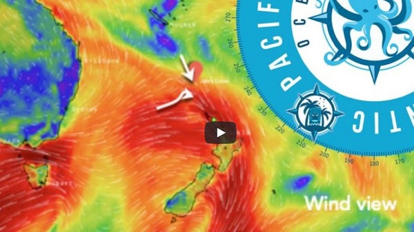
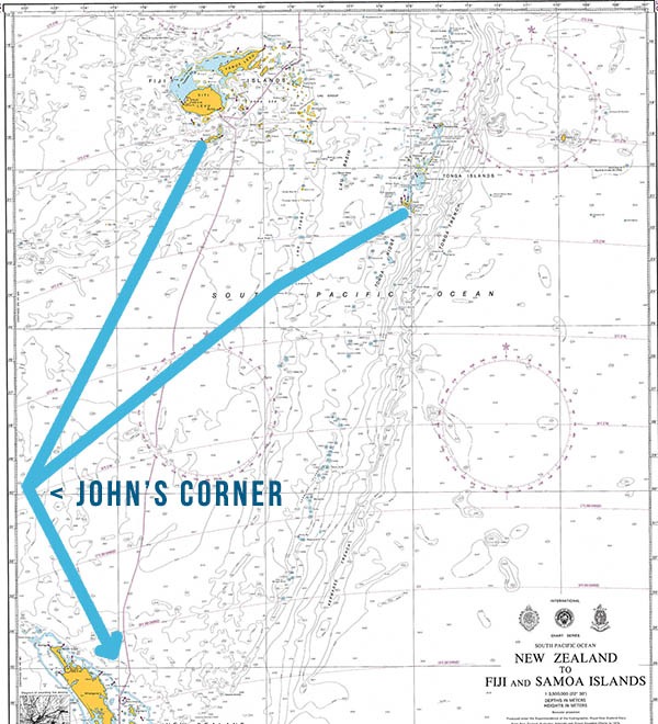
John's Corner

6) RE or REGISTER FOR SPP '24

SIGN UP FOR THE
'24 SOUTH PACIFIC POSSE
South Pacific Posse

Pre-Season Dec '23 - Feb 24'
Active Season Mar '24 - Oct 24'

BENEFITS FOR YOU, YOUR YACHT & YOUR CREW

✔️ Up to date and verified information by fellow yachts

📊 Focused on facts, not opinions or unsolicited advice

💰 Save real money at 12 Marinas with discounts

🛰️ Free vessel and fleet tracking courtesy of Predict Wind

🚩 Free Burgee

💰 Save with service providers and chandleries

🕵️ dedicated, experienced and discounted agents

🗺️ Free aid to navigation 150 Gb OpenCPN satellite charts (mac/pc/android)

💰 Save Money on parts with a Westmarine Pro Discount

💰 Save Money with a Predict Wind Pro Discount

🗺️ Free Printable Reference Charts emergency backup to your electronics

📹 Free Video Seminars on destinations from those who are there

🌩️ Top weather routing discount by Ocean Tactics and Seminars

⛵ Community of voyagers all are welcome, kids, single-handers, pets

⚓ Peer support in emergencies with escalation procedures

🛈 Fleet Updates via email – free

🏆 Fun Award Categories

📍 Free access to GOOD NAUTICAL 1,500 + South Pacific Anchorages

☎️ Free Weekly live calls on Mondays via dedicated LINE.me group

💬 Free 24/7 LINE group channel from now – December ’23

🌊 Benefit from the latest information and prior experience participants

🔭 Be part of a fleet of sensor for those who come behind you or meet

🚷 Always priority traffic – for participants by participants

a.m.o. >>


PRIOR PARTICIPANTS
RENEW
FOR NEXT SEASON
We Sail

ENTRY INTO THE '22 SPP PICTURE OF THE YEAR AWARD - VA WE | SAIL

7) PICTURES OF THE WEEK

DRONE PICTURE

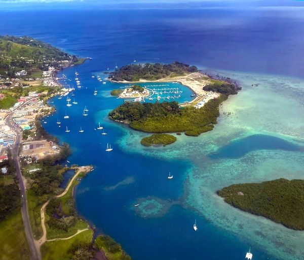
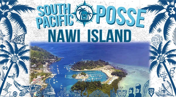
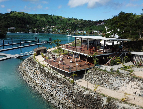
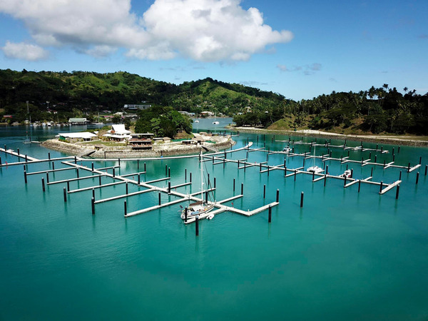
This is Nawi Island Marina. We went here because of the discount we got through the Posse and would definitely recommend. The facilities are excellent. Photo taken by my brother in law as he flew in to join us.

SY CERULEAN 🇳🇿 Helen & Stephen - Seastream 43 Mk3′

CERULIANCERULIAN
https://pacificposse.com/nawi-island

send us good ju ju… anchored in Suwarrows - has been blowing a steady 30+ for over 24 hrs. No sign of it going down. We’re above the reef, but barely and to top it off our snubber snapped - broke. We doubled up and put our smaller one on the other side- but it’s not totally happy. Was chaffing already- through fire hose. I’d not buy this product! There are 4 other boats here now. A solo guy somehow managed to fall out of his dingy doing something up by his bow. He got back in…. But did say he hit his head. He later scuba dove for his camera… yes in 45 knot winds ????

Everyone seems to be holding ok…. So far. Another anchor watch night.

image

Apia - Western Samoa

image

At anchor

nanai

SY NANAI 🇺🇸 Chris, Kay, Kevin & Mark - Tashing,Taswell 49′

8) THE FINAL STRECH
FLEET TRACKING FOR PARTICIPANTS

Tracking

About Tracking:

Designed to give interesting parties an overview. For specific vessel details including their float plan, latest updates, changes, positions and specific location related questions please contact each vessel directly. If you are on passage let us know and the fleet can monitor your progress.

https://pacificposse.com/add-to-tracking

9) MEET
SOUTH PACIFIC POSSE SPONSOR

https://pacificposse.com/gulf-harbour-marina

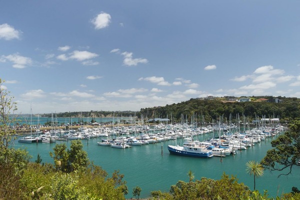
We are pleased to let you know that Gulf Harbour Marina will offer a discount on berthage plus a Welcome Gift valued at $200 for participants upon arrival at our marina.

Lisa de Ruiter Gulf Harbour Marina

Lisa de Ruiter

Customer Services Manager

36°37.23′ S 174° 47.2416′ E

https://pacificposse.com/gulf-harbour-marina

10) FREE ACCESS TO GOOD NAUTICAL

IF YOU ARE SIGNED UP FOR THE '23 SOUTH PACIFIC POSSE you will be assigned access credentials to GOODNAUTICAL South Pacific regions

Good Nautical

CONSIDER MAKING A TAX DEDUCTIBLE DONATION TO GOOD NAUTICAL

https://www.paypal.com/paypalme/goodnautical

https://www.paypal.com/paypalme/goodnautical

Wallis and Futuna 🇼🇫 in Good Nautical

11) HISTORIC PORTS ⚓ OF THE SOUTH PACIFIC

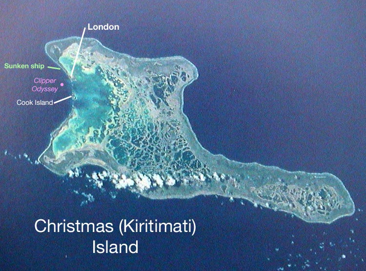
Kiritimati Atoll

Kiritimati Atoll 🇰🇮 Kiribati

Christmas Island, also known as Kiritimati, is part of the Republic of Kiribati, located in the central Pacific Ocean. The island was discovered by Captain James Cook on Christmas Eve in 1777, hence its name. Covering an area of about 388 square miles (1,006 square kilometers), it is the world's largest coral atoll.

In the years following its discovery, Christmas Island had several uses, including as a coconut plantation and a stopover for whalers and fishermen.

During the Cold War era, the island was the site for nuclear testing conducted by the United Kingdom and the United States. The island's indigenous population was evacuated during these tests. Kiribati gained independence from the United Kingdom in 1979, and Christmas Island became a part of this newly independent nation.

Battle of Tarawa

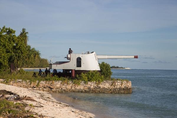
Mounted gun pointing at the ocean at the entrance of Betio

The Battle of Tarawa was fought on 20–23 November 1943 between the United States and Japan at the Tarawa Atoll in the Gilbert Islands, and was part of Operation Galvanic, the U.S. invasion of the Gilberts. Nearly 6,400 Japanese, Koreans, and Americans died in the fighting, mostly on and around the small island of Betio, in the extreme southwest of Tarawa Atoll.

The Battle of Tarawa was the first American offensive in the critical Central Pacific region. It was also the first time in the Pacific War that the United States faced serious Japanese opposition to an amphibious landing. Previous landings had met little or no initial resistance, but on Tarawa the 4,500 Japanese defenders were well supplied and well prepared, and they fought almost to the last man, exacting a heavy toll on the United States Marine Corps. The losses on Tarawa were incurred within 76 hours.

Today, the island is primarily known for its rich biodiversity, including an extensive variety of birds and marine life. It has become an attractive destination for ecotourism and is especially popular among recreational anglers, divers, and birdwatchers.

The island faces various challenges, such as climate change, which poses a significant risk due to rising sea levels. Kiribati's government and various international organizations are working to mitigate these issues and preserve the island's unique environment.

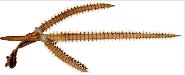
Shark tooth weapon from the Gilbert Islands, manufactured in the mid to late 19th century.

Shark tooth weapon from the Gilbert Islands, made in the mid to late 19th century.

12) SOUTH PACIFIC POSSE
IN THE SOUTH PACIFIC PRESS

image
Chris
EVENT
LAYS

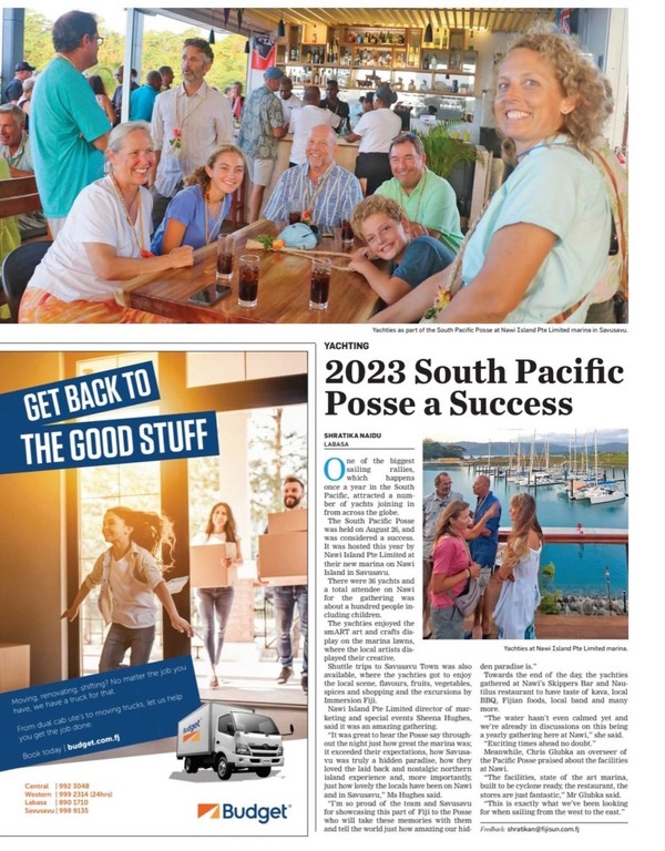
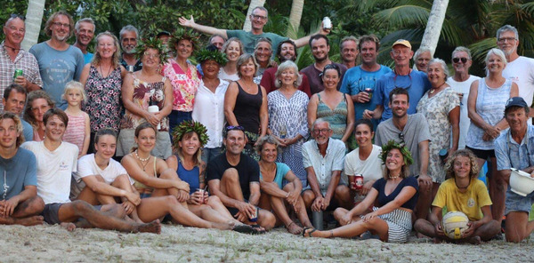
A few more pics from the Nawi Island South Pacific Posse event

13 MEET OUR SPONSORS

  • PREDICT WIND
  • PANAMA CANAL AGENT ERICK GALVEZ CENTENARIO CONSULTING
  • YACHT AGENTS GALAPAGOS
  • YACHT AGENTS NUKU HIVA
  • SAIL TAHITI
  • OCEAN TACTICS | PACIFIC WEATHER ROUTING
  • SHELTER BAY MARINA PANAMA
  • DENARAU MARINA FIJI
  • NAWI ISLAND MARINA
  • VUDA POINT MARINA
  • COPRA SHED MARINA FIJI
  • CLOUD 9
  • PUERTO AMISTAD ECUADOR
  • RIVERGATE MARINA AUSTRALIA
  • MARSDEN COVE MARINA NEW ZEALAND
  • GULF HARBOUR MARINA NEW ZEALAND
  • YACHTING WORLD MARINA PORT VILA VANUATU

WE OPERATE UNDER INTERNATIONAL MARITIME LAW

YOUR VESSEL YOUR CREW YOUR RESPONSIBILITY

South Pacific Posse

© 2021 South Pacific Posse / Good Nautical Inc


TONGA

FLEET UPDATE 2023-08-20


South Pacifc Posse '23


    "Storms don't come to teach us painful lessons, rather they were meant to wash us clean."

- Shannon L. Alder


   SOUTH PACIFIC POSSE FLEET UPDATE 

2023-AUGUST-20

14 Ensigns
South Pacific Posse Gatherings

 
2+ SOUTH PACIFIC POSSE BOATS EQUAL A PARTY 

TOP NEWS

  • SOUTH PACIFIC POSSE PARTY
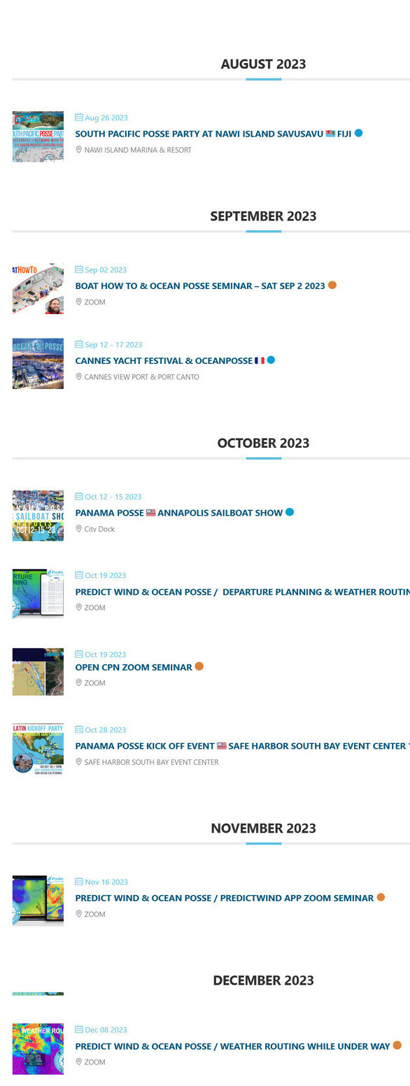
  • THE OCEAN POSSE 🐙 CALENDAR 
  • PICTURES OF THE WEEK
  • SAVUSAVU 🇫🇯  NAWI ISLAND MARINA LAUNCHED 
  • MUSKET 🇫🇯  COVE FIJI
  • NEIAFU VAVA'U 🇹🇴 TONGA
  • BLACKBIRDING 
  • ELECTRICAL BOAT HOW TO  
  • THE BANK ISLAND 🇻🇺 VANUATU  
  • THE PASSAGE TO NEW ZEALAND 
  • CLOUD NINE 🇫🇯 FIJI 
  • FLEET TRACKING FOR PARTICIPANTS  
  • CORRUPTION ALERT ⚠️ AMERICAN SAMOA 🇦🇸
  • GOOD NAUTICAL  
  • HISTORIC PORTS ⚓LAHAINA HAWAI'I

1) SOUTH PACIFC POSSE PARTY 
NAWI ISLAND 🇫🇯 FIJI


Monoriki


 16° 46.5716' S  179° 19.9533' E -  Nawi Island Savusavu 🇫🇯 Fiji


RSVP NOW
AUG 26 2023


NAWI ISLAND


All yachts are welcome - simply RSVP to get on the list >>

2)  SEMINARS,  EVENTS  MEETUPS FOR ALL  
THE OCEANPOSSE 🐙 CALENDAR 
  

join the fleet
 

https://oceanposse.com/calendar/


3)   PICTURES OF THE WEEK

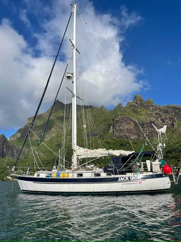
Jack Iron

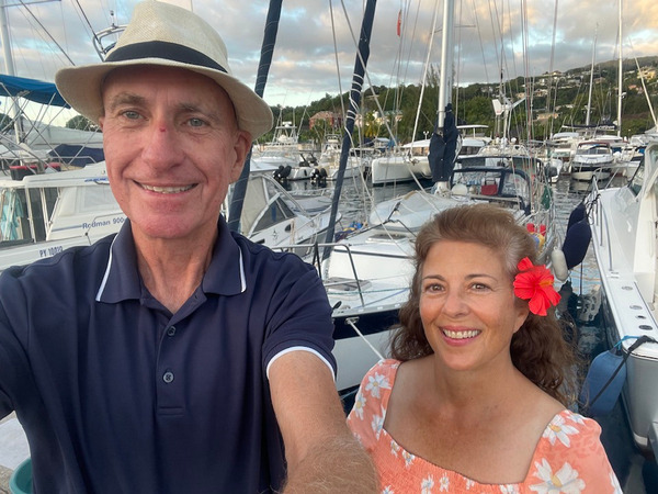
SY JACK IRON  🇺🇸   Kent & Michele - Valiant 42′

JACK IRON KentJACK IRON Michelle

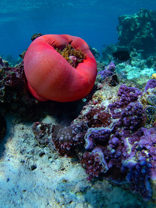
 HUAHINE  🇵🇫 FP

Giant anemone (folded up) and purple coral.

Huahine was our last stop in French Polynesia, and one of our favorites.  
Giant anemone (folded up) and purple coral.

SY FIRST LIGHT  🇺🇸 Don & Julie  -  Hallberg Rassy 39′

FIRST LIGHT DonFIRST LIGHT Julie

4) SAVUSAVU 🇫🇯  NAWI ISLAND MARINA LAUNCHED 

A very nice place to stay with lot of place.

For the people who wants to know about Nawi Marina in Savusavu. 

A very nice place to stay with lot of place.

The Marina is done at about 70%  completed 

The Marina is done at about 70% but no possibility to haul out a boat and no specific technical services

It's
just a marvelous place to stay very friendly people there and the
restaurant has a very good kitchen, but no possibility to haul out a
boat and no specific technical services 

The pool is not ready just the restaurant, the bar, toilets and laundry are done. But it is very well done and nice here.

SY KAWAINE II  🇨🇭   Jean-Dominique & Guylène  - C.M.P.F. – Fecamp 42′

KAWAINE II Jean-DominiqueKAWAINE II Guylène
 

 NAWI ISLAND 🇫🇯 SPONSORS THE SOUTH PACIFIC POSSE 16° 46.566’S 179° 20.1’E BULA ! Nawi Marina is proud to sponsor the South Pacific Posse with discounted rates! NAWI ISLAND LOGO Idyllically located in the spectacular Savusavu Harbour, a port of entry to Fiji, the Nawi Island Marina welcomes the international yachting community with its 132 modern slips, providing safe and secure berths for monohull yachts, catamarans and superyachts. World Class Marina facilities, currently under development, will include a yacht club and extensive service facilities. Access to and from Nawi Island is simple and convenient, with Savusavu town nearby and Savusavu Airport just 10 minutes away. Nawi-Island-Marina AMENITIES & SERVICES MARINA 132 fully serviced berths 21 dedicated superyacht berths for vessels up to 85m 2m to 5.4m draft at mean sea level (msl). 16amps 3 phase from April 2023 and this will increase up to 250-300amps 3 phase from Dec 2023 Fresh Water, Fuel & Gas facilities Sewer pump out facility by June 2023 Garbage Disposal services High speed wireless internet 24/7 cctv security services with controlled marina gate access Restaurant & Bar Harbour Master Building Yacht Agency and authority clearance services Chandlery Grocery Store Restrooms, showers & laundry ATM Retail & Kiosk services BALAGA BOATYARD FACILITIES * Cyclone pits and storage bays Maintenance Shed & Back of House Area Haul out facility (75tonne) Boat ramp Fueling pontoon Wash Bay Engineering and welding workshop Paint and antifouling workshop Open maintenance areas for catamarans Office, restroom and outdoor lounge area with parking *BALAGA BOATYARD FACILITIES (under construction – to be completed by Dec 2023) CONTACT E: marketing@nawiisland.com P: +679 893 1082 W: nawiisland.com FB: facebook.com/nawiisland I: https://www.instagram.com/nawi.island A: PO Box 101, Lot 12, Nawi Island, Savusavu, Vanua Levu, Fiji Islands NAWI ISLAND MARINA RATES FJD x Meter x Day Meters / Feet MONOHULL FJD x Meter x Day MULTIHULL FJD x Meter x Day < 20 / 66 4.37 8.60 ≥ 20 / 66 8.60 8.60 ≥ 30 / 98 11.55 23.00 ≥ 50 / 164 17.35 ≥ 70 / 230 20.90 ≥ 85 / 279 24.00 Live Aboard Rate 7.50 per day Electricity Metered Water Included in Berth Fee -but please conserve * All rates are per lineal meter defined by LOA (other than Moorings) * All prices inclusive of 9% Government Taxes * All berthing to be paid in advance * Free WIFI included in berthing – conditions apply * Other marina services will have separate fees & charges SAFE APPROACH TO NAWI ISLAND MARINA + − 500 m 2000 ft goodnautical.com for pananaposse LOCATION OFFICIAL WEBSITE >> NAWI ISLAND MARINA OFFICIAL WEBSITE LINK


NAWI ISLAND MARINA 🇫🇯  16° 46.566’S 179° 20.1’E
SPONSORS THE SOUTH PACIFIC POSSE


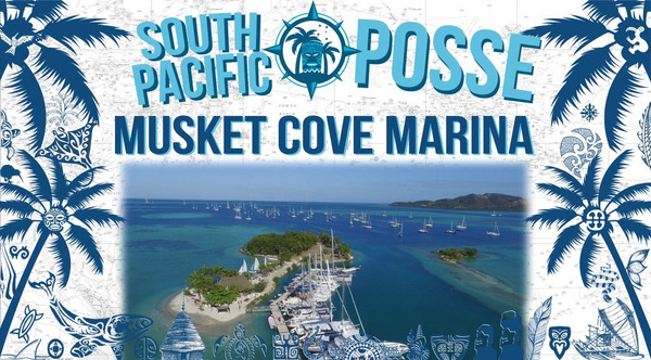
5) MUSKET 🇫🇯  COVE FIJI

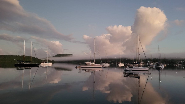
Good night Musket Cove

Good night Musket Cove

SY SEAGLUB  🇺🇸 Chris - Hylas 46′

SEAGLUB Chris
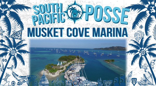
MUSKET COVE FIJI

Musket
Cove stands as a haven for true seafaring aficionados. It's one of the
magnetic ports and therefore hard to get out of.  Everyone is
welcome. The discounts extended to the Pacific Posse  rally
participants are not just a gesture of benevolence, but a salute to the
shared devotion to life on the water—a nod that It acknowledges the call
of the open sea running through our veins. 


MUSKET COVE FIJI


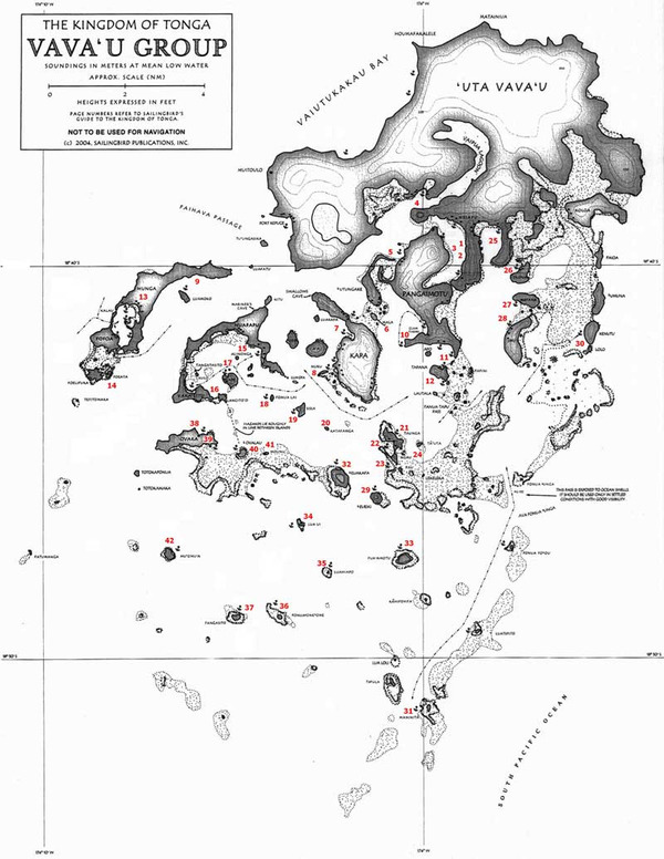
6) NEIAFU VAVA'U 🇹🇴 TONGA

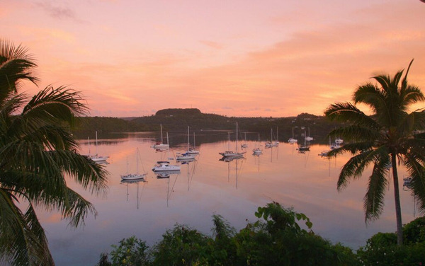
A rare sight in Tonga. Completely calm waters

A rare sight in Tonga. Completely calm waters

SY CATWEAZLE  🇬🇧 Harriet & Russell - Allures 45′

CATWEAZLECATWEAZLE

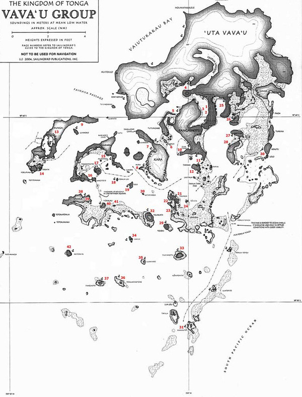
Vava'u,
a picturesque island group within the Kingdom of Tonga, stands as a
serene haven for small yachts . Nestled in the northern part of Tonga
the  Vava'u archipelago boasts a unique blend of natural beauty,
welcoming local culture, and inviting waters that welcomes sailors from
around the world. This maze like  destination offers a myriad of
anchorages for small yachts to explore its cruising grounds.

Vava'u Tonga

Vava'u's
charm lies in its breathtaking landscapes, where lush green hills meet
cerulean waters, creating a stunning backdrop for sailing adventures.
The island group encompasses numerous sheltered anchorages, secluded
coves, and pristine beaches. Most anchorages provide a calm sanctuary,
offering a tranquil refuge for sailors to drop anchor, unwind, and
immerse themselves in the beauty of nature.


The
archipelago is renowned for its vibrant underwater world, making it a
paradise for snorkelers and divers alike. Beneath the surface, coral
reefs burst with life, showcasing an intricate tapestry of colors and
marine species. Small yachts can anchor near snorkeling and diving
hotspots, offering easy access to this underwater wonderland teeming
with tropical fish, vibrant corals, and even the chance to swim
alongside majestic humpback whales during the annual migration season.

 The
warmth of the Tongan culture is an integral part of the Vava'u
experience. The locals, known for their genuine hospitality, greet
sailors with open arms. Visiting the local villages is an opportunity to
engage in cultural exchanges, learn traditional customs, and savor
Tongan cuisine. The Tongan people's genuine smiles and warm interactions
create an enriching experience that leaves an indelible mark on the
hearts of visiting sailors.

Mango Cafe

Mango Cafe & dinghy dock 

Community and Camaraderie:

The
small yachting community that gravitates toward Vava'u fosters a strong
sense of camaraderie among fellow sailors. Small businesses in the area
provide essential amenities and opportunities to connect with other
adventurers. The exchange of stories, tips, and experiences adds to the
allure of Vava'u as a place where friendships are forged and shared
passions are celebrated.

In
essence, Vava'u encapsulates the essence of a quintessential yachting
paradise. Its azure waters, captivating landscapes, hospitable locals,
and vibrant marine life converge to create an idyllic haven for small
yachts. Every voyage through its cruising grounds reveals new wonders,
ensuring that sailors leave with cherished memories and a longing to
return to the tranquil embrace of Vava'u, Tonga.


Neiafu Harbor


7)  BLACKBIRDING 

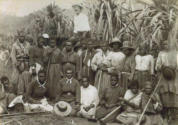
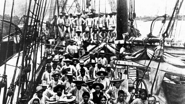
Kanaka workers in a sugar cane plantation in Queensland, late 19th century.

 Kanaka workers in a sugar cane plantation in Queensland, late 19th century.

The practice of "blackbirding"
in the mid to late 1800s in the South Pacific refers to the recruitment
of coerced labor of Pacific Islanders, primarily from Melanesia and
Polynesia, to work on plantations in other parts of the world. It was
driven by the demand for cheap labor to work on sugar cane, cotton, and
other agricultural plantations.

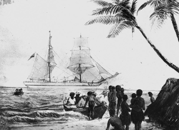
Para (ship) South Sea Islanders, recruited for the Queensland cane fields, being carried in boats to the Para. (Descriptions supplied with photograph). The English artist who produced this drawing, William Twizell Wawn, captained ships between 1875 and 1891.

Para (ship) South Sea Islanders, recruited for the Queensland cane fields, being carried in boats to the Para. 
William Twizell Wawn, captained ships between 1875 and 1891. 

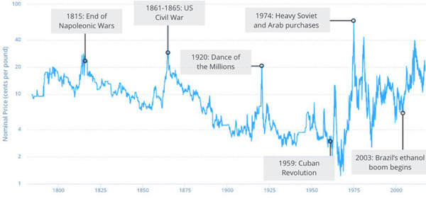
The
demand for labor during the 4 year US Civil War lead to an increase in
the practice of black birding. The war and subsequent union victory and
end of slavery meant a continued  need for labor on plantations to
produce cotton and sugar cane. This resulted in an intensified
recruitment of Pacific Islanders through blackbirding to meet the offshore labor needs.

these exploitative labour market practices in the sugar industry started in 1863 – almost 60 years after Britain and the United States had made slave trading illegal.

Exploitative
labor market practices in the sugar industry started in 1863 – almost
60 years after Britain and the United States had made slave trading
illegal.

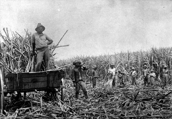
Tens
of thousands of Pacific Island laborers were brought to Australia from
neighboring Melanesian and Polynesian islands.  In particularly
Queensland, during the late 19th century used these indentured laborers
for work on sugarcane plantations. Estimates suggest around 60,000 to
80,000 humans were involved.

Fiji
was another major destination and saw a significant influx of
blackbirded laborers, with estimates ranging from 60,000 to 70,000
individuals. The sugarcane industry in Fiji heavily relied on coerced
labor.

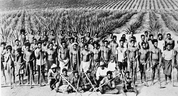
The deportations began in 1906 and continued until 1908. More than 7500 South Sea Islanders were returned to their home country, though some had arrived in Australia at such a young age they would have had no memory of it. About 2500 Pacific Islanders stayed in Australia.

In
Australia and other colonial powers involved in black birding,
legislative measures were introduced to regulate and eventually restrict
the recruitment of labor from Pacific Island nations. These measures
aimed to improve labor conditions and protect the rights of indigenous
populations. The practices associated with blackbirding were
increasingly criticized by humanitarian and human rights advocates
internationally. Reports of abuse, mistreatment, and exploitation of
laborers led to growing pressure on countries involved in the practice
to address these concerns. In various regions, including Australia and
Fiji, labor reforms were introduced to address the unethical practices
associated with blackbirding. The goal was to ensure fair treatment,
appropriate wages, and better working conditions for laborers.
Indigenous communities in affected regions began advocating for their
rights and raising awareness about the mistreatment and exploitation
they faced due to blackbirding. Their efforts contributed to increased
attention on the issue and the need for change. As economies evolved and
industries changed, the demand for labor through blackbirding
diminished. Economic factors, coupled with increased awareness of
ethical concerns, contributed to the decline of the practice. By the
early 20th century, blackbirding had largely faded as a widespread
practice due to a combination of the factors mentioned above. Many
countries introduced laws and reforms to prevent the recruitment of
labor through coercion and deception. While the formal abolition of
blackbirding marked an important step in ending the exploitative
practices, it's important to recognize that the legacy of blackbirding
continues to impact affected communities to this day. The efforts to
remember this history, address its consequences, and promote awareness
of human rights and social justice continue in the affected regions.

bundaberg 1895

The deportations  began
in 1906 and continued until 1908. More than 7,500 South Sea Islanders
were returned to their home country, though some had arrived in
Australia at such a young age they would have had no memory of their
exact origin.  Indenture ceased in Fiji in 1911.

SUGRA PRICE HISTORY.

200+ years of sugar pricing 

The official Australian South Sea Islander flag initially designed in consultation with the ASSI community. The flag was formally adopted in 1998 by ASSIUC. The colour scheme incorporates colours resonant to people with forebears of which the three quarters of the trade were taken from the 83 islands of Vanuatu and are represented through colours green, gold and black, a third of the trade was from the Solomon Islands represented with blue, white, green. The overall flag is inclusive other parts of the South Pacific affected by Blackbirding as we are connected through the ocean blue and white stars.

The
official Australian South Sea Islander flag initially designed in
consultation with the ASSI community. The flag was formally adopted in
1998. The color scheme incorporates colors resonant to people with
forebears of which the three quarters of the trade were taken from the
83 islands of Vanuatu and are represented through colors green, gold and
black, a third of the trade was from the Solomon Islands represented
with blue, white, green. The overall flag is inclusive other parts of
the South Pacific affected by Blackbirding as we are connected through
the ocean blue and white stars.

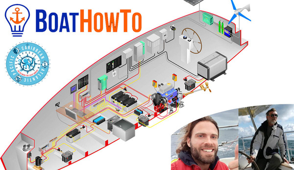
8) ELECTRICAL BOAT HOW TO  


https://oceanposse.com/events/boat-how-to-ocean-posse-seminar-sat-sep-2-2023/


SAT Sept 2 - we have a zoominar with Nigel Calder introducing BOATHOWTO

BOAT HOW TO & OCEAN POSSE SEMINAR – SAT SEP 2 2023

We are please to announce an introduction to BOAT HOW TO and their most comprehensive online learning   system.

This ZOOM introduction is hosted by NIGEL CALDER

INTRODUCTIONS TO THE FOLLOWING YACHT ELECTRICAL SYSTEM TOPICS

  •     Properly sizing conductors ( q&a )
  •     Making reliable connections ( q&a )
  •     Batteries The Charging System  ( q&a )
  •     Best practices of monitoring and improving your electrical system ( q&a )
  •     Adding appropriate over current protection ( q&a )
  •     Check before you head out ( q&a )
  •     Simple troubleshooting techniques ( q&a )
  •     Emergency repairs, parts and tools ( q&a )
  •     Back Up system ( q&a )

TIME

Sat Sept 2 @ 7 AM Pacific Time 10 AM Eastern Time 4 PM Spain - follow the link above to the zoom link 

  https://oceanposse.com/events/boat-how-to-ocean-posse-seminar-sat-sep-2-2023/

Nigel’s Story


Nigel
got into motorcycles and sailing dinghies as a teenager, and has never
been far from mechanical things and boats ever since. He has a BA in
Philosophy from Exeter University (UK) and an MSc in Operations Research
from Sussex University. In a varied career, before becoming a full-time
sailing writer, with a focus on marine technical systems, he worked on
automotive assembly lines, in foundries and machine shops, and on
offshore oil production platforms.

He
and his wife, Terrie, built a couple of 70-foot canal boats (on which
they lived in England), and a 39-foot Ingrid cutter. They then sailed a
Pacific Seacraft 40 for 5 years, following which they had a Malo 45
built in Sweden. This was sold to be replaced by the same boat but with
an experimental electrical distribution and propulsion system.

It
has been used for extensive testing of cutting edge systems, including a
4-year European Union funded project (HyMar), of which Nigel was the
Technical Director, investigating the applicability of hybrid
technologies to marine propulsion systems. Based on data collected
during the HyMar project, Nigel initiated, and was a lead developer in, a
multi-year project resulting in the award-winning advanced generator
technology now sold under the Integrel brand name.

Nigel
and Terrie have sailed in the North Sea, the Atlantic as far north as
the Faroe Islands and as far south as Portugal, the U.S. east coast, the
Bahamas and extensively in the Caribbean, with Pippin (now aged 37) and
Paul (36) augmenting the crew along the way. In addition to his books
on boat systems and hundreds of magazine articles, he has also authored a
‘Cruising Guide to the Northwest Caribbean’, ‘Cuba: A Cruising Guide’,
‘Nigel Calder’s Cruising Handbook: a Compendium for Coastal and Offshore
Sailors’ and ‘How to Read a Nautical Chart’. He recently released a
memoir of his family’s first long cruise titled ‘Shakedown Cruise’.

Nigel
is currently the Technical Editor and/or Associate Editor of
PassageMaker, Professional Boatbuilder, Sail, and Ocean Navigator
magazines and a consultant on marine energy issues. He has recently
joined marine energy systems company OceanPlanet Energy as a mechanism
to continue his passion for constantly improving boat electrical
systems.

Nigel
is a 30-year veteran of the American Boat and Yacht Council’s
Electrical Project Technical Committee, which writes the U.S. standards
for recreational boat electrical systems, and a founder member of
www.BoatHowTo.com, the online marine technical education site which is
at the heart of today’s discussion.’

Dr. Jan C. Athenstädt

Jan
runs KlabauterKiste, the German online magazine for boatowners and
Klabauter-Shop, an online shop for boat electrics as well as
BootsBastler.org, a German online community for people who love “messing
about in boats”.

He holds a PhD in computer science and loves to teach people new skills.

ver since he set foot on his grandfather’s boat as a child, Jan has been dreaming of sailing around the world.

During
his studies in computer science, he has worked as a deckhand and bosun
on tall ships such as the Schooner Zodiac and the Bark Europa, sailing
well over 10,000 miles on the world’s oceans and making it all the way
down to Antarctica. In recent years, he has been responsible for
rewiring and maintaining the technical systems on various yachts, such
as the research vessel Aldebaran.

Jan
holds a PhD from Konstanz University and a master’s degree from
Karlsruhe Institute of Technology. (Both in Computer Science, but for
his PhD he worked with archaeologists in the Caribbean, using network
science to reconstruct pre-Columbian voyages.) He also studied for a
year at the University of Washington in Seattle on a Fulbright grant,
which gave him the opportunity to explore the beautiful Pacific
Northwest and British Columbia.

When
he bought his Laurin32 Ahora in north Germany to prepare it for
extensive cruising, he noticed that there is very little reliable
information on the internet about boat electrics and mechanics. So he
started the German online magazine KlabauterKiste where he publishes
technical advice as well as stories about boatbuilding and refit
projects.

In
order to help boatowners acquire supplies for their rewiring projects,
he started his online store Klabauter-Shop, where people can order
everything from a simple cable lug to a high end radar system. 

9) THE BANK ISLAND 🇻🇺 VANUATU  

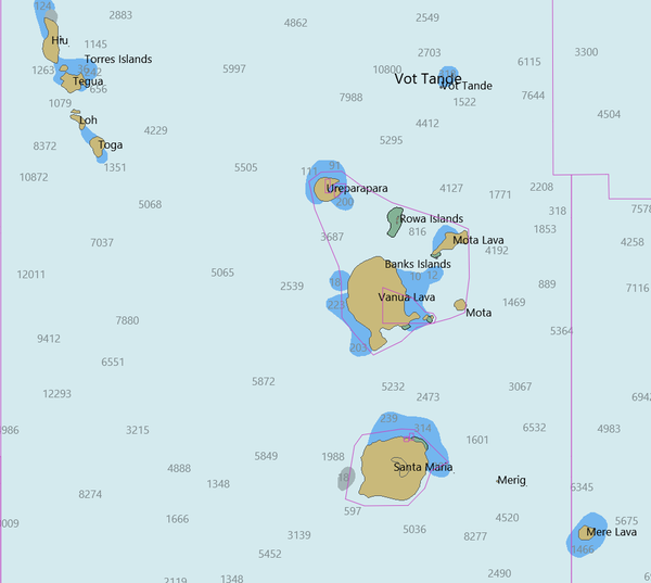
the banks vanuatu torba province

The Banks Islands (in Bislama Bankis)
are a group of islands in northern Vanuatu. Together with the Torres
Islands to their northwest, they make up the northernmost province of
Torba.  

Entracne to Ureparapara

To
the east of these larger islands lie a number of smaller ones. The
furthest north of them 31 mi  northeast of Ureparapara, is Vet
Tagde (also known as Vot Tande or Vot Ganai), which is an extinct
volcano that last erupted 3.5 million years ago.   Ureparapara (also known as Parapara means  "full of slopes"  ), is an old volcanic cone that has been breached by the sea, forming a bay, known as Divers Bay, on its east coast.

 Ureparapara entrance

 Ureparapara Entrance 

Anchored in Dives Bay

Anchored in Dives bay Ureparapara 

ROWA

Other small islands in this eastern chain in the Banks Island group include the Rowa Islands
(also called the Reef Islands), which are a few very small, low islands
on a coral atoll and are unihabited. Mota Lava is the largest and
highest (411 m) of this eastern chain of islands; off its southern
coast, attached by high corals that can be waded through at low tide, is
the tiny islet of Ra. The islands of Mota, Merig, and Merelava complete
the southeastern part of the archipelago.

GAUA

The
largest island is Gaua (formerly called Santa Maria), which has a
rugged terrain, rising to Mount Gharat, an active volcano at the centre
of the island, at 797 m (2,615 ft). Gaua's freshwater Lake Letas, in its
volcanic crater, is the largest lake in Vanuatu. A slightly smaller
island in the group, Vanua Lava, is higher, at 946 m (3,104 ft); it too
has an active volcano: Mount Suretamate (also spelled Süretimiat or
Sere'ama, 921 m (3,022 ft)). To the east of Vanua Lava are two islets in
the groupo, Ravenga and Kwakea (also spelled Qakea). Sola, the
provincial capital, is on Vanua Lava. 

SY CARINTHIA '09  


10) THE PASSAGE TO NEW ZEALAND 

ZOOM WEBINAR SEP 30 2023

Should I stay or should I go ?


https://oceanposse.com/events/the-passage-to-new-zealand-presented-by-ocean-tactics/


YOUR PASSAGE TO NEW ZEALAND 
presented by  John Martin from Ocean Tactics

JOHN MARTIN
 

South Pacific Posse


SEASON '24 SIGN UP STARTS IN DECEMBER 

11) CLOUD NINE 🇫🇯 FIJI
SPONSORS THE SOUTH PACIFIC POSSE


CLOUD 9


CLOUD 9 🇫🇯 FIJI

12) SOUTH PACIFIC POSSE  
🏆 
AWARD CATEGORIES 

  • BIGGEST FISH CAUGHT ✔ 
  • PICTURE OF THE YEAR ✔  
  • PACIFIC POSSE YODA OF THE YEAR ✔  
  • THE CAPTAIN RON AWARD ✔
  • MOST UNWELCOME VISITOR ONBOARD ✔ 
  • HIGHEST WIND RECORDED ✔ 
  • SPIRIT OF EXPLORATION ✔ 
  • GALLEY GOD(ESS) ✔ 
  • SPEEDY AWARD
  • GOOD SAMARITAN OF THE YEAR ✔  
  • BOAT YOGA POSE OF THE YEAR ✔
  • COURAGE AWARD 

Burgee Back

South Pacific Posse '23 BUrgee Front

13)  "AND THEY ARE UNDERWAY"
 FLEET TRACKING FOR PARTICIPANTS  


Tracking


 About Tracking:

Designed to give interesting parties  an overview. For specific vessel details including their float plan,
latest updates, changes, positions and specific location related
questions please contact each vessel directly.  If you are on
passage let us know and the fleet can monitor your progress.

https://pacificposse.com/add-to-tracking

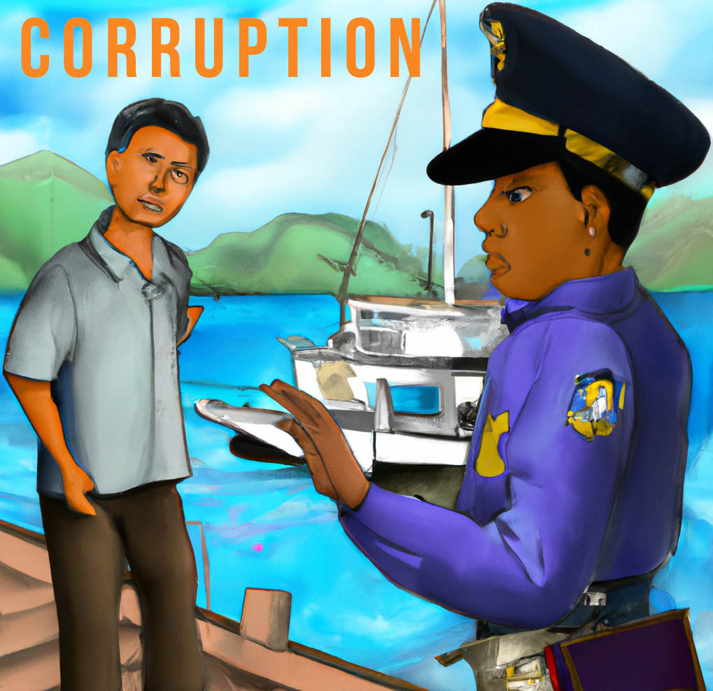
14) CORRUPTION ALERT ⚠️ AMERICAN SAMOA 🇦🇸

AMERICAN SAMOA - an  unincorporated US TERRITORY FEATURES SOME CORRUPT OFFICIALS AS REPORTED BY SEVERAL VESSELS 

While
currently these "facilitation fees" without receipts  are
relatively small this sets a dangerous precedence and we plan on
reaching out to law enforcement. Corruption is usually the first step in
a bureaucrats downfall. It's ok to offer officials some food or non
alcoholic beverages upon clearing in  paying under the table fees
is ill advised and illegal - pleas email any reports to
registration@pacificposse.com ( anonymous ok ) we will start beating the
drums on behalf of all seafarers.

CORRUTPTION IN AMERICAN SAMOA

QUICK FACT :
THE
U.S. Department of the Interior Interior provided $26.6 Million to
American Samoa for Fiscal Year 2022 Government Operations  - for a
link to how much agency support the US government provides AS
follow this link >>

15) FREE ACCESS TO GOOD NAUTICAL  

IF
YOU ARE SIGNED UP FOR THE  '23 SOUTH PACIFIC POSSE  you will
be assigned  access credentials to GOODNAUTICAL South Pacific
regions 


Good Nautical


CONSIDER MAKING A TAX DEDUCTIBLE DONATION TO GOOD NAUTICAL 

https://www.paypal.com/paypalme/goodnautical


https://www.paypal.com/paypalme/goodnautical


NEW CALEDONIA'S ANCHORAGES ARE IN GOOD NAUTICAL 

16) HISTORIC PORTS ⚓ OF THE  PACIFIC 
LAHAINA HAWAI'I

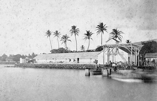
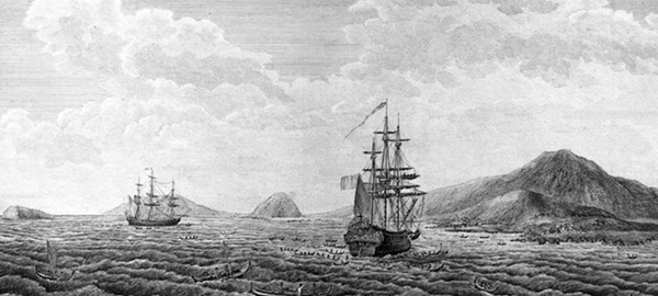
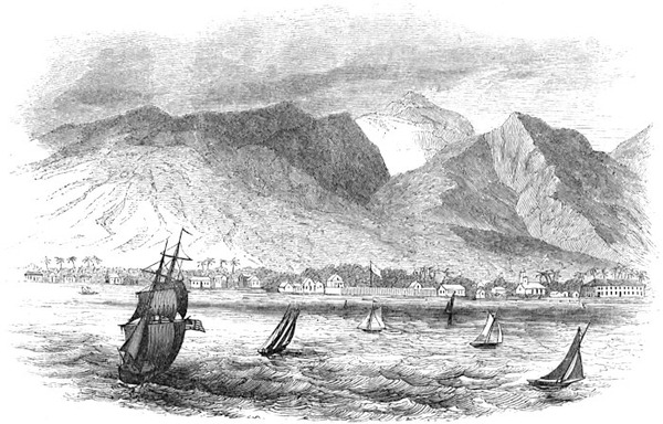
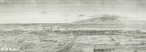
The Port of Lahaina goes back almost two centuries since Lahaina was the capital of the Kingdom of Hawaii from 1820 to 1845.

 Lahaina Harbor
 Lahaina Harbor

Historic View of Lahaina by J G Sawkins

Lahaina 3

The
Old Lahaina Fort was originally built in 1831 by Hoapili, the Royal
Governor of Maui. He built the fort to protect the town from riotous
sailors when Lahaina was used as an anchorage for the North Pacific
whaling fleet.

After
the fort was demolished in 1854, a courthouse was built on the site. A
portion of the old Lahaina Fort was reconstructed in 1964.  

Lahaina

Whaling
ships hunting sperm whales in the Pacific began to arrive in Hawaiʻi in
1819, and many ships anchored in Honolulu and Lahaina. The impact of
the whaling fleets on the Hawaiian Islands during the reign of
Kamehameha III (1825–1854) shaped the entire Hawaiian economy and was
the primary source of income for the islands until the discovery of oil
in Titusville, Pennsylvania in 1859 and the onset of the American Civil
War (1861–1865).

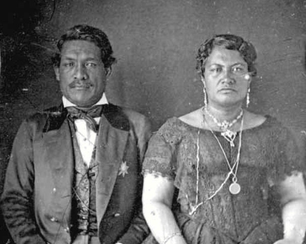
Kamehameha III and Kalama, ca. 1850

Kamehameha III and Kalama, ca. 1850

 Ships
would generally seek repairs in Honolulu, but captains preferred
anchoring off Lahaina because of its easy access from the Lahaina Roads
and for the fresh provisions available in town. According to Henry L.
Sheldon, "the business of the entire population was the furnishing of
supplies to whalers and entertaining the crews". Sailors who had been
hunting whales for months at a time went to Lahaina to drink grog and
meet women.

LAHAINA

By
1825 a kapu prohibiting women from going out to ships for the purpose
of prostitution was proclaimed by the Hawaiian chiefs (ali'i ). Enraged
that they could not cajole, coax, or coerce Hawaiian women into
violating the kapu, the sailors turned their frustrations on the
American missionaries, whom they blamed for the emergence of this new
unreasonably strict moral law.

Whalers
opposed any rules governing alcohol and prostitution, and blamed
missionaries for influencing the Kingdom of Hawaii to enforce such
rules. Riots broke out at least four times—in 1825, 1826, 1827, and
1843. In the 1827 riots, sailors on the John Palmer fired their cannons
at the home of missionary William Richards and threatened the safety of
the community.

Lahina

Queen
Kaʻahumanu (1768–1832) visited Maui in February 1832, just months
before she died, to support the construction of a new fort to protect
the town from whalers. With her help, Hoapili (1775–1840), Royal
Governor of Maui, built the fort on the Lahaina waterfront and it was
completed within a month. The fort was constructed from coral blocks
with walls approximately 15–20 feet high topped with 47 cannons. An 1848
inventory lists 6 large cannons, 21 small cannons, 6 breech-loaders,
and 8 which did not work. The fort stored quantities of gunpowder, guns,
rifles, and swords, and was used as a prison. Sailors who docked at
Lahaina were subject to a sunset curfew; it they did not return to their
ship when the drums sounded they would be imprisoned in the fort.

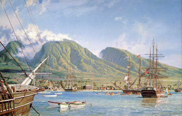
John Stobart - Lahaina Maui: The Whaling Brig

John Stobart - Lahaina Maui: The Whaling Brig "Isabella" Arriving In 1865

In
1841, American naval officer Charles Wilkes (1798–1877) visited Lahaina
Fort as commanding officer of the United States Exploring Expedition.
Wilkes observed, "After the king's palace, the fort is the most
conspicuous object: it is of little account, however, as a defence,
serving chiefly to confine unruly subjects and sailors in.

As
the whaling industry declined and the California Gold Rush gained
prominence in the late 1840s, Hawaii's population dropped, and
infectious disease epidemics contributed to the loss of local
populations. The fort was restored in 1847 but was now used more as a
prison than for defending the Kingdom. The cannons were rusting and the
fort was mostly empty of personnel except for a few soldiers and the
Governor of Maui who lived there. When Henry Augustus Wise visited in
1848, he met James Young (1797–1851), then Governor of Maui, who was
living in the fort.

Wise
wrote that it was: "an oddly assorted battery of some thirty pieces of
artillery, of all sorts of carriages and calibre—long, short, and
mediums; they command the usual anchorage, and no doubt do very well to
prevent any acts of violence from merchant ships; but it is a question,
if, at the second discharge of shot, they do not tumble to pieces."

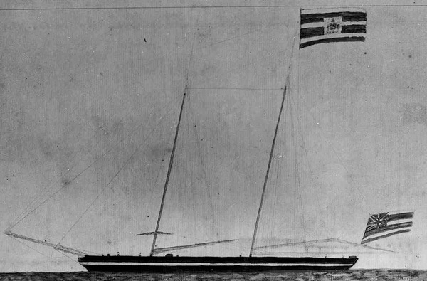
Hawaii Flag

17) MEET OUR SPONSORS 

  • PREDICT WIND
  • PANAMA CANAL AGENT ERICK GALVEZ CENTENARIO CONSULTING
  • YACHT AGENTS GALAPAGOS
  • YACHT AGENTS NUKU HIVA
  • SAIL TAHITI
  • OCEAN TACTICS | PACIFIC WEATHER ROUTING
  • SHELTER BAY MARINA PANAMA
  • DENARAU MARINA FIJI
  • NAWI ISLAND MARINA
  • VUDA POINT MARINA
  • COPRA SHED MARINA FIJI
  • CLOUD 9
  • PUERTO AMISTAD ECUADOR
  • RIVERGATE MARINA AUSTRALIA
  • MARSDEN COVE MARINA NEW ZEALAND
  • GULF HARBOUR MARINA NEW ZEALAND
  • YACHTING WORLD MARINA PORT VILA VANUATU

WE OPERATE UNDER INTERNATIONAL MARITIME LAW

YOUR VESSEL YOUR CREW YOUR RESPONSIBILITY 


South Pacific Posse
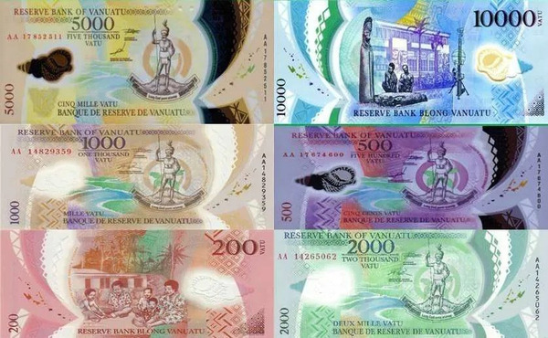
VATU

The colorful VATU


TAHANEA

FLEET UPDATE 2023-07-01

South Pacifc Posse '23

“Every explorer I have met has been driven—not coincidentally but quintessentially—by curiosity, by a single-minded, insatiable, and even jubilant need to know.”

- Jacques-Yves Cousteau


SOUTH PACIFIC POSSE
FLEET UPDATE

2023-07-01

14 Ensigns

65 Yachts from 13 ensigns are signed up from now until November '23 they will share up to date information, scout for opportunities and alert each other to threats.

To join next season follow this link >>

Jean-Michel Cousteau Resort Fiji in Savusavu

Jean-Michel Cousteau Resort Savusavu 🇫🇯 Fiji

TOP NEWS

  • FALSE PASS TOAU
  • EPI & PENTECOST 🇻🇺
  • PICTURES OF THE WEEK
  • MARQUESAS REDUX
  • SAVE THE DATE
  • SUWARROW 🇨🇰 UPDATE
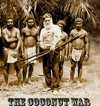
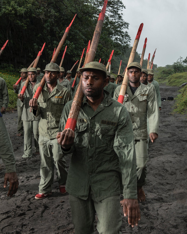
  • CARGO CULTS &🥥THE COCONUT WAR
  • BACK ON LAND
  • HIENGHENE 🇳🇨 NEW CALEDONIA & THE KANAK CULTURE
  • SAU BAY 🇫🇯 FIJI SPECIAL PADI DIVE COURSE
  • PREDICT WIND DATA HUB SPECIAL

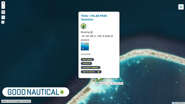
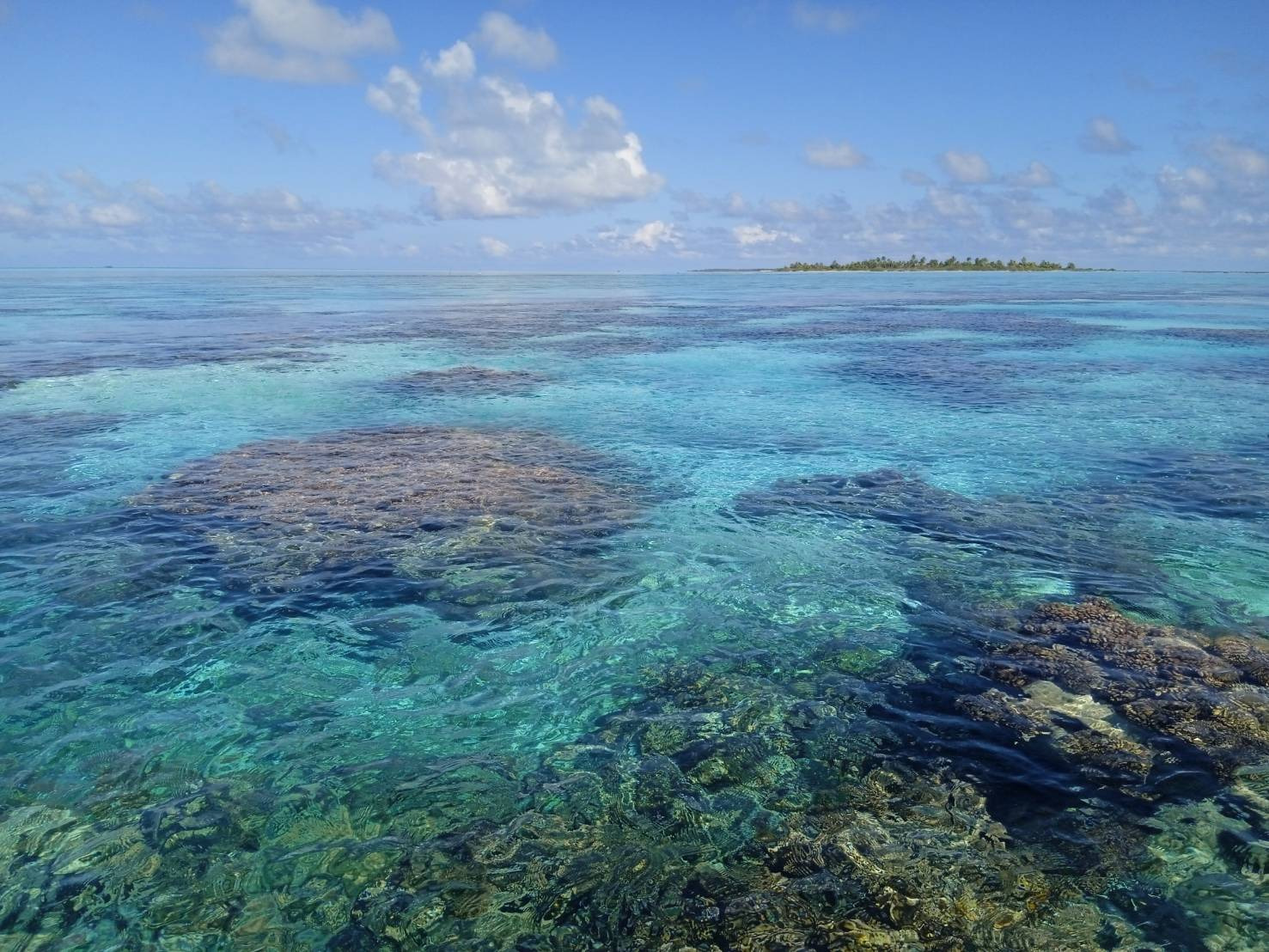
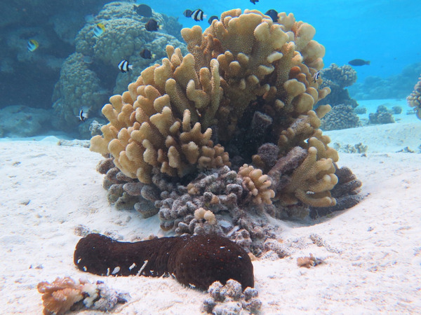
1) FALSE PASS, TOAU, TUAMOTUS
🇵🇫 FRENCH POLYNESIA

 TOAU - FALSE PASS Tuamotus Mooring @ -15° 48.188 S -146° 9.2246 W 20.00 ft

⚓ Good Anchorage & Mooring @ TOAU - FALSE PASS Tuamotus

15° 48.188 S 146° 9.2246 W @ 20.00 ft

Clarity

this is the water clarity - bets snorkeling ever - we could see 40 feet down perfectly

underwater

SY MONSOON 🇺🇸 Travis, Yeen Yee, Rowan , Everyn - Fuji 32′

MONSOON Yeen YeeMONSOON CrewMONSOON Crew

Burgee Back

South Pacific Posse '23 BUrgee Front

2) EPI & PENTECOST 🇻🇺 VANUTAU

meet benny

Meet Bennington ( aka Benny - same as she ever was with her amazing garden - note she likes chocolate chop cookies )

David traded a set of knives

Lamen Bay Epi Vanutau

Lamen Bay ⚓ 16° 35.773 S 168° 09.893 E 20 ft Epi 🇻🇺 Vanuatu

Pentcost Vanuatu Land Diving

Land diving is a ritual performed by the men of the southern part of Pentecost Island, Vanuatu. Men jump off wooden towers close to 90 feet high, with two tree vines wrapped around the ankles. Land diving is done by tying vines to each ankle. According to the Guinness World Records, the g-force experienced by those at their lowest point in the dive is the greatest experienced in the non-industrialized world by humans.

LAND DIVING VANUATU PENTECOAST 2023 VIDEO

The origin of land diving is described in a legend of a woman who was dissatisfied with her husband, . It is sometimes claimed that the woman was upset that her husband was too vigorous regarding his sexual wants, so she ran away into the forest. Her husband followed her, so she climbed a banyan tree.

She tied lianas to her ankles and jumped and survived.

She tied lianas to her ankles and jumped and survived. Her husband jumped after her, but did not tie lianas to himself, which caused him to plummet and die. Originally, women did it in respect to the original woman who did it, but husbands were not comfortable with seeing their wives in such positions, so they took the sport for themselves, and it gradually changed from trees to specifically designed wooden towers. The men performed the original land diving so that they would not be tricked again.

SY DREAMER 🇺🇸 David & Gerne - Caliber 40lrv’

DREAMER CrewDREAMER GerneDREAMER David
LONDOT

Londot ⚓ 15° 54.789 S 168° 11.277 E 23 ft Pentecost 🇻🇺 Vanuatu

3) PICTURES OF THE WEEK

Song of the Sea in Tahanea

Tahanea, Tuamotus 🇵🇫 French Polynesia

Tahanea

Anchorage @ Tahanea, Tuamotus 🇵🇫 French Polynesia

Tahanea

Floating Anchor Chain deployed @ Tahanea, Tuamotus 🇵🇫 French Polynesia

SY SONG OF THE SEA 🇸🇪 Tore & Maud - Najad 46′

SONG OF THE SEA MaudSONG OF THE SEA Tore

4) MORE PICTURES OF THE WEEK

Monsoon

SY MONSOON 🇺🇸 Travis, Yeen Yee, Rowan , Everyn - Fuji 32′

MONSOON Yeen YeeMONSOON CrewMONSOON Crew

5) MARQUESAS REDUX 🇵🇫 FRENCH POLYNESIA

Picture of the week

Marquesas 🇵🇫 French Polynesia

For anyone still in Marquesas or heading there our favorite anchorage was Hanatefau Bay in Tahuata. There is sand and good holding on the north side. The morning light is magical, there are spinner dolphins swimming around the bay most days. Hapatoni village is beautiful and the people are friendly. We got to see a traditional Marquesian performance, pick fruit with a local woman and eat an amazing lunch at her home.

In the next bay up Vaitahu the village is also very nice. We heard it was tough anchoring so we dinghied there. Jimmy a local restaurant owner hosted an awesome cruisers barbecue at his house.

In the first bay valley Baie du Nord there’s a beach and manta rays often come into the anchorage or you can wait just outside the anchorage at sunset in the dinghy or paddle board and you’ll see them.

wanderlust

Marquesas 🇵🇫 French Polynesia

wasnderlust

Marquesas 🇵🇫 French Polynesia

Wanderlust

Approaching Fatu Hiva, Marquesas 🇵🇫 French Polynesia

fatu hiva

Fatu Hiva is absolutely stunning and when we were there some cruisers organized a type of circus acro yoga performance with the village kids that was really sweet.

fatu hiva

Marquesas 🇵🇫 French Polynesia

Wanderlust Pool

On the north side of Hiva Oa in Baie Hanaiapa there’s a small fresh water pool with a waterfall on a man’s well tended property. He sells fruit & carvings he makes. We met someone who went on a goat hunt with him.

SY WANDERLUST 🇺🇸 Kristin & Fabio & Yoda - Seawind 52′

WANDERLUST FabioWANDERLUST KristiWANDERLUST Crew
https://www.youtube.com/c/harborsunknown

WATCH THEIR YOUTUBE CHANEL ▶️
https://www.youtube.com/c/harborsunknown


6) SAVE THE DATE

NAWI ISLAND FIJI

MEET THE FLEET CELEBRATION

Aug. 26 '23

NAWI ISLAND MARINA
SAVUSAVUS FIJI

Nawi

artists rendering


RSVP NOW
SEPT 2 2023

FREE RUM, MUSIC and
BULATASTIC PORK ROAST

Save the date

Saturday AUG 26 ’23 FIJI

NAWI ISLAND

Nawi Island is located in the beautiful Fiji Islands.It will feature an International Superyacht Marina, which will have 132 marina berths, including 21 superyacht slips (up to 85m). The marina has been designed and built up to category 5 cyclone resistance rating.

The South Pacific Posse is planning a get together at Nawi on Sept 2nd 2023. A week before the infamous Musket Cove regatta. Nawi will be offering entertainment, markets, kava tasting and discounts on berths, water sport activities, restaurant & bar orders, with Pacific Posse hosting a Pig on the spit and rum delights.

The fully serviced marina will include “plug in” services through utility pedestals to water, sewerage pump out, power, fuel & gas facilities, plus 24hr security, complimentary Wifi, a.m.o..

16° 46.5716' S 179° 19.9533' E - Nawi Island Savusavu 🇫🇯 Fiji

waterlust

7) UPDATE SUWARROW 🇨🇰 COOK ISLANDS

sland caretakers like Harry Papa'i are chosen by the Cook Islands government every five years to look after the island. Harry's back in 2023 with assistant park ranger Teina Vakapora. Together they're responsible for protecting and managing the environment and wildlife of the island They also act as customs, immigration and biosecurity officers for visiting yachties who help pay for them by way a fee of NZ$50 to anchor in the lagoon. Their home doubles up as the island's cyclone shelter which has recently been renovated. But the caretakers will never be lonely...they share the island with an estimated one million seabirds!.

Island caretakers like Harry Papa'i is back in 2023 with assistant park ranger Teina Vakapora. Together they're responsible for protecting and managing the environment and wildlife of the island They also act as customs, immigration and biosecurity officers for visiting yachties who help pay for them by way a fee of NZ$50 to anchor in the lagoon. Their home doubles up as the island's cyclone shelter which has recently been renovated. But the caretakers will never be lonely...they share the island with an estimated one million seabirds!.

shelter

"Hello everyone, I just wanted to give everyone an update. Voodoo has just arrived at Suwarrow reef. So prior to arrival in Suwarrow I messaged the officials, they stated that you could not check into the cook islands in Suwarrow, bummer. But we ended up sailing this route anyway bc there were less storms and better winds. We figured we would stop in on hopes we could get in. We heard rumors of offics turning all the arc boats away. The rangers could not be friendlier today and check us in to the cook islands today. We have all official paperwork and everyone was very friendly. So yes you can go to Suwarrow and the rangers will check you in. Safe travels everyone

Suwarrow Sharks

SY CERULEAN 🇳🇿 Helen & Stephen - Seastream 43 Mk3′

CERULIANCERULIAN
Suwarrow

8) CARGO CULTS &
🥥
THE COCONUT WAR

https://www.amazon.com/Coconut-War-Vanuatu-Struggle-Independence-ebook/dp/B00787DSIE

The Coconut War was a conflict that occurred in the early 1980s between two groups on the island of Espiritu Santo in what was then New Hebrides ( Vanuatu) , a condominium jointly ruled by France and the United Kingdom.

Before the conflict, the New Hebrides was administered as a colonial territory jointly by France and the UK. However, the islands had a unique political arrangement where there were two separate administrations for each colonial power, and local chiefs held significant influence in their respective areas.

Stamps

In the early 1980s, there was growing tension between the French-speaking and English-speaking communities, particularly on the island of Espiritu Santo. The French-speaking community, predominantly located in the southern part of the island, sought independence from the joint colonial rule and proposed a plan for the island to become a separate French territory.

On the other hand, the English-speaking community in the northern part of the island wanted to remain under the joint colonial administration or gain independence as part of a united New Hebrides. They were concerned that becoming a French territory would lead to loss of their land rights and cultural identity.

The Coconut War erupted when the Andrew Christopher Stuart was forced to quell a rebellion by bow-and-arrow-wielding cargo-cult devotees on the eve of independence in July 1980.

The conflict escalated when both communities formed paramilitary groups to assert their demands. The conflict became known as the "Coconut War" due to the prominence of coconut plantations in the region.

Amidst the escalating tensions and fears of a full-scale civil war, the leaders of both communities agreed to a compromise. A new constitution was adopted, and on July 30, 1980, the New Hebrides gained its independence as the Republic of Vanuatu, with a government elected by the people. The name "Vanuatu" was chosen to reflect the nation's cultural heritage and means "Our Land" in many of the country's indigenous languages.

CARGO CULT

The Cargo Cult is another interesting aspect of Vanuatu's history, particularly during the colonial era. Cargo cults are a phenomenon that emerged in the South Pacific, including Vanuatu, after the arrival of European colonizers and missionaries. These cults were characterized by the belief that the goods and "cargo" brought by the Europeans were gifts from their ancestral spirits or gods.

The origins of the Cargo Cults can be traced back to the late 19th and early 20th centuries when indigenous peoples in Vanuatu and neighboring islands witnessed the vast material wealth and technology possessed by the European colonizers. The indigenous populations often found themselves in awe of the goods, such as manufactured products, clothing, tools, and other commodities, which were vastly different from their traditional ways of life.

To the indigenous people, the sudden appearance of these goods seemed inexplicable and almost magical. They interpreted the arrival of these foreign goods as a sign that their ancestors or gods were rewarding them. Consequently, they developed religious movements, known as Cargo Cults, that centered around the belief that if they performed certain rituals and ceremonies, the gods would provide them with even greater wealth and prosperity in the form of "cargo" from the sky.

CARGO CULT

These movements often involved the construction of symbolic landing strips, control towers, and mock airplanes made from local materials like bamboo and thatch. The believers would gather at these sites, imitating the behavior of the Europeans they had observed, hoping that their efforts would attract more cargo from the heavens.

The Cargo Cults varied in their beliefs and practices from one region to another and were not limited to Vanuatu but were also observed in other parts of Melanesia and Papua New Guinea.

It's essential to understand that the Cargo Cults were a response to the drastic changes brought by European colonization and the overwhelming material disparity between the colonizers and the indigenous populations. They were an attempt by the local people to make sense of these changes within their own cultural and spiritual frameworks.

The Coconut War erupted when the Andrew Christopher Stuart was forced to quell a rebellion by bow-and-arrow-wielding cargo-cult devotees on the eve of independence in July 1980.

Andrew Christopher Stuart was the last resident commissioner * on Santo, the largest of the 80 islands of the New Hebrides, now Vanuatu in the South Pacific. He arrived there in 1978, with the brief of bringing the islands to independence. That he managed to see this through in the face of a local rebellion and machinations by the French was tribute to his smooth operation under pressure.

(*Resident commissioner was or is an official title of several different types of commissioners, who were or are representatives of any level of government. Historically, they were appointed by the British Crown in overseas protectorates amo)

CARGO CULT
South Pacific Posse
57 vessels

9) BACK ON LAND

AARON

'To the USCG, Tahiti Maritime team, and the 21 member crew aboard The Baker Spirit I have gotten to know, thank you. Despite losing everything materialistic in my life, you provided me with a beautiful perspective on life I can only hope offers others seeking the same, a chance to SEE too. It’s worth more than all the funds and savings, I lost. While I am not fully sure what details on the events that took place are known by the public yet or what my options are on arrival, I just wanted to post an official update, long overdue as I now found out too. I am speechless on how much support there is now from my friends groups that were set up and new followers on the social media pages for it all. All I can say is I love you all and look forward to sharing so many more details to the story below, many in person soon too. Forgive me, this is my best effort not to push my private beliefs on anyone, yet at the same time share the unique perspective with facts of what happened as I continued on my ‘See Level’ Expedition. The effort to connect the world in a positive way thru humanity while exploring my own spiritual curiosity thru the solo travel. I believe the dates and times are on point but with the official journal and all other notes now underwater remaining in Smiles, the capsized vessel, possibly still floating, this is the best I can recall. Please excuse the gramatical and spelling error sent from my new phone brought to me on arrival from good friend Jeremy Corum who showed up here in Honolulu, to ID me and offer his support out of his own pocket, like many of you have done .

“Be Brave”, the words I heard in my head and wrote down in my Captains log , understanding that I had now lost total power 7 days ago, May 13th , coordinates being 4.31 south and 117 west, roughly 1600 NM from closest land way point of 7.9 south and 137 west, roughly the Marquises. Now the 21st of May, aside from my gifted fixed Epirb and Personal Locator Beacon with built in batteries for emergency use only, I was left with 13 percent battery life on my iPhone and 5 percent left on my Spot GPS tracker. I had been powering on and off the iPhone for the last 8 days, just to write down my coordinates using the offline Navionics app, and continue to do my best rowing in the blind. Calculating the last 8 days of my progress, it was clear that with roughly 1410 miles remaining I was truly on the sought spiritual pilgrimage. Having read the stories of Moses and the Mount, Noah and the rain, Jesus and the wilderness, and David with Goliath, I too was projected to officially be embarking on a similar 40 days with God, from the Ocean. At least that’s what I had told myself anyway, with nothing to lose other than Sanity. I made the deal with God in my head after calculating the 40 miles a day average and 1600 to go onward since the outage in silence. I could also test my faith, as I was not in need of a rescue at that time and had enough basics to make it 50 days or so at least. Just no devices, no communication instruments, no screen time, no internet, no music, no man-made sounds, nothing. Oh, and no sugar left either, just 40 kilos of rice with a few emergency bars and cans of fish if needed. It was also then, after the first week of no success trying to come up with a fix for the surged solar panels, I powered on my Spot Device again and attempted to quickly check my gps location as well send an official satalite message to my point of contact for the expedition, Chris Martin. Spot had been doing a great job tracking hourly for the months prior, but because the battery power was low, I was turning it on an off now, which took some time to find get on satellite, when and if it did in the short time I kept it on. I mentioned the above in my text and that I did not feel I needed a rescue, but wasn’t able to know my locations much longer and this would be my last message until I reach land. I was also noting that each day the iPhone was off, I was still losing battery power, roughly 1 percent per day. Then, on June 1st after 18 days of rowing in the blind with my heading at 190 degrees referenced with fixed compass on deck, I wrote down my final coordinates, before my phone officially died. 5.39 south, 121 west , amazingly I was still on track, with such hope that the Godspeed would save the day, keeping me with a COG I needed at 225 going slightly more miles than expected at 45 NM per day. Over the course of the following 15 days, I continued on. More stories and details for another time, but in short, my daily routine was simply eat, pray, row. Manually making 1 gallon of water for the first hour of the day to survive, catching generally 2 fish daily with the same pink lure I was gifted too, and cooking them with 1 kilo of rice in the solar oven after 4 hours. It truly felt like a devotee fasting to say the least. Offering me something to do to avoid insanity while getting through each SLOW day. Admittedly, life after Cancer had gone by so fast already over the last 15 years it now felt like a blessing to have it slow down. I was also making amends with the vivid memories I was now getting of the past. My failed lines of communication with my poor business moves, my failed efforts with some independent contractors, loss of communications with immediate family, and coping mechanisms thru it all. Putting it to rest in my mind now and making peace with it all. Without that ‘need for speed’, where the only stimulants came from the fresh clean air, a warm sea breeze, and a clear mind taking in the natural beauty of it all out on the Ocean. Something I enjoyed sharing to all of you as well. Overall, it was a pure dopamine hit that offered a daily sweet taste from the rice and cool glass of clean water with fresh fish to compliment. But again, more details for hopefully in person stories at a later time, because now, it’s the morning of June 15th. I estimated I had officially now entered the ‘Marquises Fracture Zone’ with about 350-400 ish NM left before I may see land, another 7 days I expected. I noticed the seas were different than my roughly prior 80 days since my Galapagos departure. It felt like 30 knot plus winds from the south this time, not SE. By now, I also knew that the waves generally increased in size up to 13 times before doing the cycle over again. I believe it was about 9 am as I had the first 3 hours of Sun, made water and fished and had just finished putting my to be daily meal, in the solar oven. It was then I felt for the first time a deadly silence to my right side. Out of my right eye, I was 90 degrees and close to the largest wave crest, I had seen to date. What appeared to be about 4 meters of crest, I knew I was in trouble. I jumped backwards into the hatch and leaned into the approaching wave side, bracing for impact, still harnessed to the deck safety lines attached to my life jacket. Within that next 2 seconds, Smiles (the boat) was toppled and I was now upside down, water coming in. Thinking, did this really just happen? Still attached to the deck outside, with my safety harness and life jacket, I swam out of the hatch where I held onto the boat and saw my world, now upside down. Doing my best to understand the confusion and process it all, I tried to get my bearings, to locate my needed items now under the boat. I spent the next 2 min I believe, trying to upright Smiles with no success. I began to dive under a few times thinking it was the bow, trying to reach the port side but on the starboard, etc. Eventually I got the life raft free, along with my PLB that was fixed near the door of the hatch, next to the fixed Epirb. After 33 days of trying to avoid using unnecessary rescue resources, it was clear I needed help now. I pleaded with God, why? I thought we had a deal? We are only 7 days away from success in faith? Then, lifted the antenna and officially activated the PLB at that time with success. I had tested and pressed the gps check on the device a few times in the prior days in effort it may show that despite I was not activating an emergency, still alive and making progress to land, as I mentioned in my final SMS text. I don’t know if that worked or was received but couldn’t have hurt and with various submarine sounds around the 28th of May and 30th I believed some form of maritime knew I was still making progress. I hoped anyway. I then pulled the painter on the life raft floating a few feet next to me, which inflated. I also attempted to free my safety cable from Smiles but couldn’t untangle the line, with the confusion still lingering around. Concerned Smiles may take me down if she sinks, removed the attached life jacket and jumped in the life raft with only my PLB in hand and my bathing suit on. I then unhooked the painter line which I then lost hold of as the Seas continued to bounce Smiles into the raft, which then left me floating slightly faster down current than capsized Smiles. Knowing the hatch was still open with my life inside, I was faced with the choice of jumping back in to attempt to grab hold of Smiles and also ideally grab my ditch bag containing all my dry box with devices, paperwork, cash, cards, emergency food, passport, etc, or staying put with only my plb and swimsuit to my name. I reluctantly stayed. As Smiles and I drifted apart, thoughts ran thru my head, and I questioned the deal I had with God, telling him it was only day 33, and all I knew about 33 was that was the age Jesus was said to have died, and now wondered if this was the plan for me. Hoping it wasn’t, I now began assessing my new boat, the second hand life raft I recently acquired. I noticed there were small packets of water, a drogue anchor, and small oars. Unfortunately, I also noticed that there was a leak coming in that would leave me bailing out the salt water for my remaining time in it if I wanted to stay floating. Lots of details for another time too but after what felt like an expected 3-4 hours, I heard and saw the first plane I had seen in the 80 days. Speechless on how quick the response was, be it I was in the middle of the South Pacific Ocean, in a hard to see life raft. It was the ultimate sight for sore eyes, and despite still bailing water out, did my best to signal distress as I noted the beautiful red and white lettering for the USCG plane. With I believe another 2 hours of Sunlight left, the plane began dropping things from the sky with the hopes I believe of reaching me. Flares to keep things light during the sundown, inflatable rafts I believe as they may have seen my leak issue with the raft, and a barrel of what I guessed was survival coms, food, and more attached to a parachute. Still in complete silence the thoughts in my head were running all over the place, trying to process it all, but managing and staying calm. Was a person coming down next? Did they see the shark circling the raft from the images they may have been able to take? Did they have knowledge of Smiles and eyes on it? The seas were still high and with the items being dropped above the current, I couldn’t seem to reach them, trying to use the oars to paddle closer. I debated trying to swim too, but was still being circled by an estimated 6 foot shark with an odd white tipped fins and with possible a tag on it near the tail for the last few hours. So I stayed with the raft. After the sun went down, I began going into a different survival mode, trying to stay tight in a ball as the temperatures went down. I was sitting in ankle deep water that felt warmer than the air outside, but wet, still bailing water, knowing it maybe a while before I would see a ship the USCG may try to divert and rescue me. I bailed water thru the night, thinking about the floating barrel still and Smiles, which I believed was still floating a few miles away. 20 minute naps was about all I could get as the bailing continued and the sun came up offering warmth. I believe then it was after about 30 total hours, the Baker Spirit Cargo ship came into view. So many more details here too but with the crew of 21 on deck with the captain piloting closer was able to maneuver the ship next to the raft, a miracle to say the least. On the second attempt, I was able to grab the life ring, jump into the cage, and be lifted up. The cheers from the crew when I grabbed a hold of the cage, provided me the strength to hold on to say the least. On arrival, I was immediately offered a warm jacket and unable to gain my sea legs, aided down to the cabin where I was given a towel, sandals, shorts, and two shirts. Clothes from the crew directly and a chance to shower after they took my vitals. I hadn’t had time to tell them anything of my journey yet, and it would be the first time I spoke to anyone in 34 days. I couldn’t believe how clean and proper the ship and team was as I got my senses back a bit more. Coming to my bearings again now processing it all, my all in journey had left me with nothing to my name. Thoughts of what went wrong and if I misread my entire journey purpose? While I could blame it on the weather or the as is boat, I tried my best to make it work with no official sponsors, I felt and still feel, this was my own captain error. No one else to blame but myself who got sideways with the wrong wave and won’t make the same mistake twice, that’s for sure. As for my spiritual pilgrimage, well as I got a quick shower and went to put on the shirt I was offered, I noted the writing on the front and nearly fell to the ground. It read the words, ‘Brave’. Proof in the picture from the crew who will only now know the significance it offered me when they read this post, is below. A wink and a nod from the man up stairs that our deal was still on and it was clear this was meant to be. While making it in the blind after 40 days would be a personal faith success story, this ending is much better. As it is truly other strangers, turned friends, who have connected the dots now, like brothers and sisters. I believe that’s why I am still here, to share the story of faith, humanity, and what happens when one acknowledges the mistakes of the past and leads by action steps, moving forward. ‘Rowing my boat’. Personally, I finally saw what I hoped to SEE, God. While I can’t quote scripture versus, offer a homily to a parish, or claim a perfect past, I hope this story of a simple effort with human power demonstrates a true effort to a purposed life. One others can try themselves in their own life, with their own Ocean and boat. My loss of Smiles and all the items I had is no match to the friends I made and communities I saw and connected with along the way. It was and is my goal to go back and pay forward to various individual and communities, sharing their stories as I like to do best on the now ever growing social media I have seen here now grow. Work with maritime to educate and learn from all the lessons learned, mindful of all the lives risked and resources used on my efforts. Still processing others here now believing in the journey, I believe success is happening on the effort to connect the world in a positive way. I too am reborn, starting from scratch, with a few lose ends to mend now before....

For a full rescue article visit

AARON

RB SMILES 🇺🇸 Aaron -

https://pacificposse.com/rivergate-marina-shipyard

10) SOUTH PACIFIC POSSE
🏆
AWARD CATEGORIES

  • BIGGEST FISH CAUGHT ✔
  • PICTURE OF THE YEAR ✔
  • PACIFIC POSSE YODA OF THE YEAR ✔
  • THE CAPTAIN RON AWARD ✔
  • MOST UNWELCOME VISITOR ONBOARD ✔
  • HIGHEST WIND RECORDED ✔
  • SPIRIT OF EXPLORATION ✔
  • GALLEY GOD(ESS) ✔
  • SPEEDY AWARD
  • GOOD SAMARITAN OF THE YEAR ✔
  • BOAT YOGA POSE OF THE YEAR ✔
  • COURAGE AWARD
chris

ENTRY INTO THE '22 SPP BIGGEST FISH CAUGHT AWARD - CHRIS SEAGLUB

11) HIENGHENE 🇳🇨 NEW CALEDONIA
& THE KANAK CULTURE

Hienghène

The Kanaks are the indigenous Melanesian inhabitants of New Caledonia, an overseas collectivity of France in the southwest Pacific

The earliest traces of human settlement in New Caledonia go back to Lapita culture, about 1000 BC In addition, Polynesian seafarers have intermarried with the Kanaks over the last centuries.

Linderalique rocks on the edge of the lagoon,

Linderalique rocks on the edge of the lagoon

Hienghène, located in the northeast of New Caledonia, is a town with significant Kanak culture. The reason for this is primarily due to its historical significance as a traditional Kanak territory and its geographical location.

Hienghène is also known for its natural landmarks and rock formations, which hold spiritual significance in Kanak culture. For instance, the "Henri S. Milliard" or "Brooding Hen" rock formation is a famous symbol associated with the town, and it holds cultural and spiritual significance for the Kanak people.

Kanak people of New Caledonia.

The remoteness of the region has often served as a protective factor in preserving traditional customs and practices and the Kanak culture is deeply connected to the land and the sea. Hienghène's location, with its lush landscapes, mountains, rivers, and access to the ocean, has played a vital role in shaping the cultural practices and traditional subsistence activities of the Kanak people living in the area.

New Caledonia

These natural resources have supported their traditional lifestyles, such as agriculture, fishing, and hunting, and have remained integral to their cultural identity.

Surf Camp New Caledonia

The Kanak population is traditionally contrasted with two other groups of European descent: (1) the Caldoche, who were born in New Caledonia; and (2) the Zoreille, who live in the territory yet were born in modern France.

NOumea

Port of Noumea with ample yachting services and an advanced mining industry has advanced technical repair facilities for yachts

Nouméa, on the other hand, is the capital city of New Caledonia and is located in the southern part of the main island, Grande Terre. It is a major urban center and the country's administrative, economic, and cultural hub. Nouméa has a cycloen accounts for a significant portion of the country's population. It is a bustling urban area with modern amenities, infrastructure, and a diverse population comprising Kanak, European, and other ethnic groups. As of September 2021, when comparing per capita GDP, which measures the average economic output per person in a country or territory, New Caledonia has a higher per capita GDP compared to both New Zealand and Australia.

HERVE

Meet Noumea Yacht Services: Hervé Moal
Noumea Yacht Services

40c Rue Austerlitz

Noumea, New Caledonia

+ 687 24 01 23

nys22s@hotmail.com

NOUMEA NEW CALEODNIA

Chief engineer, then captain on the drilling rigs’ supplies in Africa, he has also been in charge of a navigation’s company agency in Cameroun. His attention then turned to nautical charters where he worked as a skipper on many boats everywhere around the world.

Attracted by the Pacific, he settled in Tahiti and created the API YACHTING company: a naval repair building site with sail and cable-making services. He created a service for large units haul out at the PAPEETE Slipway and dry dock where large yachts (Maltese Falcon, FetutTéa, Askaris, Sorsha, etc) did their refit. He thus gained a good knowledge in solving yachts’ problem and their specific needs. He now offers his services in Noumea which objective is to bring yachts the best and thoroughly exhaustive range of services.

 Bourail New Caledonia

BOURAIL 🇳🇨 NEW CALEDONIA

12) "AND THEY ARE OFF"
FLEET TRACKING FOR PARTICIPANTS

Tracking

About Tracking:

Designed to give interesting parties an overview. For specific vessel details including their float plan, latest updates, changes, positions and specific location related questions please contact each vessel directly. If you are on passage let us know and the fleet can monitor your progress.

https://pacificposse.com/add-to-tracking

Key Features GPS Tracking PredictMail Service Boat Polars Transmit Wind Data Firewall Log Data Remote Support Insurance Claims Broadcast AIS Data Broadcast GPS Data Broadcast Internet

Key Features

  • GPS Tracking
  • PredictMail Service
  • Boat Polars
  • Transmit Wind Data
  • Firewall
  • Log Data
  • Remote Support
  • Insurance Claims
  • Broadcast AIS Data
  • Broadcast GPS Data
  • Broadcast Internet

US$299

Discounted from $399 for a limited time. Track, blog, connect and save all your onboard data sources

BUY NOW
DATA HUB

Track, blog, connect, save & broadcast all your onboard data sources

13) MEET
SOUTH PACIFIC POSSE SPONSOR
SAU BAY 🇫🇯 FIJI
SPECIAL PADI DIVE COURSE

https://pacificposse.com/sau-bay

Learn to Dive or take Advanced PADI Dive Course - Stay on our Mooring and Learn and take a course in 4 days (half day sessions, relax the rest of the time) with full use of resort including nightly entertainment.
Includes Full Board: **US $900** and free mooring.

Add accommodation @ US $300/night in Deluxe Oceanfront Bure
(regular price is $350/night). Additional non-diver rate (meals and resort use)
@ US $ 115/day. Prices include 15% VAT.

“Get your Landlegs Back” Special - 5 night stay on the resort in Deluxe Oceanfront Bure, all meals, welcome drink and complimentary foot massage, unlimited use of non-motorized watersports, nightly entertainment. $2,500 per couple.

Free mooring. Prices include 15% VAT.

SERVICES Moorings $10 x day $ 50 weekly Moorings up to 32’ (12,000 lbs) Depth: 40-90 feet 21+ AMAZING DIVE SITES – INCLUDING THE COVETED “GREAT WHITE WALL” HOUSE REEF FOR SNORKELING AND DIVING ORGANIZED DAY TRIPS (TAVEUNI ISLAND, VILLAGE TOURS, MANTA RAY SNORKEL) DIVE INSTRUCTION AND CERTIFCATION (PADI FACILITY) WITH HIGH QUALITY GEAR HIGH END RESTAURANT WATERFRONT PRIVATE DINING VALE CULTURAL DINNER EXPERIENCE (LOVO, MEKE AND KAVA CEREMONY) FULL BAR SHOWERS DELUXE WATERFRONT BURES WITH INDOOR/OUTDOOR SHOWERS FULL SERVICE OVERWATER SPA 100 ACRES OF RAINFOREST TO EXPLORE

SERVICES

  • Moorings $10 x day $ 50 weekly
  • Moorings up to 32’ (12,000 lbs)
  • Depth: 40-90 feet
  • 21+ AMAZING DIVE SITES – INCLUDING THE COVETED “GREAT WHITE WALL”
  • HOUSE REEF FOR SNORKELING AND DIVING
  • ORGANIZED DAY TRIPS (TAVEUNI ISLAND, VILLAGE TOURS, MANTA RAY SNORKEL)
  • DIVE INSTRUCTION AND CERTIFCATION (PADI FACILITY) WITH HIGH QUALITY GEAR
  • HIGH END RESTAURANT
  • WATERFRONT PRIVATE DINING VALE
  • CULTURAL DINNER EXPERIENCE (LOVO, MEKE AND KAVA CEREMONY)
  • FULL BAR
  • SHOWERS
  • DELUXE WATERFRONT BURES WITH INDOOR/OUTDOOR SHOWERS
  • FULL SERVICE OVERWATER SPA
  • 100 ACRES OF RAINFOREST TO EXPLORE
SAU BAY

CONTACT

Leo Rebele

Sau Bay Resort & Spa

Box 62, Waiyevo Fiji Islands

Tel: / Whatsapp +1 (562) 761-9191

Resort Tel +679 603-1003

info@divesaubay.com

www.divesaubay.com

https://pacificposse.com/sau-bay

14) FREE ACCESS TO GOOD NAUTICAL

IF YOU ARE SIGNED UP FOR THE '23 SOUTH PACIFIC POSSE you will be assigned access credentials to GOODNAUTICAL South Pacific regions


Good Nautical

CONSIDER MAKING A TAX DEDUCTIBLE DONATION TO GOOD NAUTICAL

https://www.paypal.com/paypalme/goodnautical

https://www.paypal.com/paypalme/goodnautical

New Caledonia 🇳🇨 in Good Nautical

SOUTH PACIFIC POSSE

15) MEET OUR SPONSORS

  • CLOUD 9
  • COPRA SHED MARINA FIJI
  • DENARAU MARINA FIJI
  • GULF HARBOUR MARINA NEW ZEALAND
  • MARSDEN COVE MARINA NEW ZEALAND
  • MUSKET COVE MARINA
  • NAWI ISLAND MARINA
  • OCEAN TACTICS | PACIFIC WEATHER ROUTING
  • PANAMA CANAL AGENT ERICK GALVEZ CENTENARIO CONSULTING
  • PREDICT WIND
  • PUERTO AMISTAD ECUADOR
  • RIVERGATE MARINA AUSTRALIA
  • SAIL TAHITI
  • SAU BAY FIJI
  • SHELTER BAY MARINA PANAMA
  • VUDA POINT MARINA
  • YACHT AGENTS GALAPAGOS
  • YACHT AGENTS NUKU HIVA
  • YACHTING WORLD MARINA PORT VILA VANUATU

https://pacificposse.com/yachting-world-marina

WE OPERATE UNDER INTERNATIONAL MARITIME LAW

YOUR VESSEL YOUR CREW YOUR RESPONSIBILITY

South Pacific Posse

south pacific posse
Ocean Posse LLC
@ 9811 w charleston blvd 2262 89117 Las Vegas USA

© 2023 Ocean Posse LLC


FLEET UPDATE 2023-06-11


South Pacifc Posse '23


"Do just once what others say you can't do, and you will never pay attention to their limitations again.."

- Captain James Cook FRS


SOUTH PACIFIC POSSE
FLEET UPDATE

2023-06-11

13 Ensigns

63 Yachts from 13 ensigns are part of a forward scouting fleet looking for opportunities and looking out for threats.

To join follow this link >>

Jean-Marie Tjibaou Cultural Centre Noumea designe by Renzo Piana Noumea New Caledonai

Jean-Marie Tjibaou Cultural Centre Noumea designed by Renzo Piano 🇳🇨 NEW CALEDONIA

TOP NEWS

  • L'ÎLOT AMÉDÉE 🇳🇨 NEW CALEDONIA
  • PICTURES OF THE WEEK
  • GET YOUR BURGEE
  • MONSOON'S TAKE
  • SAVE THE DATE
  • OCEAN TACTICS 🌪🌀
  • CYCLONE HOLES 🇫🇯 FIJI
  • RIVERGATE MARINA & SHIPYARD 🇦🇺
  • MANUAL TRACKING WITH PREDICT WIND SWITCH OVER
  • BOLO ALERT
  • HISTORIC PORTSVAVA'U KINGDOM OF 🇹🇴 TONGA

1) L'ÎLOT AMÉDÉE
🇳🇨 NEW CALEDONIA

 Amedee Lighthouse

The Amedee Lighthouse, located near Noumea, New Caledonia has some fascinating facts.

Construction: The Amedee Lighthouse was constructed in France in the late 1860s and was shipped in pieces to New Caledonia. It was designed by French engineer, Henri Becquerel, and stands as a testament to 19th-century engineering.

Tower Height: The lighthouse stands at a height of 56 meters (184 feet). It is one of the tallest lighthouses in the Southern Hemisphere and offers panoramic views of the surrounding ocean and islands surrounded by white sandy beaches and crystal-clear waters with sea turtles nearby.

The lighthouse is made of cast iron plates, which were riveted together to form the cylindrical tower. It features a spiral staircase with 247 steps leading to the lantern room at the top. The lighthouse's distinctive red and white stripes make it easily recognizable.

The Amédée Lighthouse

The Amedee Lighthouse is not just a historical , it is still an active lighthouse. It serves as an essential navigational aid, guiding ships through the coral reefs and marking the entrance to the Noumea harbor.

The lens, the original one fitted, is made up of a series of prismatic segments and known as a Fresnel lens. It was made in Paris in 1862 by the Société des Etablissements Henry-Lepaute. It was brought, dismantled, to New Caledonia and reassembled on top of the Amédée lighthouse in 1865. It was removed in 1985 when the lighthouse was automated, and replaced by a more modern lens.

The original lense was made up of a series of prismatic segments and known as a Fresnel lens. It was made in Paris in 1862 by the Société des Etablissements Henry-Lepaute and was replaced in 1985.

Conservation

Conservation Efforts: Due to its ecological importance, Amedee Island and its surrounding waters have been designated a marine protected area. This designation aims to preserve the diverse marine ecosystem and promote sustainable tourism practices

 Ilot Amadee

⚓ Good Anchorage & Mooring Balls @ 22° 28.55 S 166° 27.93 E Ilot Amadee 🇳🇨 NEW CALEDONIA

2) PICTURES OF THE WEEK

Suwarrow

@ anchor with sharks

At anchor

very good visibility * location withheld ;-)

At Anchor

SY GLADAN 🇵🇱 Giancarlo & Paola - Lagoon 44′

Gladan PaolaGladan Giancarlo
Mt Yasur

Mt Yasur Volcano in Vanuatu with David in all it's glory

On the edge of hell

On the edge of the caldron - phet phet phet is the sound of 2000 degree lava rocks landing all around you as they are launched at 1,000°C / 1,800°F. Estimated to erupt 10-20 times every hour as the volcano is constantly rumbling and causing the ground to shake.

MT YASUR

SY DREAMER 🇺🇸 David & Gerne - Caliber 40lrv’

DREAMER CrewDREAMER GerneDREAMER David
 

Experience in 30 seconds what a volcanic eruption looks like up close !

VANUATU IS IN GOOD NAUTICAL

VANUATU IS IN GOOD NAUTICAL ⚓

Rolling Stones

SY ROLLING STONES 🇺🇸 Geoff, Meghan & crew Leopard 45′

Rolling Stones Rolling Stones Rolling Stones Rolling Stones Rolling Stones
FIRST LIGHT

SKY LIGHT

 A coral bombie off a motu in Tahanea atoll

A coral bommie off a motu in Tahanea atoll FP

UNderwater

The sailing duo of Don Atwood and Julie Dunne will be chronicling their adventures, both land and sea with pictures and stories as they journey across the South Pacific aboard the sailboat First Light.

Coral
At Peace

More shots of the beautiful atolls of French Polynesia.

Floating the anchor chain to avoid coral damage and avoiding getting tangled up our bommies

FIRST LIGHT

SY FIRST LIGHT Don & Julie - Hallberg Rassy 39′

FIRST LIGHT DonFIRST LIGHT Julie
 

Marquesas
Marquesas
NANAI

SY NANAI 🇺🇸 Chris, Kay, Kevin & Mark - Tashing,Taswell 49′

3) GET YOUR BURGEE FROM KEVIN
@ NUKU HIVA YACHT SERVICES

Burgee Back

South Pacific Posse '23 BUrgee Front

Yacht Services Nuku Hiva 🇵🇫 Sponsors the South Pacific Posse

Yacht Services Nuku Hiva 🇵🇫 Sponsors the South Pacific Posse

I look forward to meeting and helping the participants

Cheers, Kevin

BP 301 Taiohae, 98742 Nuku Hiva, French Polynesia

+689 87 22 68 72, YSNukuHiva@hotmail.com

VHF 72, Monday – Friday 0800-1400

4) INTRODUCING THE LATEST
SOUTH PACIFIC POSSE MARINA

MUSKET COVE MARINA 🇫🇯 SPONSORS THE PANAMA POSSE

MUSKET COVE FIJI

We welcome any of the South Pacific Posse to Musket Cove at any time.

We’re pleased to offer a Free Berthing Day for 5 Paid Days to all South Pacific Posse Members.

Wayne Deed Musket ove Fiji

Wayne Deed
Musket Cove Fiji

Musket COve Fiji

Musket Cove in Fiji is a renowned destination that holds a special allure for yachts from all around the world.

Musket Cove is located in the idyllic Mamanuca Islands of Fiji, surrounded by crystal-clear turquoise waters, pristine beaches, and lush tropical landscapes. The natural beauty is breathtaking and provides a perfect backdrop for hanging out a season in the tropics.

Fiji offers excellent sailing conditions and service oriented staff and vendors with consistent trade winds, calm waters, and numerous sheltered anchorages and amazing surf breaks. Musket Cove, in particular, benefits from its strategic location within the Mamanuca Islands, providing easy access to nearby islands, reefs, and marine parks with an easy ferry to get you and your crew and guest back to and from the main island and Nandi airport.

The marina offers a range of services, including berthing, fueling, making it a convenient and well-equipped base for yachts to dock, moor and refuel.

Musket Cove has developed a vibrant yachting community hosting various events, races, regattas, and social gatherings, fostering a sense of camaraderie among cruisers. These events provide opportunities for networking, sharing experiences, and celebrating the joy of exploring via yacht.

It also offers a range of amenities and services that appeal beyond sailors. The Musket Cove Island Resort provides luxurious accommodation, restaurant options spa facilities, and additional recreational activities, allowing you to unwind and indulge in a relaxed setting.

MUSKET COVE MARINA 🇫🇯 SPONSORS THE PANAMA POSSE

5) MORE PICTURES OF THE WEEK

BRAVO ZULU

enjoying some dolphins in the distance, or maybe to get some alone time

Mary Caraway Ewing enjoying some dolphins in the distance, or maybe to get some alone time

More exploration of the dramatic Marquesas. These islands were once the home of tens of thousands of Polynesians

We sail where the coconuts grow

We sail where the coconuts grow and ... FALL!

Local Fruits

Legendary Pampelmousse and local fruits grow among breadfruit plant or 'uru, the coconut, the dozens of varieties of bananas including the incomparable orange plantain banana or fe'i, various root vegetables such as the taro, the tarua, the ufi, and the 'umara make up the basis of island cuisine

 Tiki: Anthropomorphic Sculptures, Sacred Structures and Powerful Places in Marquesas Islands Tiki : Sculptures anthropomorphiques, structures et localités sacrées des îles Marquises Sidsel Millerstrom p. 1828-1846 Abstract Index Text Bibliography Notes AuthorIllustrations Abstract English Français The ancient Marquesan anthropomorphic stone and wood sculptures or tiki have received wide attention since they were first noted in 1595. However, they have not been systematically and scientifically studied until the Marquesas Rock Art Project was created in 1984. Over several years eighty‑four anthropomorphic sculptures were located through intensive field survey and interviews with local Marquesan. Information gathered at each site included metric data, archaeological, social, architectural and environmental context. Stylistically the Marquesan stone tiki are remarkably similar and followed certain social rules. The similar characteristics also seen in Marquesan rock art, tattoo, and material objects suggest that the fundamental principles regarding the symbolic order remained unchanged for a long time. Moreover, the homogeneous decorative system demonstrates that the Marquesan adhered to a common ideology and belief system. Index terms Mots clés : Océanie, Polynésie française, Îles Marquises, Tiki, pierres anthropomorphiques, archéologie, sculpture sur bois, art rupestre, lieux sacrés, tatouage Keywords : Oceania, Marquesas Island, Tiki, anthropomorphic stone, archaeology, wood Sculptures, rock art, sacred place, tattoo Full text Acknowledgement The Marquesan Rock Art Project was a team effort and several archaeologists and local volunteers worked with us. While they are too numerous to mention here I am grateful for their enthusiasm, help and their friendship. I wish to acknowledge Maeva Navarro, former director of C.P.S.H., Tahiti, for initiating the Marquesan Rock Art Project, and for allowing my team and me to conduct research in the Marquesas. I thank her for her support and encouragement. Thank you to Edmundo Edwards, with whom I was fortunate to be able to work; he headed the project and became my working partner from the beginning. His knowledge of Polynesia and his overwhelming generosity and kindness touched everybody. Heidy Baumgartner Lesage, a long‑time friend and team mate, and I spent much time together in the Marquesas surveying, recording the petroglyphs, tiki, and associated architecture. I will always be indebted to Heidy for her sound advice and companionship. I thank the government of French Polynesia for allowing me to do archaeological research in the islands and for the many Marquesan that housed and fed us, showed us archaeological sites and became our friends. Introduction 1 A publication about a tiki exhibit in 2016, Tahiti, just become available. Tik (...) 1Since the 1590s, with the arrival of the first Europeans to the Marquesan Archipelago, stone and wood sculptures have been described, exhibited, photographed, sketched, painted and admired. However, the sculptures have never been systematically surveyed, documented and analysed. I present here a summary of metric information and empirical observation generated from data collected on the stone sculptures during several archaeological field seasons to the Marquesas Islands.1 2In 1984, Maeva Navarro, then Director of Département d’Archéologie, Centre Polynésien des Sciences Humaines, Te Anavaharau, Tahiti (C.P.S.H), initiated the Marquesas Island Rock Art Project. This government organization is presently known as Service de la Culture et du Patrimoine (S.C.P). Edmundo Edwards, then chief archaeologist with the department, directed the project. I was part of the venture from the beginning. During the Marquesan Rock Art Project, from 1984 to 1989, eighty‑four stone statues or tiki were documented in seventeen valleys on the presently six inhabited islands. Figure 1. The Marquesas Archipelago, French Polynesia Figure 1. The Marquesas Archipelago, French Polynesia Zoom in Original (png, 48k) © Map courtesy Melinda Allen 2016 2 Their work was published in 2007 by Service de la Culture et du Patrimoine, Mi (...) 3Since 1998, additional sculptures have been found and documented by others. For instance, the French couple Catherine Chavaillon and Eric Olivier, while living on Hiva Oa, recorded several previously undocumented statues2. 3 In the 1890s a large anthropomorphic head was taken from Me’ae Iipona, Puamau, Valley, (...) 4In 1997, the American archaeologist Barry Rolett, with University of Hawaii, Manoa, discovered four tiki heads on the surface of a shrine (me’ae) in Vaitahu, Tahuata. Several sculptures are located in Musée de Tahiti et des îles, Punaauia in numerous museums worldwide as well as in private collections. None of these anthropomorphic figures are included in this study. Some statues have been carried away by foreigners or they were hidden by Marquesan when Christianity became established in the archipelago.3 4 A stone monument in Vaitahu, Tahuata, raised in 1995 in commemoration of the discovery o (...) 5The first encounter between Europeans and Te Enana, as the Marquesan people now wish to be called, was brief and brutal.4 In July 1595, the Spanish commander Alvaro de Mendaña and his pilot Portuguese Pedro Fernández de Quiros came upon Fatu Hiva, Tahuata, Hiva Oa, and Montane islands in the southern group, on their way from Peru to form a colony in the Solomon Islands. Te Enana then became the first Polynesian island society to be discovered by the Europeans. During their visit to Vaitahu, Tahuata, Mendaña and his crew held a Mass, raised three wooden crosses, planted a few corn seeds, and took possession of the island in the name of Spain. Due to misunderstandings between Te Enana and the Spanish some two hundred islanders were massacred. Only Quiros left a record of what they saw during their sojourn in the islands. His account contained the first description of anthropomorphic sculptures and a sacred structure: 5 Markham, 1904, p. 27‑28. Apart from the village there was an oracle surrounded by palisades, with the entrance on the west side. Within there was a house, almost in the middle, in which were wooden figures badly carved; and here were offerings of food and a pig, which the soldiers took. When the Spanish soldiers attempted to take some of the objects, they were made to understand by the Enana that they had great respect for the place.5 6As far as the written record is concerned, no Europeans visited the islands during the following 179 years. Western influence first spread after Captain James Cook’s three‑day visit in 1774. Cook, commander of the Resolution and the Discovery, also anchored in Vaitahu Bay, Tahuata. 7He renamed it Resolution Bay. From then on numerous explorers, missionaries, traders and a few beachcombers arrived in the archipelago. Thus, the Marquesan social fabric dramatically changed forever. Anthropomorphic Sculptures (Tiki) Characteristics 8All representations of human like figures such as the statues, anthropomorphs seen in the petroglyphs, pictographs and tattoo repertoire, carved figures on bones, wood and shells are collectively referred to as tiki. This, however, does not mean that they represent the god Tiki, an important figure in Marquesan mythology. In general, the anthropomorphic statues represent deified ancestors such as important chiefs and priests, people that were considered sacred or tapu. For instance, Takai’i, at Me’ae Iipona, Puamu, Hiva Oa, the largest tiki in the Marquesas, was a powerful chief and warrior. Figure 2. Me'ae Iipona, Puamau, Hiva Oa. Takai’i and a sitting tiki Figure 2. Me'ae Iipona, Puamau, Hiva Oa. Takai’i and a sitting tiki Zoom in Original (jpeg, 1,1M) © Millerstrom Location 9Of the 84 stone anthropomorphic sculptures that we documented, the majority, 53 tiki (63,1 percent), were found on Hiva Oa (Table 1). At Me’ae Iipona, there are 18 tiki (5 statues, 10 heads, and three sculpture fragments), as well as numerous boulders with petroglyphs. Several of the heads were uncovered in 1991 when the French archaeologist Pierre Ottino and his crew restored the site for the Third Marquesas Islands Festival. The only sitting tiki recorded by us is located at this site (see figure 2). The sitting tiki, named Te aua ehu ehu or Fau poe, is believed to represent the wife of Takai’i, the tallest tiki in the Marquesas. Island Valley Frequency of tiki Percentage Hiva Oa Puamau 30 ‘Atu’ona 9 Hanaiapa 3 Eiaone 3 Ta’a Oa 2 Tahauku 2 Mutu Ua 2 Hanapa’ao’a 1 Punaei 1 Subtotal 53 63.1 Nuku Hiva Taipivai 12 Hatiheu 4 Anaho 1 Taiohae 4 Subtotal 21 25.0 Ua Huka Hane 4 Vaipaee 1 Hokatu 1 Subtotal 6 7.1 Tahuata Vaitahu 1 Subtotal 1 1.2 Ua Pu Hakamoui 1 Hakatehau 1 Subtotal 2 2.4 Fatu Hiva Omoa 1 Subtotal 1 1.2 Total 84 100 6 One of the “horizontally placed” tiki is located at Me’ae Iipona. In the 1 (...) 10A total of 48 tiki were documented in situ; the remaining 36 sculptures had been relocated, and their exact original location and archaeological contexts are uncertain. Based on morphology, five main categories are distinguished: 1) statue carved in the round; 2) modified boulder; 3) rectangular block with tiki figure in deep bas‑relief; 4) double figure; and 5) exotic figure. The last category includes two separate horizontally placed tiki resting on blocks and one seated figure (mentioned above).6 The most common visual characteristics are large circular eyes, wide nose, mouth, slightly flexed legs, and arms placed on a protruding stomach. It may include intricate facial features, tattoos, and headbands, while the rest of the body is only roughly outlined. 7 Millerstrom, 2003a, p. 103‑110. 11Tiki are associated with shrines (me’ae), chief’s household units, or ritual places located within the tribal communal complexes (tohua). Tiki may also be linked to fishing shrines (Figure 3). We found a small tiki on the surface of a fishing shrine in Anaho, Nuku Hiva.7 At Paepae Paeke, Nuku Hiva, another site with several tiki, the statues are fully carved and placed on or in the walls of platforms. Figure 3. Anaho, Nuku Hiva. Tioka Puhetini with a tiki discovered on Me’ae Atatai, a fisherman's shrine (331ANA T‑1) Figure 3. Anaho, Nuku Hiva. Tioka Puhetini with a tiki discovered on Me’ae Atatai, a fisherman's shrine (331ANA T‑1) Zoom in Original (jpeg, 408k) ©Millerstrom 12Regarding the Paepae Paeke site, when German ethnographer von den Steinen visited in the 1890s, he was told that each of the 12 tiki present at the site was named after a district in Taipi Valley. The name of one of the tiki was Puamamau Etua. Furthermore, the Paepae Paeke was protected by a tapu (a spiritual protection). The sacredness of the place, the location on top of a peak, and the name of one tiki indicate that this was a me’ae and that one tiki may represent a deified inspirational priest. When the American archaeologist Ralph Linton examined the site in 1920, his guide claimed that the site was neither sacred nor a shrine and the people of Taipi did not know of any names. 13Sometimes statues are directly associated with a chief’s domestic complex. A chief’s house is sometimes referred to as a me’ae in the historic literature. It is possible that an important chief’s house became so infused with supernatural power after his death that the site became sacred and thus became become a shrine as. This is what might have taken place at Paepae Paeke. Structure 14Typically, the size of the head is one third or more of the body’s height. Because the head was considered sacred and the seat of supernatural power (mana), it was the most important part of the statue. Thus, it was carved with careful attention to the smallest details. It is usually resting directly on square shoulders lacking a neck. A tiki at Me’ae Iipona is unusual because of the small size of the head in relation to the body (Figure 4). It is possible that the original head broke off, and the statue and the head were re‑carved to fit into a smooth groove in the upper torso. Round, large, and bulging eyes are usually encircled with a 1‑2‑cm‑wide raised rim under high‑arched eyebrows. Sometimes the eyes have a raised or incised curved line that bisects them from the outer part of the eye to the inner corner of each eye. Some tiki have circular indented pits indicating the pupils. Figure 4. Me'ae Iipona, Puamau, Hiva Oa Figure 4. Me'ae Iipona, Puamau, Hiva Oa Zoom in Original (jpeg, 418k) © Millerstrom 15A broad nose with wide nostrils fills out most of the centre of the face. The outline of the nose goes upward and connects with the eyebrow. High eyebrows reach down on the outer side of the head and link with the ears, resembling the stems of eyeglasses. A long, wide mouth, sometimes with a protruding tongue or even teeth with great canines, covers the lower part of the face. When tattoo occur, they depict anthropomorphic figures, dogs, and geometric motifs. Tattoo are usually placed on the side of the mouth chest or on the thighs. 8 Linton, 1925, p. 74. 16Carved headdresses (hei) are the most common form of decoration, but wreath around the neck, tattoo, short mantles, and hair‑knots on each side of the head occur. Some tiki have drilled circular perforation in the earlobes for placement of earplugs. Takai’i at Me’ae Iipona, has tattoo on the chest and legs, what appears to be a hair knot at the back, and we noted several vertical grooves in each eye, perhaps this was to emphasize their size and the direction of the gaze. The American archaeologist Ralph Linton8 mentions ornamental grooves, circles and chevron patterns on the abdomen and buttocks on some images, but these tattoo design are no longer visible on the tiki we recorded. We do not know if the neck ornaments represent plants or marine material. Perforated shell tabs, pearl pendants, fish, porpoise and whale teeth are found in archaeological deposits. In fact, whale teeth were so treasured that towards the beginning of the Classical Period (1600‑1790) and onwards imitation whale teeth were carved from the lips of Cassi shell. Wreaths of perishable plant material are difficult to ascertain archaeologically. Paul Pétard (1912‑1980), a French ethnobotanist, reported that garlands were strung from the keys of Pandanus (Pandanus tectorius), also referred to as Screw Pine, to decorate the body during feasts. Several varieties of the Pandanus were recognized by the Polynesian according to the various parts of the tree, and the changing colour of the ripening fruit. Garlands strung from the Pandanus keys, especially the red type (ha’a kua), was reserved for garlands to decorate the tiki during feasts and hence tapu or forbidden to commoners. 17Wide, rounded hips and short, stubby extend legs rest on a pedestal. Some tiki have a peg base to secure them in the ground. Legs were considered less important and many images have the legs only indicated, while other sculptures are cut off below the waist. Ankles may be indicated by raised circular knobs. Only a few images depict toes. The back is often carved with spines and buttocks even when the statues are fitted into a stone platform. The tiki recorded by our team vary in height from 32.7 to 250 cm above the ground. The majority of the statues measure between 50 and 100 cm. 18During some ceremonies, the tiki was girdled in tapa or bark clothes. While tapa beating was usually done by women, the loincloth for the tiki were ceremonially beaten by the priest. Early explorers describe old inspirational priests (tuhuna/tuhuka) beating loincloth for the gods. The act was so sacred that the priest could only eat in the evening. Offerings of human victims, animals, fruit, and vegetables were placed in front of the statue or hung in nearby trees. Contributions were placed near the tiki and priest were seen presenting food to the mouth of the statues. Robarts, an English beachcomber that lived eight years in the islands noted that during the memorial feast, food was always sent to the priests at the me’ae. A small portion of the food was placed on the head of the image. Edward Robarts wrote: “This no one eats, being held sacred” (1974). Several of the images we documented have a flat surface on top of the head which may have been a space to place decoration such as a crown of shell, teeth, bones, or plant material as well as offerings to the ancestors. 9 Quoted from E. S. Handy (1923, p. 224) in The Native Culture in the Marquesas: Bernice (...) 19Hands with fingers are most often resting on a protruding abdomen. As ritual knowledge, genealogy and oral tradition were believed to be held in the stomach, hands placed on a protruding belly may have been a way to protect these memories. A tiki, part of Tohua Pehe Kua, Puamau, have the left hand touching the mouth (Figure 5). The reason for this is unknown. At Me’ae Iipona, a headless tiki placed on a terrace below Takai’i has 6 fingers on each hand also resting on a protruding stomach. A circular tattoo on the left ankle indicates that it is a high raking person. A tribal inspirational priest or shaman was called tau’a. Sometimes they would also be called atua (called etua in the Southern group), which means literally god. A shaman could be a male or female. He or she was thought to be persons who could be possessed by spirits or gods and their position were demonstrated by some type of phenomenon or “distinguished by remarkable physical deformity of some kind”.9 This statue is the only one we recorded that showed deformity, although a tiki located at Paepae Paeke, Nuku Hiva, has two heads. However, double‑headed tiki or the Janus figure phenomena seen elsewhere in Polynesian carvings may have different connotations. Figure 5. Tohua Pehe Kua, Puamau, Hiva Oa. The tiki, one of a pair, is presently located at chief Te Hau Moe’s tomb Figure 5. Tohua Pehe Kua, Puamau, Hiva Oa. The tiki, one of a pair, is presently located at chief Te Hau Moe’s tomb Zoom in Original (jpeg, 40M) © Millerstrom 20It is generally assumed that all the tiki represented men. This may not be the case. Leaving out sculptured heads from the calculation, there are 61 torsos and fully carved tiki. Of these 39 sculptures (64.0 percent) have no sex depicted. While 16 sculptures (26.2 percent) represent males, 6 tiki (9.8 percent) represent females. At Paepae Paeke, Taipivai (Nuku Hiva), 4 of the 12 tiki represent females and 4 are males (Figure 6). In the past all tiki had a name, but most of them are forgotten today. According to legends and local informants the tiki with 6 fingers on with both hands at Me’ae Iipona carries names that are both male and female; Te torae e nohu ua, or Maiauto, or Pete ta mu imui are masculine and feminine names. Thus, the male/female distinctions in carved ancestral figures may or may not have been meaningful to the Marquesan in the past. Figure 6. Paepae Paeke, Taipivai, Nuku Hiva. A female tiki carved in red volcanic tuff Figure 6. Paepae Paeke, Taipivai, Nuku Hiva. A female tiki carved in red volcanic tuff Zoom in Original (jpeg, 2,5M) © Millerstrom Material 10 Millerstrom & Edwards, 1998. 11 Linton, 1925, p. 162. 21A total of 31 tiki (37.0 percent) were carved from sacred red volcanic tuff, but some basaltic tiki were once painted red10. When we used artificial light at night to checked on an image at Me’ae Utukua, Punaei Valley, Hiva Oa, we discovered traces of red pigment around the eyes (Figure 7). Ralph Linton11 saw traces of red pigment in protected parts of a statue at Me’ae Iipona, Hiva Oa. Some of the sculptures, 16 (19.0 percent) in total, were carved in a gray or yellow tuff. The remaining 37 sculptures (44.0 percent) were crafted in basalt. Figure 7. Me’ae Utukua, Punaei Valley, Hiva Oa. Figure 7. Me’ae Utukua, Punaei Valley, Hiva Oa. Zoom in Original (jpeg, 433k) ©Photo courtesy C. Chavaillon and E. Oliver 12 Ibid., p. 8‑9, 164‑165. 13 Ibid., p. 8. 22There are numerous quarries in the Marquesas, but none of them have been investigated. Ralph Linton12 writes that all the “great tiki” at Me’ae Iipona were sculptures with material from the quarry of Teohopuapu, located in a small valley in the stream bed on the south‑western side of Teohovevau, Puamau Valley. Both red and gray tuff are found in the quarry. In the same area there is a 10 feet stratum of gray tuff deposit. The outline of a large block, also called ke’etu, has been removed and an unfinished tiki head is still visible. Linton13 mentioned another quarry in Puamau that were quarried for stones for secular structures and a quarry at Hakahetau, Ua Pou. None of these quarries have been visited by our team. 14 Ibid., p. 74‑75. 23Ralph Linton14 claims that the tuff on Nuku Hiva is coarser than the tuff elsewhere and that the sculptures are “technically inferior to those of Hiva Oa”. This has yet to be confirmed. On the beach of the isolated Ha’ata’ive’a Valley, located on the north coast of Nuku Hiva, there are two quarries one on each side of the bay. On the east side, a 2‑3 m wide, red tuff band is exposed in a cliff, and a cave is situated above. In the cave, approximately 5 m above the ground, two anthropomorphic faces are pecked on the floor (Figure 8ab). Rectangular outlines, the results of removing blocks of red tuff, are visible on the north side of the 2‑3 m tuff deposit. At high tide the area is partly submerged, a rough outlined tiki is still in place. A basalt adze quarry with the remains of a white beach rock pavement is situated across the bay. Figure 8. Ha’atai’ve’a, Nuku Hiva. Two petroglyph faces placed on the floor of a rock shelter (331haa 1) Figure 8. Ha’atai’ve’a, Nuku Hiva. Two petroglyph faces placed on the floor of a rock shelter (331haa 1) Zoom in Original (jpeg, 9,2M) © Millerstrom 15 Linton, 1925, p. 165. 24Numerous rituals took place before cutting trees for canoes or quarry stones for tiki. Most of these are now forgotten. In the Polynesian past, all boulders and stones were embodied with supernatural power, but some were thought to be more powerful or sacred than others. Boulders, like all things in nature, were believed to grow in the same manner as people and plants. Te Enana believed that ke’etu “grows slowly but constantly ‑a quality peculiar to it”.15 In fact, carving of stone was so important that certain rituals were observed while quarrying. Workers had to render themselves tapu and has to avoid women prior to working with stones or their tools would break. Conservation Issues 25The stone sculptures, especially those carved in the coarse and soft red and yellow volcanic tuff, are friable. Deterioration of the sculptures due to the exposure of the environment continuous to be a serious threat to the Marquesan cultural remains. Over the years many discussions considering the best way to preserve the sculptures have taken place, e.g., chemical treatment, replace the original with copies, or cover them with roofs. In 2016, conservation efforts have been implemented at Me’ae Iipona, Puamau, a site that receives a relatively large number of tourists. Thatched roofs have been built over each of the most fragile tiki. This certainly will help to slow the deterioration, but in many respects, it may be too late. Since the early 1980s my team and I have noticed slow deterioration of the tiki especially at Me’ae Iipona and Paepae Paeke. In the 1920‑21, Ralph Linton noticed tattoo patterns on the upper and lower legs of Takai’i, such as herringbone patters on the thigh and horizontal grooves on the lower legs. These figures are no longer visible. When our team recorded Takai’i in 1985, we noted 4 vertical grooves in his right eye and 27 vertical grooves in his left eye. These grooves are now difficult to distinguish. 16 Heyerdahl & Ferdon, 1965, p. 127, plate 40c. 26When the Norwegian Archaeological Expedition excavated at Me’ae Iipona in 1956, they made a complete plaster mold, a total of fifty‑nine parts, of Takai’i16. An identical copy was then made for the Kon‑Tiki Museum, Oslo, Norway. In the 1990s, I contacted Arne Sjølsvold at the Kon‑Tiki Museum and asked him if they still had the plaster mold. The plaster cast was made by archaeologists Sjølsvold and Figueroa, members of the Norwegian Archaeological Expedition. Sjølsvold also excavated Me’ae Iipona. While they searched the museum, no mold was found. Sjølsvold speculated that the pieces were thrown away after the copy for the museum was completed. Discussions Age Determination 17 Heyerdahl, 1965, p. 123‑150. 18 Ferdon, 1965, p. 117‑121. 19 The radio carbon age determination for Paeke is 1516 plus or minus 80 year (...) 27To determine the age of the sculptures is challenging. It appears that the conventional image face was first developed in the petroglyphs system and later became part of the tiki face in the sculptures (Figure 9). According to informants in 1890s who could recite approximately 25 generations, Karl von den Steinen, calculated that Me’ae Iipona was constructed circa 1700‑1750. Excavation in 1956 by members of the Norwegian Archaeological Expedition to Easter Island and the East Pacific, financed and directed by Thor Heyerdahl, yielded three significantly earlier radiocarbon dated from about 1300 to 1700 (uncalibrated) for the site17. At Paepae Paeke, Taipivai, Edwin Ferdon18, also a member of the Norwegian Archaeological Expedition, collected an early radiocarbon date, approximately from 1500‑1600. While these dates indicate the occupation of the sites, it is uncertain if the age determinations reflect the age of the associated sculptures19. Suggs (1961), based on his excavations on Nuku Hiva, suggests that the sculptures were first made around 1600‑1700. Rolett noted that the tiki uncovered in Vaitahu (Tahuata) probably dated to the late prehistoric or early historic period, 1700‑1850. Figure 9: Vaitahu, Taipivai, Nuku Hiva. Two mata or tiki faces (333vai 1) Figure 9: Vaitahu, Taipivai, Nuku Hiva. Two mata or tiki faces (333vai 1) Zoom in Original (png, 30k) © Millerstrom 20 Linton, 1925, p. 167. 28The statues at Paepae Poevau, Puamau Valley, were, according to Ralph Linton20 “among the last products of the Marquesan sculptures tradition and prove conclusively that the art of stone carvings was alive and vigorous at the time of the French conquest”. A pervasive art system 21 Linton, 1923, p. 269. 22 It is assumed that human figures are the most numerous Marquesan design element. This (...) 29Polynesian decorative systems e.g., tiki, petroglyphs, pictographs and tattoo, are pervasive. Ralph Linton21 stated that the Marquesan material culture was homogeneous. For example, human images were more often depicted on all Marquesan media (e.g., houses, canoes, implements, and ornaments) than on the same media in the other Polynesian islands or island groups22. Ruth Greiner (1923) numerically demonstrated that the distributions of design elements and motifs used in carving occurred in more Marquesan media than in the islands on Hawaii, Tahiti, Austral, Tonga, Fiji, Samoa, the Cooks, and New Zealand. Unfortunately, Greiner did not have the opportunity to examine Karl von den Steinen’s (1969(I), 1969(II), 1969(III)) seminal work on Marquesan material art. Von den Steinen’s work would have bolstered Greiner’s argument. 23 Walsh & Biggs, 1966. 24 Millerstrom & Allen, 2006. 25 DeBoer, 1991, p. 157. 26 Crook William, 2007 [1797‑1799]. 30A great number of petroglyph faces, stylistically similar to the faces of the sculptures, are often referred to mata both by the local people and in the literature. Mata is also a word linked to numerous tattoo motifs given to von den Steinen in 1897. Mata, a Proto‑Polynesian taxeme refers to eye and face.23 The word has the same meaning in Tonga, Samoa, the Cooks, Easter Islands and among the Maori. Maka is a Hawaiian cognate. Other glosses for mata include genealogy, clan, tribe, or status lineage. This word is still retained in Polynesian dialects indicate that the face motif is connected with important concepts that go far back in Oceanic history. The pervasive mata motif seen in tiki and petroglyphs is also expressed on the surface of, for instance, stilt holders, calabashes, ear plugs, hair ornaments, bark cloth masks, wooden clubs ivory fan handles and so on, collected in the early historic period. There is also a connection between the decoration on tiki, petroglyphs and tattoo.24 They all show remarkable similarities in their decorative systems. This homogeneous decorative system probably identified and intensified the ideology of a group of people. A pervasive art system, furthermore, promotes and reinforces social solidarity in order to maintain belief systems that bolster the political position of the hereditary chief, priests or warriors. Pervasive decorative organization experience much less rate of change that for example an opposing partitive art system.25 These theoretical perspectives have important implications regarding changes in the Marquesan art system and how these changes reflect social transformation. The emphasis on the mata may also have been a way to memorialize, honour, and venerate ancestors. Concern with genealogy was strong in Polynesia. Genealogy linked people with their ancestors and defined their social position to their chiefs. Genealogies were chanted in rites of adoption, birth of a firstborn, marriages, funerals, and so on. Because the head was considered the seat of mana, ancestral skulls were frequently removed from burials and treated as sacred relics. The similarity of much of the archaeological art may be, in part, because the craft specialist (tohuna), despite unrest and warfare, could safely travel between islands.26 Conclusion 27 A version of this essay was presented at the Fourth International Conference on Easter I (...) 31This brief essay on the Marquesan statues presents metric data and some discussion on the statues linked to sacred structures.27 The similarities seen in Marquesan rock art, tattoo, and material objects suggest that the fundamental principles regarding the symbolic order remained unchanged for a long time. Moreover, the homogeneous decorative system demonstrates that the Marquesan adhered to a common ideology and belief system. Stylistically the Marquesan stone tiki are remarkably similar, obviously following certain social rules. However, numerous variations exist suggesting that each tiki not only symbolized important deceased ancestor but in fact represented a specific ancestor. 32The research discussed above is but a small part of the potential wealth of information still to be gleamed from investigating the tiki. Several issues remain to be examined. For example, although the Marquesan tiki are remarkably homogeneous, attribute variations occur. While I speculate that these variations reflect the individual deified ancestor, the stylistic variations could be due to the individual craft‑person, regional or chronological differences, or perhaps associated with the type of material used. Furthermore, is it possible to identify the sex of the 72.8 percent genderless statues by isolating specific male and female characteristics? Futures tiki studies may involve the examination of quarries, as well as to investigate the source of the tiki. To be able to link the source of the statues to the various quarries may reveal information on, for instance, exchange systems, the distance the statues were transported across a challenging landscape, time and efforts of both manufacturing and transportation, division of labour, the limitation of natural resources, social structure or status involved in the quarrying and the carving of the statues, technology and quality of the material, and, in general, social context. Future projects may, furthermore, include the documentation of the anthropomorphic sculptures in museums worldwide and those that are accessible in private collections. Together with the 84 sculptures recorded by my team it will further our knowledge of the Marquesan cultural heritage. Without a doubt, additional tiki will be discovered in the future during archaeological survey, excavation as well as during road and house constructions. Bibliography Books Crook William P., 2007 [1797‑1799], An Account of the Marquesas Islands 1797‑1799, Haere Po, Tahiti, 215 p. Markham Clements, 1904, The Voyages of Pedro Fernandez de Quiros, 1595 to 1606, 2 vol., The Hakluyt Society, London. Millerstrom Sidsel, 2017, Te Henua Enana; Images and Settlement Patterns in the Marquesas Islands, French Polynesia, 67, Contributions of the Archaeological Research Facility, University of California, Berkeley eScholarship, DOI: https://escholarship.org/uc/item/9v38f0zt. [97809890022-5-7] Robart Edward, 1974, The Marquesan Journal of Edward Robarts 1797‑1824, edited by Dening Greg, University Press of Hawai'I, Honolulu, 360 p. [0708106358] Walsh D. S. & Biggs Bruce, 1966, Proto‑Polynesian Word List i, Linguistic Society of New Zealand, Auckland, 133 p. Papers and contributions to books DeBoer Waren R., 1991, “The Decorative Burden: Design, Medium, and Change”, in Longacre William A. (ed.), 2016, Ceramic Ethnoarchaeology, The University of Arizona Press, Tucson, 318 p. [9780816534791] Ferdon Edwin N., 1965, “Surface Architecture of the Site of Paeke, Taipi Valley, Nuku Hiva”, in Heyerdahl Thor & Ferdon Edwin N. (eds.), Reports of the Norwegian Archaeological Expedition to Easter Island and the East Pacific, vol. ii, School of American Research and Kon‑Tiki Museum, Monograph 24, part. 2. Santa Fe, p. 117‑122. Greiner Ruth H., 1923, Polynesian Decorative Designs, B. P. Bishop Museum, Bernice P. Bishop Museum, Bulletin 7, Honolulu, 358 p. Heyerdahl Thor, 1965, “The Statues of the Oipona Me’ae, with a Comparative Analysis of Possibly Related Stone Monuments”, in Heyerdahl Thor & Ferdon Edwin N. (eds.), Reports of the Norwegian Archaeological Expedition to Easter Island and the East Pacific, School of American Research and Kon‑Tiki Museum, Monograph 24, Vol. ii, part. 2, Santa Fe, p. 123‑151. Linton Ralph, 1925, Archaeology of the Marquesas Islands, B. P. Bishop Museum, Bernice P. Bishop Museum Bulletin 23, Honolulu. Millerstrom Sidsel, 1997, “Carved and painted rock images in the Marquesas Islands, French Polynesia”, Archaeology of Oceania, vol. 32, no 3, p. 181‑196. Millerstrom Sidsel & Edwards Edmundo, 1998, “Stone Sculptures of the Marquesas Islands (French Polynesia)”, in Stevenson Christopher M., Lee Georgia & Morin F. J. (eds.), Easter Island in Pacific Context, South Seas Symposium, University of New Mexico, Easter Island Foundation, Proceedings of the Fourth International Conference on Easter Island and East Polynesia, Albuquerque, p. 55‑62, 402 p. [1880636131] Millerstrom Sidsel, 2006, “Ritual and Domestic Architecture, Sacred Places, and Images in the Marquesas Archipelago, French Polynesia”, in Lilley Ian (ed.), Archaeology of Oceania: Australia and the Pacific Islands, Blackwell Publishing, Malden (Mass.), p. 284‑301, 416 p. [9780631230823] Millerstrom Sidsel & Allen Tricia., 2006, “Carved Images and Punctured Skins: Rock Carvings and Tattoos in the Marquesas Islands”, American Indian Rock Art, IRAC Proceedings, Rock Art World Heritage, American Rock Art Association, vol. 21, p. 131‑138. Notes 1 A publication about a tiki exhibit in 2016, Tahiti, just become available. Tiki. Co‑édition Musée de Tahiti et des Iles et Éditions Au Vent des iles. Polynésie Française, 2017. I did not have an opportunity to examine this publication. 2 Their work was published in 2007 by Service de la Culture et du Patrimoine, Ministère de la Cuture de Polynésie Française, Tahiti, called Le patrimoine archéologique de l’île de Hiva Oa (archipel des Marquises). 3 In the 1890s a large anthropomorphic head was taken from Me’ae Iipona, Puamau, Valley, Hiva Oa, by von den Steinen and his crew. It was brought to Germany and is housed in the Ethnographic Museum, Dahlem. The collection will eventually be relocated to the center of Berlin. In 2019, the Ethnographic Museum and Museum of Asian Art are scheduled to reopen in the Humboldt Forum in the reconstructed Berlin City Palace (Berliner Stadtschloss). 4 A stone monument in Vaitahu, Tahuata, raised in 1995 in commemoration of the discovery of the Marquesas Islands by Europeans has the following inscriptions: “FENUA ENATA TERRES DES HOMMES. En 1595, elle fut appelée Îles Marquises, nom qui la fit connaître au reste du monde. Qu’aujourd’hui le monde connaisse son nom d’origine. VATAHU, Le 29 Juillet 1995”. (Fenua Enata, the land of men. In 1595 she was called the Marquesas Islands, a name that become known to the rest of the world. Today the world knows the original name. Vaitahu, July 29, 1995). Because most of my archaeological field research took place in Nuku Hiva, I use the term Te Enana, the men/people rather than Te Enata, the term used in the southern group. 5 Markham, 1904, p. 27‑28. 6 One of the “horizontally placed” tiki is located at Me’ae Iipona. In the 1990s, to everybody’s surprise, a smaller but similar tiki was found below the site Meaiaute. Meaiaute is a small me’ae located on a peak in Hane Valley, Ua Huka. Three tiki and one slab with petroglyph are placed at the edge of a pavement. It is unknown where on the site the “horizontally placed” tiki was originally placed. 7 Millerstrom, 2003a, p. 103‑110. 8 Linton, 1925, p. 74. 9 Quoted from E. S. Handy (1923, p. 224) in The Native Culture in the Marquesas: Bernice P. Bishop Museum Bulletin 9. Honolulu. 10 Millerstrom & Edwards, 1998. 11 Linton, 1925, p. 162. 12 Ibid., p. 8‑9, 164‑165. 13 Ibid., p. 8. 14 Ibid., p. 74‑75. 15 Linton, 1925, p. 165. 16 Heyerdahl & Ferdon, 1965, p. 127, plate 40c. 17 Heyerdahl, 1965, p. 123‑150. 18 Ferdon, 1965, p. 117‑121. 19 The radio carbon age determination for Paeke is 1516 plus or minus 80 years. The following three dates from Me’ae Iipona are: 1) 1316 plus or minus 100 years; 2) 1497 plus or minus 200 years; 3) 1487 plus or minus 150 years. It should be noted that these dates are uncalibrated and the charcoal samples has not been identified. Furthermore, the dates do not necessary represent the first use of the site nor can we be sure that the dates correspond to the time the tiki were made. 20 Linton, 1925, p. 167. 21 Linton, 1923, p. 269. 22 It is assumed that human figures are the most numerous Marquesan design element. This may be solely due to the fact that human figures are more recognizable. Quantitative analysis of the 3 379 petroglyphs recorded in Hatiheu Valley, Nuku Hiva, demonstrates that abstract geometric figures prevail. As a whole, 998 anthropomorphic figures account for 29,5 percent whereas 2121 petroglyphs or 62,8 percent depict abstract geometric motifs. The situation in the western section, the research area of Hatiheu Valley, show a similar pattern, Millerstrom, 2017. In the painted rock shelters of Eiaone Valley, Hiva Oa, anthropomorphs are represented by 20 figures (18,2 percent), while 50 (45.5 percent) are geometric figures. 23 Walsh & Biggs, 1966. 24 Millerstrom & Allen, 2006. 25 DeBoer, 1991, p. 157. 26 Crook William, 2007 [1797‑1799]. 27 A version of this essay was presented at the Fourth International Conference on Easter Island and East Polynesia. University of New Mexico, Albuquerque, USA, 5‑10 August 1997. It was subsequently published with my colleague Edmundo Edwards in 1998. Millerstrom & Edwards, 1998. List of illustrations Title Figure 1. The Marquesas Archipelago, French Polynesia Credits © Map courtesy Melinda Allen 2016 URL http://books.openedition.org/pressesinalco/docannexe/image/33727/img-1.png File image/png, 48k Title Figure 2. Me'ae Iipona, Puamau, Hiva Oa. Takai’i and a sitting tiki Credits © Millerstrom URL http://books.openedition.org/pressesinalco/docannexe/image/33727/img-2.jpg File image/jpeg, 1,1M Title Figure 3. Anaho, Nuku Hiva. Tioka Puhetini with a tiki discovered on Me’ae Atatai, a fisherman's shrine (331ANA T‑1) Credits ©Millerstrom URL http://books.openedition.org/pressesinalco/docannexe/image/33727/img-3.jpg File image/jpeg, 408k Title Figure 4. Me'ae Iipona, Puamau, Hiva Oa Credits © Millerstrom URL http://books.openedition.org/pressesinalco/docannexe/image/33727/img-4.jpg File image/jpeg, 418k Title Figure 5. Tohua Pehe Kua, Puamau, Hiva Oa. The tiki, one of a pair, is presently located at chief Te Hau Moe’s tomb Credits © Millerstrom URL http://books.openedition.org/pressesinalco/docannexe/image/33727/img-5.jpg File image/jpeg, 40M Title Figure 6. Paepae Paeke, Taipivai, Nuku Hiva. A female tiki carved in red volcanic tuff Credits © Millerstrom URL http://books.openedition.org/pressesinalco/docannexe/image/33727/img-6.jpg File image/jpeg, 2,5M Title Figure 7. Me’ae Utukua, Punaei Valley, Hiva Oa. Credits ©Photo courtesy C. Chavaillon and E. Oliver URL http://books.openedition.org/pressesinalco/docannexe/image/33727/img-7.jpg File image/jpeg, 433k Title Figure 8. Ha’atai’ve’a, Nuku Hiva. Two petroglyph faces placed on the floor of a rock shelter (331haa 1) Credits © Millerstrom URL http://books.openedition.org/pressesinalco/docannexe/image/33727/img-8.jpg File image/jpeg, 9,2M Title Figure 9: Vaitahu, Taipivai, Nuku Hiva. Two mata or tiki faces (333vai 1) Credits © Millerstrom URL http://books.openedition.org/pressesinalco/docannexe/image/33727/img-9.png File image/png, 30k Author Sidsel Millerstrom University of California, Berkeley, Oceanic Archaeology Lab, Archaeological Research Facilities (ARF) By the same author Petroglyphs of the Society Islands within the Polynesian Rock Art Repertoire in Encyclopédie des historiographies : Afriques, Amériques, Asies, Presses de l’Inalco, 2020 © Presses de l’Inalco, 2020 OpenEdition Books License Textes de stèles de grands moines (Corée) Titres Primordiaux (Amérique latine post‑colombienne)

The ancient Marquesan anthropomorphic sculptures or tiki have received wide attention since they were first noted in 1595. However, they have not been systematically and scientifically studied until 1984. Stylistically the Marquesan stone tiki followed certain social rules with similar characteristics to tattoos and material objects.

More exploration of the dramatic Marquesas. These islands were once the home of tens of thousands of Polynesians, with stone temples and a vibrant culture. Now one finds small, well kempt villages with friendly

SY PISCES 🇺🇸 Mary & Kevin - Antares 44e’

PISCIS-Mary
CATWEAXZLE

SY CATWEAZLE 🇬🇧 Harriet & Russell - Allures 45′

CATWEAZLECATWEAZLE

SY SEAGLUB Chris - Hylas 46′

SEAGLUB Chris
Jackiron

Jackiron at anchor in Atuona, Marquesas, French Polynesia

CONGRATULATIONS

Bravo Zulu

SY JACK IRON Kent & Michele -Valiant 42′

JACK IRON KentJACK IRON Michelle
BRAVO ZULU

5) MONSOON'S TAKE

sandspit and sky

palmfringe and beach

palm fringe and beach

walk about

walkabout

Sunset

SY MONSOON Travis, Yeen Yee, Rowan , Everyn - Fuji 32'

MONSOON Yeen YeeMONSOON CrewMONSOON Crew

6) SAVE THE DATE

NAWI ISLAND 🇫🇯 SPONSORS THE SOUTH PACIFIC POSSE

MEET THE FLEET CELEBRATION

SWAP STORIES OF A LIFETIME

AUG 26 2023

NAWI ISLAND MARINA
SAVUSAVUS FIJI

Nawi

artists rendering


RSVP NOW
AUG 26 2023

FREE RUM, MUSIC and
BULATASTIC PORK ROAST

Save the date

Saturday AUG 26 ’23
SAVUSAVU FIJI

NAWI ISLAND

Nawi Island is located in the beautiful Fiji Islands.It will feature an International Superyacht Marina, which will have 132 marina berths, including 21 superyacht slips (up to 85m). The marina has been designed and built up to category 5 cyclone resistance rating.

The South Pacific Posse is planning a get together at Nawi on Sept 2nd 2023. A week before the infamous Musket Cove regatta. Nawi will be offering entertainment, markets, kava tasting and discounts on berths, water sport activities, restaurant & bar orders, with Pacific Posse hosting a Pig on the spit and rum delights.

16° 46.5716' S 179° 19.9533' E - Nawi Island Savusavu 🇫🇯 Fiji

NAWI ISLAND

The new and fully serviced marina includes “plug in” services through utility pedestals to water, sewerage pump out, power, fuel & gas facilities, plus 24hr security, complimentary Wifi, a.m.o..

7) OCEAN TACTICS
🌪🌀⛈️🌪️
SOUTH PACIFIC POSSE
WEATHER ROUTING DEAL

OFFSHORE WEATHER ROUTING
John Martin principal of Ocean Tactics has been assisting skippers with weather and passage planning in the Pacific for many years is now an official sponsor of the Pacific Posse.

SOUTH PACIFIC POSSE DEAL

BORA BORA AND BEYOND
HEADING TO NEW ZEALAND ?

For Single passage up to 3,000nm U$ 210 (30 % off)

If you are making more than one passage seasonal routing (30 % off)

Full Season, (3 x Ocean and 4 x coastal passage routing) U$ 397 (30 % off)
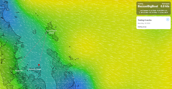
https://pacificposse.com/ocean-tactics

JOHN MARTIN

Email: admin@coastalandoffshorecruising.com

WhatsApp / Tel +64 27 242 1088

CONTACT US Email admin@coastalandoffshorecruising.com Contact WhatsApp / Tel +64 27 242 1088 Home The Good Ship ‘Windflower’
JOIN THE SOUTH PACIFIC POSSE
New Zealand
57 vessels

8) CYCLONE HOLES 🇫🇯 FIJI
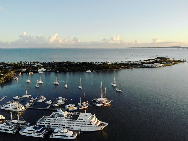
Tied up in Mangrroves

From sailingtoday.co.uk

"Winston, a category 5 storm traveling with winds at its center of 163 knots was closer than we wanted, but once communications were lost we didn’t know how close.

By 1800hrs the wind was 40 knots and rising steadily. The sound from the exposed top half of the rigging intensified to a piercing shriek. The dull groan from the hull swelled to a pulsing throb as the gale ripped over us at 100 knots. Il Silenzio was being thrown about in the dark like a drunken cork, but we trusted her steel hull and the preparations we had made.

ZAZOO

Zazoo's João up on the mast in the cyclone hole

Then we waited. More anchor checking. More rope adjustments.

More was to come in the form of an onslaught of rain in dense sheets, with flashes of lightning and crashing thunder. The initial wind direction created a tide surge and this surge, combined with the low spring tide, drained the river. Il Silenzio touched the bottom in the early hours of the morning and at low water was lying on her hull at about 40˚ on a cushion of mud. Even less windage in this position meant greater stability. Sleep was impossible at this angle, so we sat and listened to the drama playing out above us.

As the storm eased towards morning, the tide came in and Il Silenzio popped up. Our fitful dozing drifted into a restless sleep, difficult in 34-degree heat, but possible after a sleepless night. With the worst winds abated by late morning we assessed the damage. No boats had broken free and damage was minimal. Il Silenzio was in good shape, apart from a lawn of shredded mangrove leaves enveloping the deck. Our bolthole had been a good one."

A matrix of ropes reminiscent of spaghetti was the result. With a muddy bottom for good anchoring and a small catchment with not too much runoff, this was an excellent refuge. We filled the dinghy with water for stabilising weight, everything was taken off the deck, the headsail was removed and the mainsail tightly lashed. Then we waited. More anchor checking. More rope adjustments.

A matrix of ropes reminiscent of spaghetti was the result. With a muddy bottom for good anchoring and a small catchment with not too much runoff, this was an excellent refuge. We filled the dinghy with water for stabilising weight, everything was taken off the deck, the headsail was removed and the mainsail tightly lashed.

Nadi Cyclone Gunkhole

Nadi Cyclone Gunkhole
https://pacificposse.com/rivergate-marina-shipyard

SERVICES

  • Official Customs and Quarantine Port of Entry for Australia in Queensland
  • Berths and deep water access for vessels up to 90M
  • 24/7 on-water high-speed fuel facility and fuel bunkering
  • Single and 3 phase power up to 400 amp
  • Secure gated site monitored by patrols, CCTV cameras floodlit at night
  • Clean marina certified
  • Onsite storage

AMENITIES

  • Concierge service 7 days a week
  • Service berths with vehicle access
  • Free Wi-Fi
  • Laundry
  • Washrooms
  • Showers
  • Two Cafes

CONTACT

Alexander Binks

Marketing Coordinator

M +61 (0) 4 5226 3318

T +61 (0) 7 3907 1600

E marketing@rivergate.com.au

https://pacificposse.com/rivergate-marina-shipyard

10) SOUTH PACIFIC POSSE
🏆
AWARD CATEGORIES

  • BIGGEST FISH CAUGHT ✔
  • PICTURE OF THE YEAR ✔
  • PACIFIC POSSE YODA OF THE YEAR ✔
  • THE CAPTAIN RON AWARD ✔
  • MOST UNWELCOME VISITOR ONBOARD ✔
  • HIGHEST WIND RECORDED ✔
  • SPIRIT OF EXPLORATION ✔
  • GALLEY GOD(ESS) ✔
  • SPEEDY AWARD
  • GOOD SAMARITAN OF THE YEAR ✔
  • BOAT YOGA POSE OF THE YEAR ✔
  • COURAGE AWARD
SKY POND

WINNER OF THE GALLEY GOD(ESS) AWARD '22 SY SKYPOND

https://www.predictwind.com/datahub-2/

11) MANUAL TRACKING WITH PREDICT WIND

SWITCH OVER

VIA THE OFFSHORE APP

DEADLINE JULY 1 2023

How to use GPS Manual Tracking in the Offshore App.

GPS Manual Tracking using the Offshore App can be achieved on PC, Mac, iOS and Android devices. The screenshots below are taken using a PC computer, the general principle is the same across all devices, but the look of the App may differ slightly to the screenshots below if you are using Mac, iOS or Android

NOTE ; If you have automated GPS tracking set up via a satellite device you cannot manual track as well. You will need to contact our Support Team if you would like to switch from automated to manual tracking.

Predict WInd

Log in to your Offshore App and go to the GPS tracking tab on the left. It should look like this.

green

2. Select the Green Download button on the left. Make sure you have selected GPS tracking. Nothing else needs to be ticked for now.

DOWNLOAD ALL

3. Click through to Next > Download All

DOWNLOAD

4. You should now see yourself off the coast of Africa at 0lat0long in the Default position set for tracking pages. However, you will now be able to see this icon that lets you add a manual GPS location.

 5. Click on it to add your current GPS coordinates and time. Select NOW for the current time. Then select Save Point.

5. Click on it to add your current GPS coordinates and time. Select NOW for the current time. Then select Save Point.

Manual position

6. It will then notify that you have a Tracking Point pending upload/download.

DOWNLOAD

7. Do another Download the same as last time, and your Tracking point will be uploaded and synchronized with the server. Your tracking page will now reflect your updated position for friends, family and fleet to see.

TRACKING

12) SOUTH PACIFIC POSSE
FLEET TRACKING

Tracking

13) BOLO ALERT
⚠️

BOLO NE of Marquesas, French Polynesia:

BOLO NE of Marquesas, French Polynesia:

Vessel: "SMILES ROWBOAT", MMSI 338399051, U.S. flag

Aaron Carotta on "Smiles* has lost all power and charging capability. He has no comms nor functional navigation equipment. He is also low on food. He therefore set off his PLB on May 28 at 05°15S 119°00W. It pinged only briefly. There was a second ping received on May 31 with new coordinates of 5° 30.00' S 122° 00.00' W.

The coordinates of the two beacons showed movement of 180 miles @ 266°.

Based on the assumption that Aaron is still rowing, his estimated location could be as far out, on June 7, 2023, 20:56 UTC, as

5° 45.360' S

126° 37.547' W

Aaron's destination is the Marquesas. At the time of last social media update, Aaron communicated his desire to make more southerly and was being hindered by wind and ocean conditions. The bearing from the second ping to the northernmost Marquesas anchorage is 259°. He has a compass to steer by, but no way to know his position.

Please be on the lookout when approaching that area and report any sightings. Anybody who can help search or BOLO for Aaron should FIRST be in touch with JRCC Tahiti AND ALSO with our FB group to ensure good communication/coordination.

Contact info for Tahiti JRCC:

Email: contact@jrcc.pf

Phone: 0068 940 541 616

FB Group to contact: In Search of Adventure Aaron Carotta

https://www.facebook.com/groups/186285441048310/

If you have means to contact other vessels which may be in the area, please send them the above info, or post on the Facebook page above so one of Aaron's team can try to reach them.

BOLO

Those are all the boats in the area, their registration names and radio IDs and which direction and speed they are heading etc. if they all worked together and honed into a predicted location, they could find SMILES hopefully. Difficulty is knowing if he’s rowing or not. Personally Id conserve energy and water and just float as this also means he would be closer to his last known position

BOLO

14) FREE ACCESS TO GOOD NAUTICAL

IF YOU ARE SIGNED UP FOR THE '23 SOUTH PACIFIC POSSE you will be assigned access credentials to GOODNAUTICAL South Pacific regions


Good Nautical

CONSIDER MAKING A TAX DEDUCTIBLE DONATION TO GOOD NAUTICAL

https://www.paypal.com/paypalme/goodnautical

https://www.paypal.com/paypalme/goodnautical

New Caledonia 🇳🇨 in Good Nautical

15) HISTORIC PORTS ⚓ OF THE SOUTH PACIFIC

VAVA'U 🇹🇴 TONGA

VAVUA

When Captain James Cook arrived in Tonga in 1773, the local king, or Tu'i Tonga, did not intentionally lie to him. However, there might be some confusion or miscommunication that led to misunderstandings between the two parties.

During Cook's visit, he encountered Fatafehi Paulaho, who claimed to be the Tu'i Tonga, the ruling chief of Tonga. However, Fatafehi Paulaho was not the legitimate Tu'i Tonga but rather a local chief who assumed the title. It is believed that he used the opportunity of Cook's visit to elevate his status and gain recognition.

It's important to note that Tonga had a complex social and political structure at the time, with multiple chiefs and sub-chiefs. The concept of a single, central ruler, like the Tu'i Tonga, held different meanings and roles depending on the period and context.

So, while Fatafehi Paulaho may have presented himself as the Tu'i Tonga and Cook might have believed him initially, it wasn't a deliberate act of deception by the king. It was more likely a result of the complexities of Tonga's social structure and the differences in understanding between the two cultures.

Double-hulled canoes, Tonga

Tonga's ability to resist colonization can be attributed to several factors:

Geographic Isolation
Tonga is located in the South Pacific, which made it relatively isolated from major colonial powers during the era of European colonization. The distance and lack of easily accessible resources reduced the incentive for colonizers to establish a permanent presence in Tonga.

Strong Monarch
Tonga had a well-established and centralized monarchy, with a long history of rule by the Tu'i Tonga and later the Tu'i Kanokupolu. The monarchy provided a source of stability and authority, allowing the Tongans to maintain a unified front against potential colonizers.

Skilled Navigators
Tongans had a strong tradition of navigation and seafaring. They were adept sailors and had developed sophisticated navigation techniques, allowing them to explore and interact with other Pacific islands. This expertise and knowledge of the seas might have made potential colonizers wary of engaging with Tonga.

Diplomacy & Negotiation
Tonga had a tradition of diplomatic relationships with foreign powers. Tongan leaders, such as King George Tupou I, engaged in diplomatic negotiations with European powers, establishing treaties that recognized Tonga's independence and sovereignty. These treaties, along with Tonga's diplomatic efforts, helped protect the kingdom from colonization.

Internal Unity & Resistance
The Tongan people had a strong sense of cultural identity and unity, which contributed to their ability to resist colonization. There were instances where Tongans actively resisted attempts at colonization, demonstrating their commitment to preserving their way of life and sovereignty.

Tonga was never formally colonized
it did enter into a treaty relationship with Britain in 1900, known as the Treaty of Friendship. Under this treaty, Tonga maintained its independence but recognized Britain's influence in matters of foreign policy and defense. Tonga remains the only Pacific island nation to never have been fully colonized.

Tonga Sailing

Captain Cook and the ‘Friendly Islands’?

Captain Cook first landed in the Tongan islands on 2 October 1773, during his second Pacific voyage. In 1774 he returned for four days and received such a warm welcome that he named Tonga the “Friendly Islands”. However, it is now widely thought that the Tongan chiefs had planned to attack Cook and his crew and seize the Resolution and Adventure.

CAPTAIN COOK

The first account of the supposed plot against the Resolution was given by William Mariner, a young man serving on the British privateer Port au Prince when it was attacked in Lifuka in 1806. Twenty-six of the crew survived. Mariner was adopted by the chief Finau ‘Ulukalala-‘i-Ma‘ofanga and lived in Tonga for four years. |

Finau told Mariner that the “Feenow” Cook had known was his father, who had been instrumental in planning an attack on Cook. The plan was called off when the chiefs disagreed about whether to attack under cover of darkness or during the day.

Fīnau ʻUlukālala I (or his brother) on Vavaʻu in 1793, in Jacques-Julien Houtou de Labillardiere, Voyage in Search of La Perous

Fīnau ʻUlukālala I (or his brother) on Vavaʻu in 1793, in Jacques-Julien Houtou de Labillardiere,

When Mariner returned to London, he was contacted by John Martin, an ethnographically-minded doctor. Together they authored An Account of the Natives of the Tonga Islands (1817), one of the most accurate accounts of Tongan life in the early 19th century. In the opinion of most scholars, Mariner’s account is accurate. So was the plot to kill Cook in Tonga real, and was Cook so naïve as to be oblivious to the danger? There are some factors to take into account.

When the Port au Prince was attacked in 1806, Tonga had been in the grip of civil war for seven years. The prosperous and scattered people Cook had observed were corralled inside guarded fortresses and slowly starving as harvest after harvest was destroyed by neglect and attacking armies. The different island groups were controlled by warring chiefs, each aware of the advantage which possession of European firearms and iron goods would afford them in their political and economic struggles.

The outbreak of the civil war had very little to do with European arrivals. Tensions between the three chiefly lineages holding spiritual, administrative and political authority had been mounting for nearly two decades, and came to a head with the assassination of chief Tuku‘aho in 1799. By the time Mariner was living with Finau ‘Ulukalala-‘i-Ma‘ofanga, it was deemed expedient to have a European or two to assist in battles, and as a kind of status symbol.

Tonga. Natche, Ceremony in Honour of King's Son. Cook c1784 by Cook, Captain James The Natche, a Ceremony in Honour of the King's Son, in Tongataboo - a grand and reverent ceremony.

Original copperplate engraving after the drawing by the Admiralty-appointed official artist on the voyage, John Webber (1751-1793). This engraving is part of a series of 78 plates, based on Webber's drawings to include indigenous people, artifacts and views. It was published for Anderson’s “Complete History of Captain Cook's First, Second and Third Voyages” published in London published by Alexander Hogg circa 1784.

HIS MAJESTY KING TUPOU VI OF TONGA Born ‘Aho‘eitu ʻUnuakiʻotonga Tukuʻaho, on 12 July 1959 in Nuku’alofa, he is the 3rd son and youngest of four children of Their late Majesties King Taufa’ahau Tupou IV and Queen Halaevalu Mata’aho.

HIS MAJESTY KING TUPOU VI OF TONGA

Born ‘Aho‘eitu ʻUnuakiʻotonga Tukuʻaho, on 12 July 1959 in Nuku’alofa, he is the 3rd son and youngest of four children of Their late Majesties King Taufa’ahau Tupou IV and Queen Halaevalu Mata’aho.

‘Aho’eitu ‘Unuaki ‘o Tonga Tuku’aho received three chiefly titles as is customary in the Tongan tradition, He commonly used these titles Prince ‘Ulukalala Lavaka Ata, until he became Crown Prince.

Prince ‘Ulukalala Lavaka Ata was educated at The Leys School, Cambridge then attended the University of East Anglia in 1980 where he graduated with a degree in Development Studies.

Upon returning to Tonga in 1982, the young prince joined the Navy at the Tonga Defence Services and gaining promotion to Lieutenant-Commander in 1987.

He graduated from the US Naval War College in 1988 and from 1990 to 1995 he took command of the Pacific-class patrol boat VOEA Pangai and led peace keeping missions in Bougainville.

In 1997, he graduated with a Masters in Defence Studies from the University of New South Wales and in 1999 he earned a MA in International Relations from Bond University, Australia.

Prince ‘Ulukalala Lavaka Ata joined the civil service in 1998 occupying two portfolios, Minister for Defence and Minister for Foreign Affairs. He was appointed Prime Minister from January 2000 to February 2006. Later that year he received the title Crown Prince Tupouto’a Lavaka when his elder brother became King George Tupou V.

In 2008, the Crown Prince was appointed Tonga’s first High Commissioner to Australia and Ambassador to Japan until his succession to the Throne in 2012, when his brother King George Tupou V passed away and immediately became King and Head of State.

His Majesty Tupou VI was formally crowned King in July 2015 in a series of ancient private and public ceremonies and religious services attended by both regional and global leaders who travelled to Tonga for this special occasion.

His Majesty married Nanasipauʻu Vaea on 11 December 1982 who his accession to the Throne became Her Majesty Queen Nanasipauʻu Tukuʻaho of Tonga.

16) MEET OUR SPONSORS

  • PREDICT WIND
  • PANAMA CANAL AGENT ERICK GALVEZ CENTENARIO CONSULTING
  • YACHT AGENTS GALAPAGOS
  • YACHT AGENTS NUKU HIVA
  • SAIL TAHITI
  • OCEAN TACTICS | PACIFIC WEATHER ROUTING
  • SHELTER BAY MARINA PANAMA
  • DENARAU MARINA FIJI
  • NAWI ISLAND MARINA
  • VUDA POINT MARINA
  • MUSKET COVE MARINA
  • COPRA SHED MARINA FIJI
  • CLOUD 9
  • PUERTO AMISTAD ECUADOR
  • RIVERGATE MARINA AUSTRALIA
  • MARSDEN COVE MARINA NEW ZEALAND
  • GULF HARBOUR MARINA NEW ZEALAND
  • YACHTING WORLD MARINA PORT VILA VANUATU

ROYAL SUVA YACHT CLUB FIJI 🇫🇯 SPONSORS THE PACIFIC POSSE

ROYAL SUVA YACHT CLUB FIJI
🇫🇯 SPONSORS THE PACIFIC POSSE

WE OPERATE UNDER INTERNATIONAL MARITIME LAW

YOUR VESSEL YOUR CREW YOUR RESPONSIBILITY

South Pacific Posse


south pacific posse communications
@ 9811 w charleston blvd 2262 89117 Las Vegas USA


FLEET UPDATE 2023-05-16

South Pacifc Posse '23

“We cannot solve a problem by using the same kind of thinking we used when we created them.”

- Albert Einstein


SOUTH PACIFIC POSSE
FLEET UPDATE

2023-05-16

13 Ensigns

63 Yachts from 13 ensigns are signed up !

To join follow this link >>

There are now 7 posse boats in Tahuata. We should get another group photo later and have a beer or two!

TOP NEWS

  • BALL BAY 🇳🇫 NORFOLK ISLAND
  • 📷 PICTURE OF THE WEEK
  • 📢 PAN PAN TOMAS